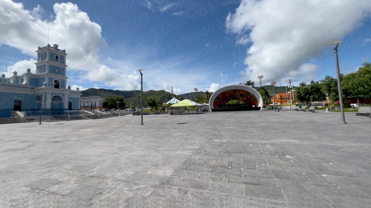
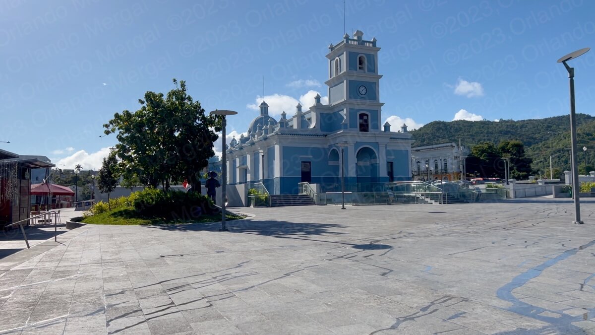
Ramón Frade Square (click on image to see it larger)
It was 8:38 in the morning, on May 26th, and my wife and I were parking in front of the Ramón Frade Square in the town of Cayey, Puerto Rico. The weatherman had announced a maximum temperature for the day of 108° F, so we planned to be in and out before noon. Well, as you will learn throughout this post that wasn’t the case.
To get to Cayey we just punched the following coordinates into our GPS and it guided us straight to the Ramón Frade Square (18.112760, ‑66.166262). For more information about arriving in Cayey please watch the video below.
Cayey was my father’s birthplace, so I was curious about it. Having lived in Puerto Rico since 1963, I must admit that the only times that I had visited Cayey was on my way to somewhere else. Not once had I actually walked its streets. So you can imagine how it felt to walk on the same plaza where my father would shine shoes as a 10-year-old boy back in 1923.
Cayey is a very nice town that seems clean and well kept. There’s some construction going on southwest of the Frade Square, but surprisingly there was hardly any traffic congestion.
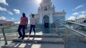
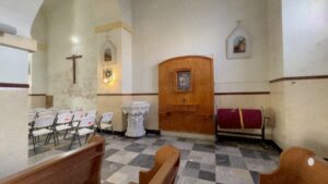
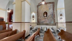
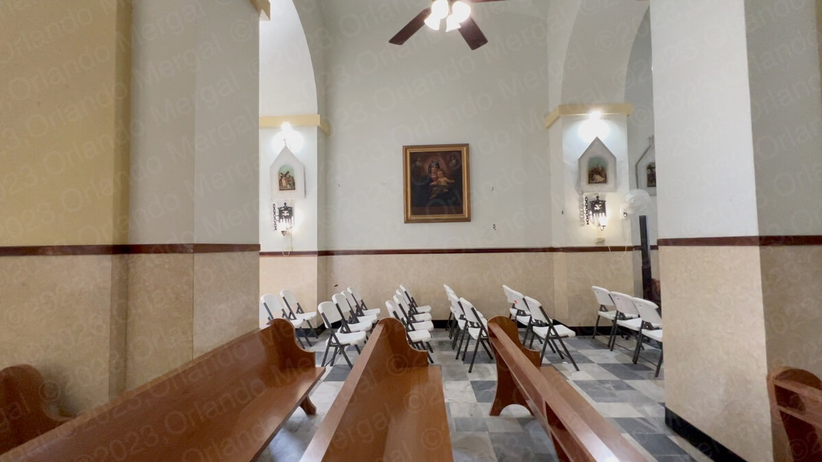
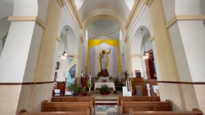
Our first stop was at the “Nuestra Señora de la Asunción Parish” a beautiful 18th century Roman Catholic temple, painted in blue, that sits on the eastern side of Frade Square. Experience has taught us that most Roman Catholic churches in Puerto Rico open early in the mornings to celebrate mass and close after 9:00 or 10:00 am.
It’s a sad fact of life that crime has risen dramatically on the Island. This is a concern for churches in general since they are the perfect target for their P.A. systems, religious artifacts and for vandalism. Other denominations are not as attractive for these hoodlums since they do not have early morning rituals.
Another thing I’ve noticed is that church officials on the Island don’t seem to understand that these temples are also attractive as tourist destinations. The fact that they are old, architecturally sophisticated and well kept makes them appealing to tourists regardless of their religious beliefs.
-


- Nuestra Señora de la Asunción Parish (click on image to see it larger
-
- Nuestra Señora de la Asunción Parish (click on image to see it larger

-
- Nuestra Señora de la Asunción Parish (click on image to see it larger

-
- Nuestra Señora de la Asunción Parish (click on image to see it larger

-
- Nuestra Señora de la Asunción Parish (click on image to see it larger

-
- Nuestra Señora de la Asunción Parish (click on image to see it larger

-

- Nuestra Señora de la Asunción Parish (click on image to see it larger
-
- Nuestra Señora de la Asunción Parish (click on image to see it larger
Hence, many times we get to one of these temples when the early mass is about to and we are tactfully shown the door several minutes later. That’s not always the case but it certainly was in Cayey.
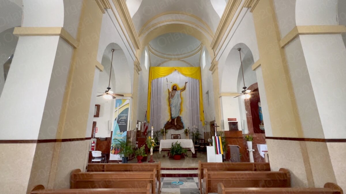
In any case, the “Nuestra Señora de la Asunción Parish” looks like something straight out of Europe. The original temple was built in 1815 and modified in 1889. On December 10, 1984 it was added to the National Register of Historic Places of the United States.
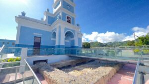
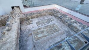
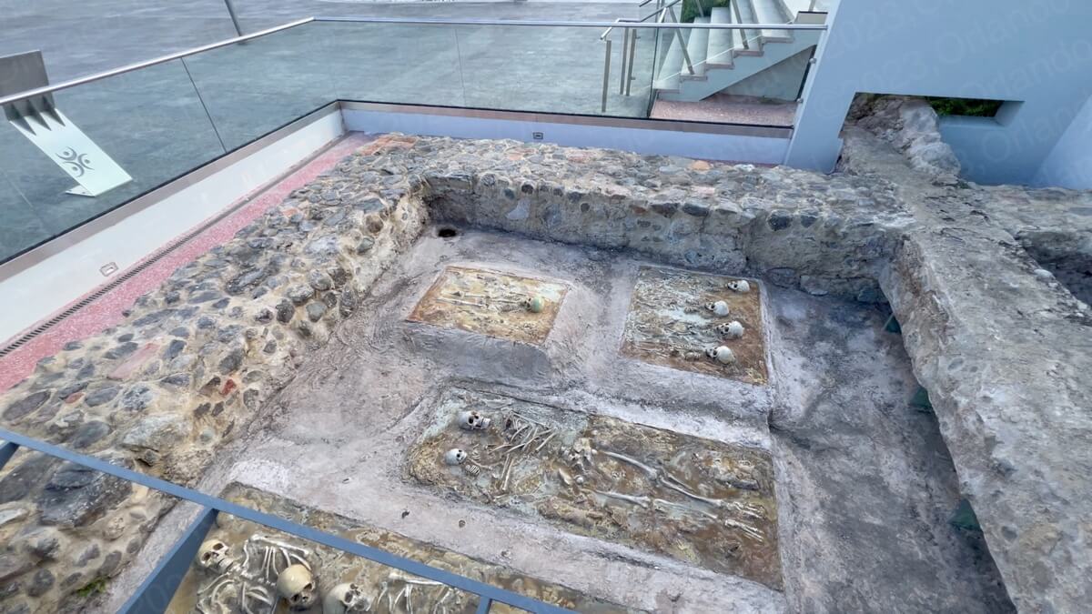
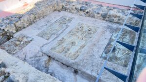
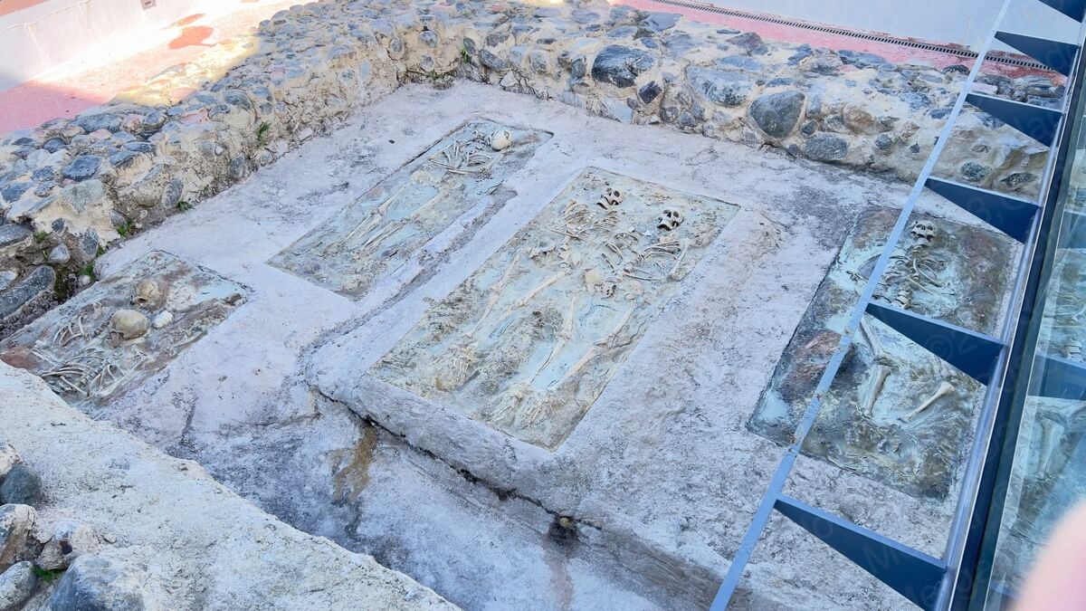
In 2016 the municipality of Cayey decided to redo the Ramón Frade Square and over 500 burials were found in the frontal area of the temple, along with a part of the original foundation. The remains were relocated to a nearby resting place to preserve their dignity and integrity and replicas were placed in the original locations to create an open air exhibit.
The exhibit is right in front of the church entrance and it lends a sense of historical context to an otherwise modern environment. There is abundant signage covering every aspect of the exhibit.
-
- Nuestra Señora de la Asunción Parish Exhibit (click on image to see it larger)

-
- Nuestra Señora de la Asunción Parish Exhibit (click on image to see it larger)

-

- Nuestra Señora de la Asunción Parish Exhibit (click on image to see it larger)
-
- Nuestra Señora de la Asunción Parish Exhibit (click on image to see it larger)
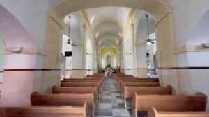
On the inside the church has beautiful wide columns, tall arched ceilings and mahogany pews, all of which create an austere but inviting environment.
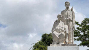
As we left the temple we went for a stroll along the Ramón Frade Square. Ramón Frade de León was a Puerto Rican visual artist and architect who lived between the years 1875 and 1954. His realist painting style captured the lifestyle of early twentieth century Puerto Ricans.
There’s also a museum with his most iconic paintings at the nearby campus of the University of Puerto Rico, but it was closed the day that we visited town.
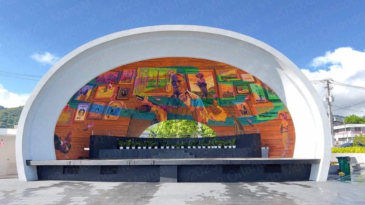
Ramón Frade de León Band Shell (click on image to see it larger)
Finally, the bandshell on the south end of the square is decorated with a portrait of Frade, as well as many of his most famous paintings.
Around the square there are small cafes and tables where you can relax and watch life go by. On the far northwestern corner of the square, on the corner of Núñez Romeu and Luis Muñoz Rivera, is a gray and white building that was once the original Town Hall or “Alcaldía”.
Like most Puerto Rican towns, Cayey also followed the Spanish tradition of building the Catholic Church on the eastern side of the town square and City Hall on the opposite end. Today’s City Hall is at another location.
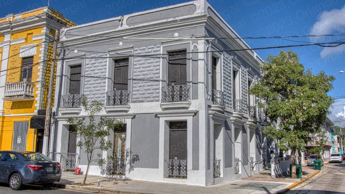
Old City Hall Building (click on image to see it larger)
In hindsite, I wonder why they moved City Hall to the new location. Maybe it’s just my impression, but the old building seems larger and it certainly is more elegant. In any case, the center of Cayey (what we Puerto Ricans call “el casco”) is nice, clean and well maintained.
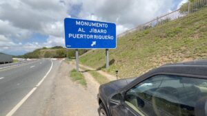
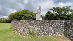
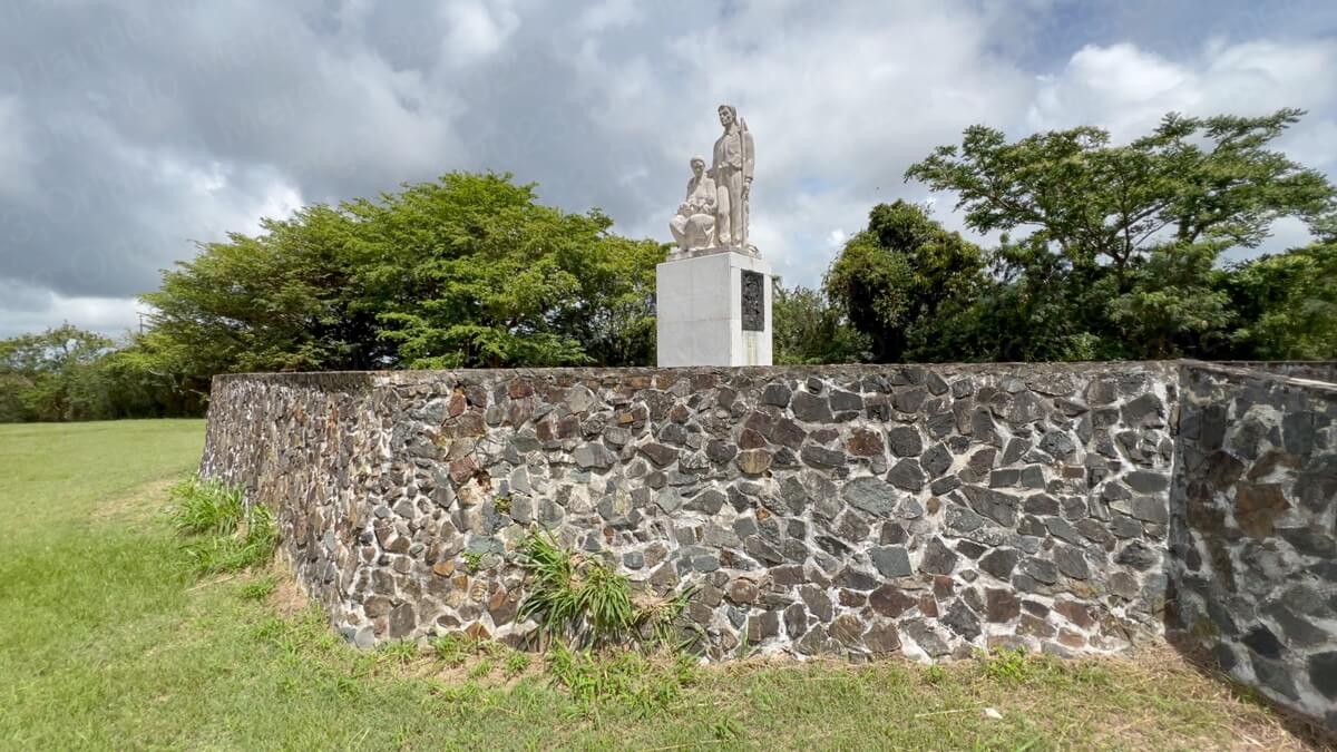
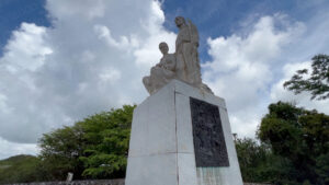
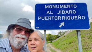
After leaving the center of town we retraced our steps back out of town and took PR-52 going south. Several miles later we were at the Monumento Al Jíbaro Puertorriqueño (that’s the monument to the Puerto Rican Peasant).
A friend of mine —who’s quite cynical— once told me that monuments are built for the dead. And I guess he was right since you rarely any see monuments dedicated to living people. I guess the Beatles would be the one exception to that belief.
In any case, in Puerto Rico the “jíbaro” was the peasant worker who did mostly menial and agricultural labor. They were also among the less educated and most economically deprived. Oh, and in case you’re wondering, they were not related to the South American “jivaros” who will shrink your head to the size of a door knob.
21st century Puerto Rico hardly has any jíbaros left. Today even the most ignorant and economically deprived on the Island have iPhones, Internet hookups and satellite TV. Not that they’re better off. They just think that they are.
-
- Bad idea to park here (click on image to see it larger)

-
- Monumento Al Jíbaro Puertorriqueño (click on image to see it larger)
-
- Monumento Al Jíbaro Puertorriqueño (click on image to see it larger)

-
- Monumento Al Jíbaro Puertorriqueño (click on image to see it larger)

-
- My wife and I at the Monumento Al Jíbaro Puertorriqueño (click on image to see it larger)

The “Monumento Al Jíbaro Puertorriqueño” was my first surprise (disappointment) of the trip. It used to be that there was a large parking area next to the statue where people would stop, walk to the base of the statue and take in the view of the beautiful “Tetas de Cayey” right behind it.
In case you’re wondering, the “Tetas de Cayey” got that name for the same reason that the “Grand Teton” mountain range, in the great state of Wyoming, got theirs. If you’re not aware of that story, just go to Google and search for “How the Grand Teton got its name”.
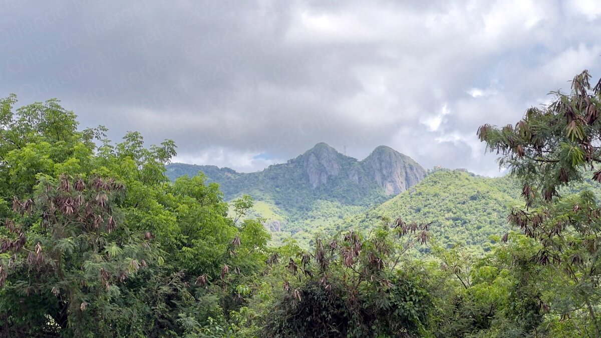
Las Tetas de Cayey (click on image to see it larger)
The funny thing, however, is that according to local experts neither peak is actually in Cayey. Some say that one is in the nearby town of Salinas and the other is in Coamo. Others say that they’re both in Salinas.
Another fact is that, like real breasts, they’re not exactly the same size. The western one is 65 feet taller, standing at a full 2,759 feet above sea level.
Finally, the actual reason why they’ll always be called “Las Tetas de Cayey” is because they’re also located on “la Sierra de Cayey”, the mountainous region that divides the northeastern portion of Puerto Rico from the southeast.
Oh, and in case you’re wondering, their real name is “Las Piedras de Collado”.
As for the Monumento Al Jíbaro, it’s another sad example of how Puerto Rico’s government has abandoned public spaces and recreation areas. There’s no longer any parking area, so if you decide to visit you’ll have to park on the shoulder of PR-52, which is outright dangerous.
To get to the monument you’ll have to walk around a tall fence until you find an opening close to the rear on the eastern side. Then you’ll have to walk over tall grass and stay clear of the many ant piles along the way. Finally, you’ll arrive at a monument that clearly hasn’t been tended to in years. What a sad way to honor the Island’s peasant workers.
After leaving the “Monumento al Jíbaro there was no way to take PR-52 going north so we had to drive all the way to Exit 58, by the Puerto Rico Olympic Training Center (Albergue Olímpico), drive under the expressway and then retake PR-52 going north until we reached Exit 32 towards the world famous Guavate Restaurant Area.

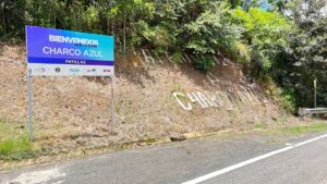
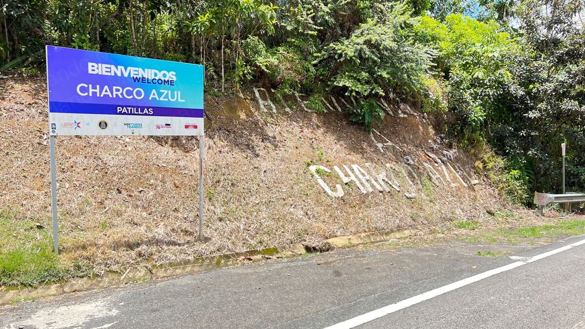
That’s right! We were missing two stops on out trip. We were headed for the Guavate Restaurant Area and for Charco Azul, a beautiful swimming pond that’s actually in the neighboring town of Patillas to the south. We decided to include Charco Azul in the Cayey video because it’s actually easier to get there through PR-184 that goes by the Guavate Restaurant Area anyway. So we decided to visit Charco Azul first and then stop at the Guavate Restaurant Area on our way back.
Charco Azul is actually located within the Carite State Forest, a national reserve that sits within the municipalities of Caguas, Cayey, Guayama, Patillas and San Lorenzo. There was a time when you could go through the entire forest and many other towns and cross the Island from east to west by the Panoramic Route.
Well, these days the Panoramic Route is in a sad state of repair and —like many other facilities in government hands— it isn’t expected to improve any time soon.
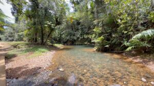
To get to Charco Azul you’ll have to do some walking through the Carite Forest. The actual distance is about half a mile, each way, along mostly flat terrain.
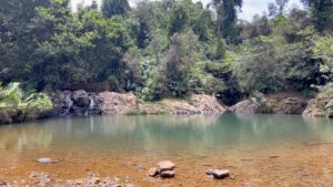
-
- Charco Azul at Carite Forest (click on image to see it larger)
-
- Charco Azul at Carite Forest (click on image to see it larger)

-
- Charco Azul at Carite Forest (click on image to see it larger)
-
- Charco Azul at Carite Forest (click on image to see it larger)
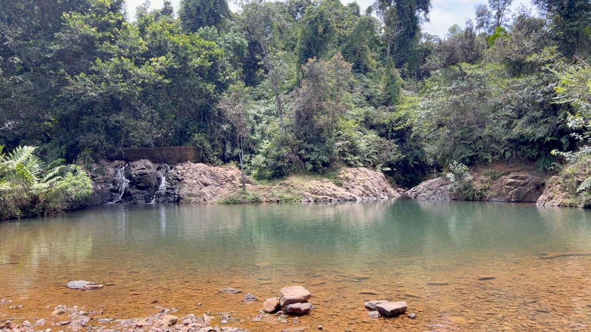
You can tell that the place is abandoned from the minute you get there. The gate is broken, the picnic facilities are abandoned and covered in graffiti, there are no restrooms and the vegetation is overgrown. The trail is mostly intact with a few areas that have been destroyed by mudslides.
My wife and I decided to leave our Pathfinder out on the road as we had no idea what we would find. Surprisingly, the few people that we did find along the way were not from the Puerto Rico. One couple was from the continental United States and the other small group was from Latin America.
I wonder what they wrote about this place on social media?
We finally reached Charco Azul about half an hour later walking at a comfortable pace. The temperature and humidity were scorching hot so —believe me— we were tempted to jump right in. But that wasn’t why I was there, so I took my pictures , recorded my footage and headed back.
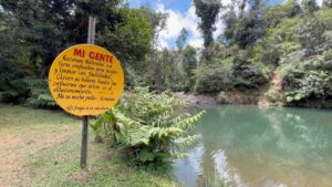
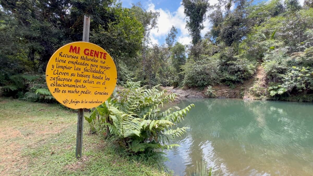
The big yellow sign saying that “Amigos De La Naturaleza” had to clean up the place caught my attention immediately. In other words, if this place is pristine it’s no thanks to the government. I would have gladly linked to them on this post, but they don’t seem to have a website.
Charco Azul lives up to its name. It actually is blue!!! Albeit the water wasn’t as clear after a couple of rainy days. The pond is about 30–50 feet across and it seems to be quite shallow along the edges. However, in my research I found that the blue area can reach a depth of 15 feet. So if you don’t know how to swim stay away!!! There’s also a rock where the locals jump into the deep end, but I’d steer clear of it.
Like always, I write these posts as a free service and for entertainment purposes only. Therefore, I assume no responsibility for your safety and/or wellbeing when visiting any of the places covered in my videos or posts. So use common sense.
Another thing I discovered on my way back is that there is no cellphone coverage in this area. It’s basically a dead zone. The only reason why my GPS took me there is because it downloaded the map information way before I entered the forest. To get back to civilization just retrace road 184 heading north and you’ll end up at the Guavate Restaurant area.
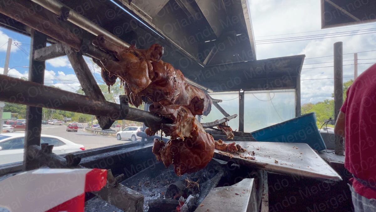
By the time we got to the Guavate Restaurant Area it was almost 2:00pm. We had been on our feet all day, walking and exploring, and we were ready to kick back and enjoy some genuine Puerto Rican cuisine.
-

- Roasted Pork at Guavate Restaurant Area (click on image to see it larger)
-
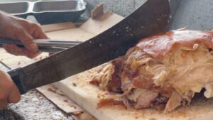
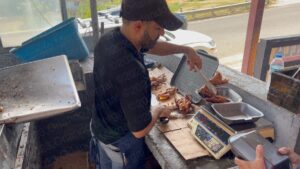
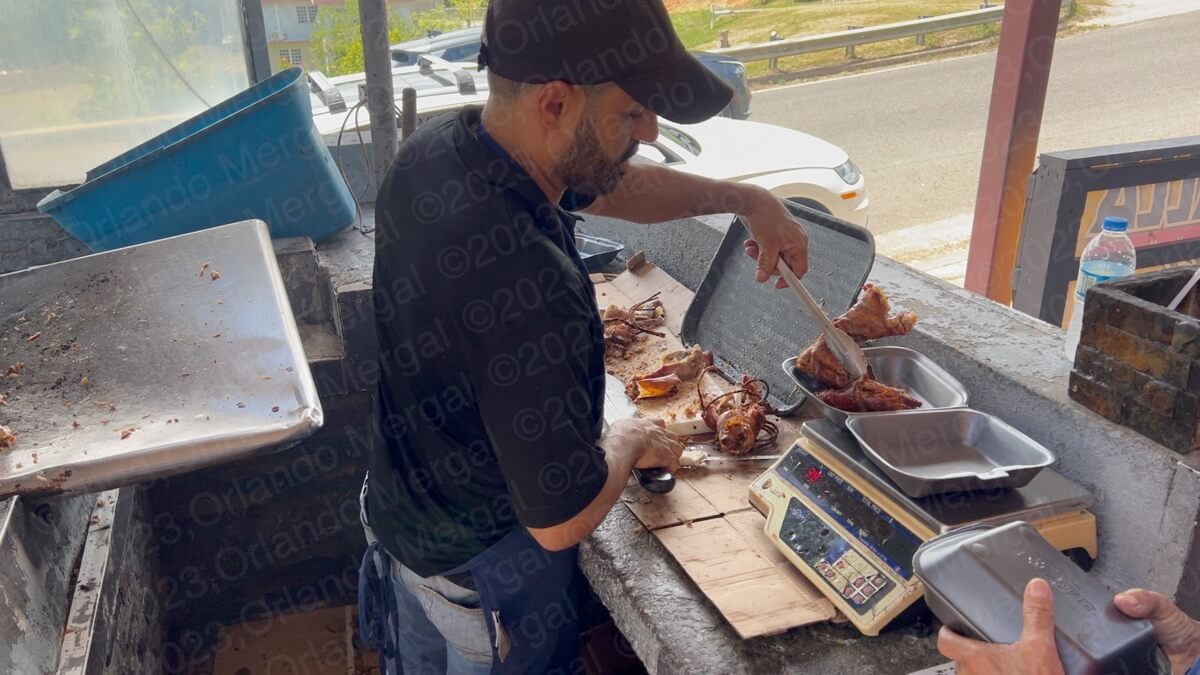
- Cutting Roasted Pork at Guavate Restaurant Area | Click on image to see it larger)

-
- Roasted Pork to go at Guavate Restaurant Area (click on image to see it larger)
-

- Side dishes galore at Guavate Restaurant Area (Click on image to see it larger)
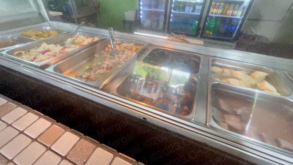
Guavate is known for roasted pig. It’s done in the traditional Puerto Rican way: whole, on a stick, over open flames and slooooowly cooked to perfection for around 8 to 10 hours. Then it’s cut up into portions, using a razor sharp machete, and served will all sorts of Puerto Rican side dishes. These can be yellow rice with pigeon peas and small chunks of pork, yucca, blood sausage, ripe plantains and many other local delicacies.
And, of course, to wash it all down, you can have a variety of adult beverages, an ice-cold beer (or several), or just a regular soda or fruit juice.
You can enjoy it all right on the spot, or get it to go, like we did.
There are several dozen restaurants along road 184 and —like anywhere else in the world— they can vary in terms of quality. So what can I say? Do what we do. Look for the ones with the most patrons. After all, they’re full for a reason.
NOTE: Due to the large extension of land covered in this post, you will need to zoom in and out on the map to see every pin. Please pardon the inconvenience.
To return to the San Juan Metroplex just take PR-52 going north and follow it to the end. You’ll end up at the Minillas Tunnel. Or better yet, do what I always do when I travel abroad. Right down the GPS coordinates for your hotel before you leave in the morning. That way you’ll always have a point of return.
See you next time!!!
©2023,Orlando Mergal, MA
____________________
Bilingual Content Creator, Blogger, Podcaster,
Author, Photographer and New Media Expert
Tel. 787–750-0000, Mobile 787–306-1590
![]()
![]()