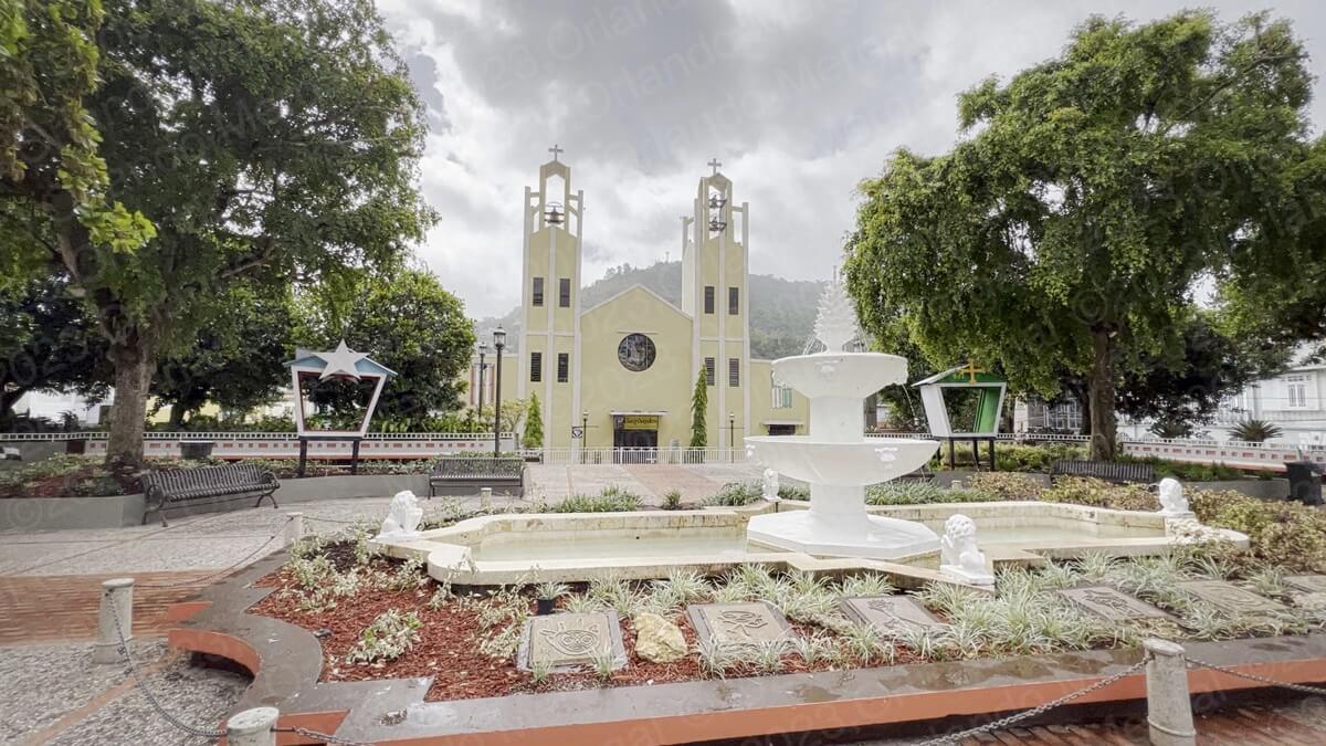
Santo Cristo De La Salud Parish
(click on images to see it larger)
It was 8:04am. My wife and I were standing in front of the “Santo Cristo De La Salud” Parish (that would be “Parroquia Santo Cristo De La Salud”), in Comerío, Puerto Rico. But it was closed! As it started to drizzle, the sky got gloomy and gray, and I couldn’t help wondering “what am I doing here”? Was it worth it to come this far?
Well, yes it was!!! You see, I’m a “glass half full” kind’a guy. I’ve also been a landscape photographer for most of my life. So for me the little town of Comerío had giant possibilities.
Minutes before arriving in town, we stopped at the Comerío Dam, better known as “Los Saltos”. It’s a huge structure, on the left side of road 167 going south, that once produced hydroelectric power for a large portion of Puerto Rico’s San Juan Metroplex. Today, the Island has abandoned hydroelectric power altogether and it mainly depends on fossil fuels to satisfy its energy demand.
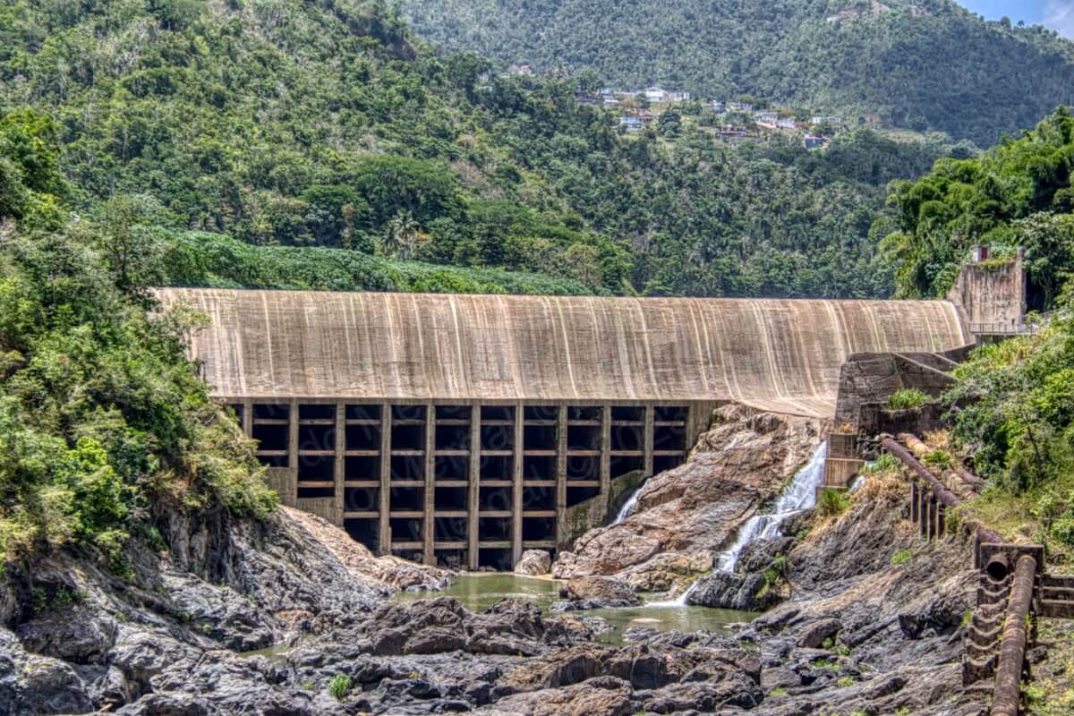
Los Saltos Dam
(click on image to see it larger)
That alone makes you wonder, since Puerto Rico produces no fossil fuels, and it sits in the middle of the Caribbean, where wind and sunlight are abundant, what are these people thinking? But I digress.
Getting to Comerío can be tricky or easy, particularly if you aren’t a local like me. The tricky way is coming from Aguas Buenas or Cidra, where there’s curve after curve and dozens of roads to know. The easiest way, albeit the longest, is coming from Bayamón along State Road 167. I’m not going to give you the blow by blow instructions, because that would be torture —and it would make this post twice as long— but what I am going to tell you is that the easiest way to get to Comerío, if you’re coming from Isla Verde, Condado or Old San Juan is to go through the Minillas Tunnel, follow State Road 18 until you get to the intersection with Road 22, take Road 22 going west and follow it until you reach Exit 13, turn left on Ramón Luis Rivera Ave. and follow it until you reach the town of Comerío.
Sounds simple, right. Well, it’s not. Ramón Luis Rivera Ave will become Road 167, which in turn will become Road # 5 at some point, and eventually it will become 167 once again just before you reach Comerío. The important thing is that you follow the road without deviating. Don’t make any turns and you’ll eventually arrive in Comerío. Or better yet, just punch the following coordinates into your GPS and you’ll go straight to the center of town (18.218439, ‑66.226497).
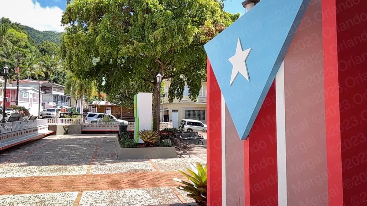
Plaza de la Trova
(click on image to see it larger)
After finding the church closed, we decided to take a stroll around “La Plaza de la Trova” to collect our thoughts. Every town in Puerto Rico follows a similar model. We inherited it from the Spanish colonizers, who in turn inherited it from post Constantine Rome. There’s a square in the middle of town, a catholic church on the Eastern side of the square and city hall on the opposite end. The location of city hall isn’t always written in stone, but the catholic church is always on the East side.
Furthermore, most buildings around the square are two-storey high, with businesses on the bottom floor and living quarters on the second. Architects call this the “Roman” model.
In Puerto Rico most squares are named after a person, a thing or a Roman Catholic saint. The one in Comerío is named after a music genre. But, not just any music, after Puerto Rican “trova”.
What’s that?
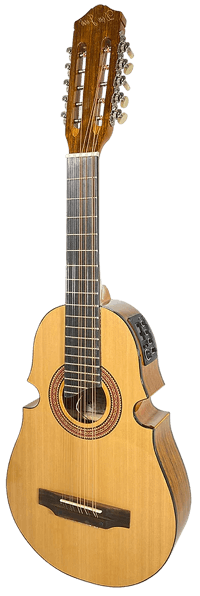
Puerto Rican Cuatro
Puerto Rican “trova” is what you frequently hear in our mountain towns. It’s the folk music of our ancestors played with guitar, güiro, bongos, maracas and cuatro.
The “cuatro” is Puerto Rico’s national instrument. It was originally inspired on the lute family of instruments, but over the centuries it has evolved into a full-blown instrument in its own right. Nothing sounds like a well played Puerto Rican “cuatro”.
But there’s more. “Trova” music is generally improvised. It can be penned beforehand, but 9 out of 10 times it comes straight out of the “trovero’s” imagination.
Well, Comerío is known as “la cuna de la trova”, or “the cradle of ‘trova’”, in the king’s English. Hence, naming this square “la Plaza de la Trova” honors the immense contribution that Comerío has made to Puerto Rico’s folkloric music.
As expected, the “Santo Cristo de la Salud” parish sits on the eastern side of “la plaza de la trova”. It’s a modern style temple, built in the 1970’s and painted in yellow with white trim. It has twin steeples with one bell on the left tower and two bells on the right.
As for the inside, I can’t tell you a thing because —once again— it was closed.
The original hermitage was built between 1829 and 1830, just 3 years after the town was founded as “Sabana del Palmar”. Later on, in 1894, the town was renamed Comerío to honor the Taíno chief that ruled this part of the Island when the Spanish conquistadors arrived.
The church in the background with the “Plaza de la Trova” fountain as foreground makes for a beautiful picture.
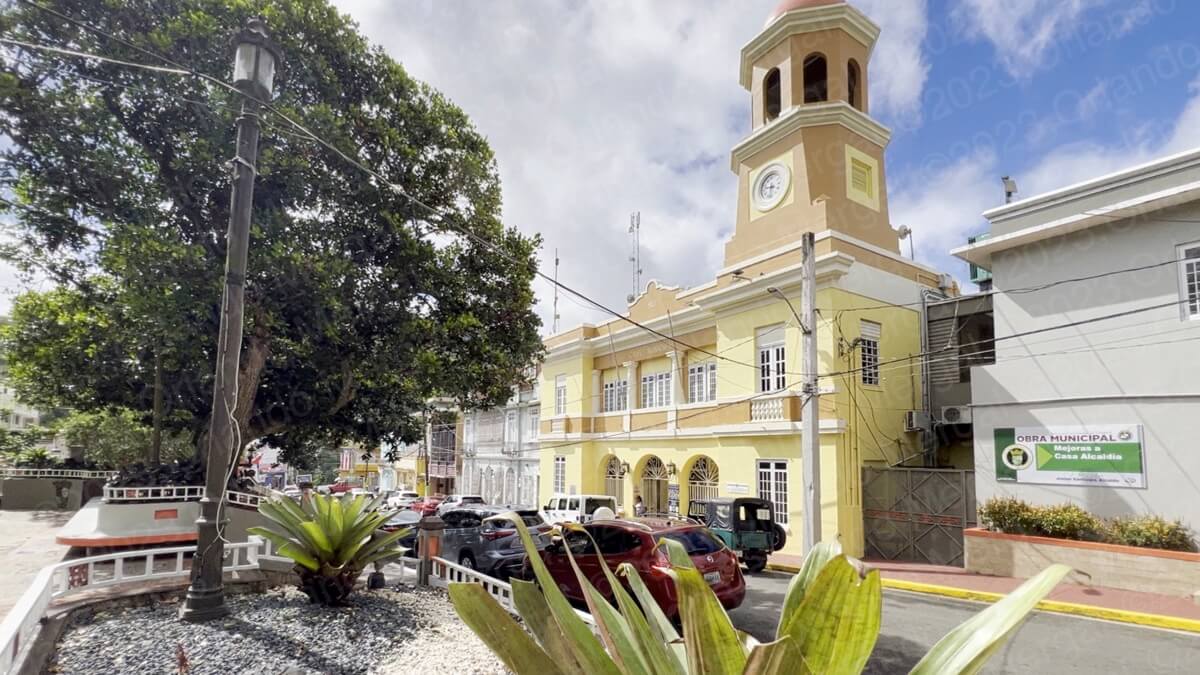
Comerío City Hall
(Click on image to see it larger)
On the South side of the square you have city hall. It’s a colonial style building, painted in yellow and light brown, with white trim. There’s a clock tower on the West side of the facade with a clock that actually works. That’s a rarity in itself.
After exploring “La Plaza de la Trova” we decided to enter city hall. Experience has taught us that it’s frequently a great place to pick up information on what to see and do in town. When we got there we struck a conversation with a young man that was standing in front of the building. Later on I learned that he was actually a municipal worker.
He told us about the city hall building itself (“la alcaldía”, like we say in Spanish), the towns points of interest and where to go next. We also learned that Comerío’s city hall is actually the mayor’s place of business.
Many towns in Puerto Rico have built larger, more posh city halls and converted their old buildings into museums. But, not Comerío. This is where the sausage actually gets made.
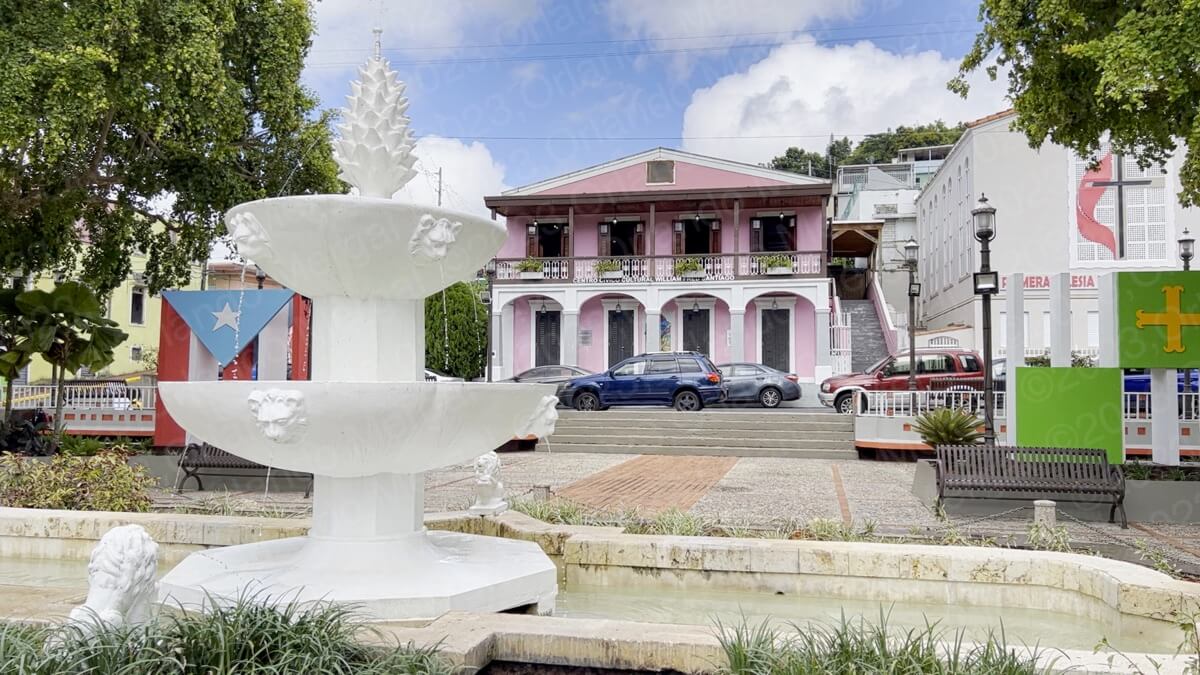
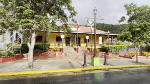
Comerío Cultural and Civic Center
(click on image to see it larger)
On the west side of the square there’s yet another noticeable building, painted in pink with white trim, that’s Comerío’s Cultural Civic Center (Centro Cívico Cultural de Comerío). Throughout the years the structure has served as a private residence, several business concerns and even a casino.
And before I continue, be advised that —as in all my posts— I’ve included a GPS map at the end with the coordinates for all the places mentioned.
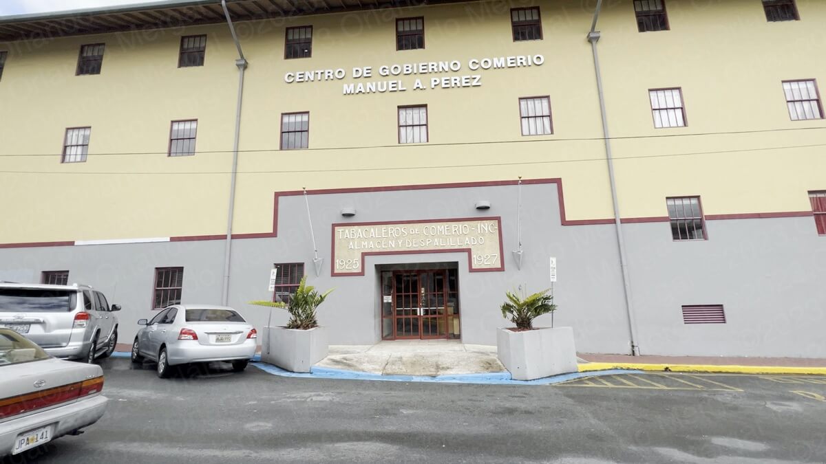
Former Comerío Tobacco Destemming
and Warehouse Facilities
(click on image to see it larger)
From this point on we did a little bit of walking. A few blocks north of the Cultural Civic Center there’s a huge building, painted in yellow and gray, that was once a tobacco destemming facility. This is because towards the turn of the 20th century Comerío was one of the most important tobacco producers on the Island. So much so that it was actually called “El Pueblo Del Tabaco”, or “the tobacco town” and its original flag had a tobacco leaf in the center.
You can tell how important tobacco was for Comerío by the sheer size of this building. In fact, at the turn of 20th Century Comerío’s tobacco was ranked among the best in the world.
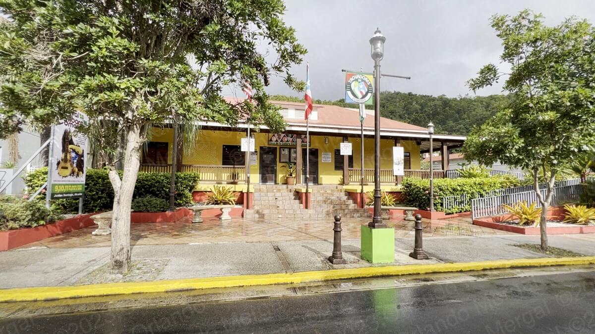
A little further north, along road 156, we visited the “Casa de La Cultura Cacique Comerío”, a reception and activity center where you’ll find information about Comerío, itinerating exhibitions and meeting rooms where different activities take place. There’s even a skeleton of a young Arawak girl, encased in glass, that was discovered in the “Piñas” ward of Comerío.
-

- Cacique Comerío House Of Culture
(click on image to see it larger)
-
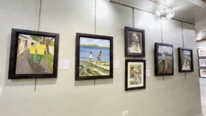
- Itinerating exhibition
(click on image to see it larger)

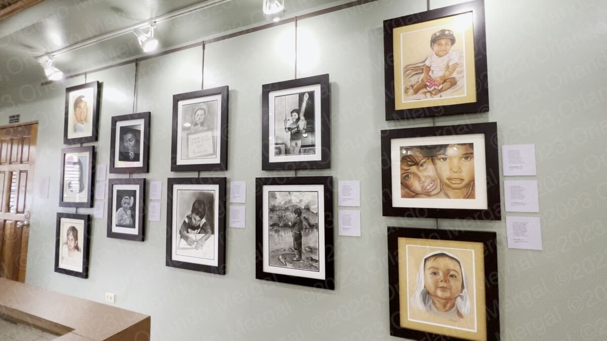
-

- Itinerating exhibition
(click on image to see it larger)
-
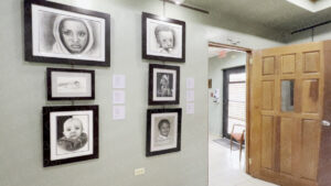
- Itinerating exhibition
(click on image to see it larger)

-
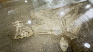
- Arawak Indian Remains
(click on image to see it larger)

-

- Mrs. Rosa Meléndez
(click on image to see it larger)
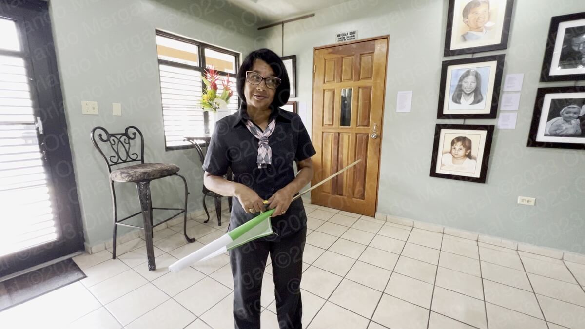
There we met with Mrs. Rosa Meléndez.
 You can also book a half-day city tour that includes a knowledgeable guide, a talk about the town’s history, visits to the most iconic places and transportation. At the time of this writing it was only $7 per person, which in my opinion is a great deal.
For more information call 787–875-7075.
And speaking about tours and guides, there are two spectacular places in Comerío that we chose to pass on. One was “La Mora” cave system and the other was a natural water pool called “Los Pilones”. According to Mrs. Meléndez, the caves are quite dangerous and getting to “Los Pilones” takes a long walk along treacherous terrain. Both require a specialized guide and a strong, healthy physique that I lost years ago. I wouldn’t be surprised if you had to sign a hold-harmless waiver as well.
There was still another place of interest just north along road 156, but we were far enough from our car already, and we would’ve just gotten further away if we continued. So we decided to go back to our car and then drive to “The Tree Of Life”˘.
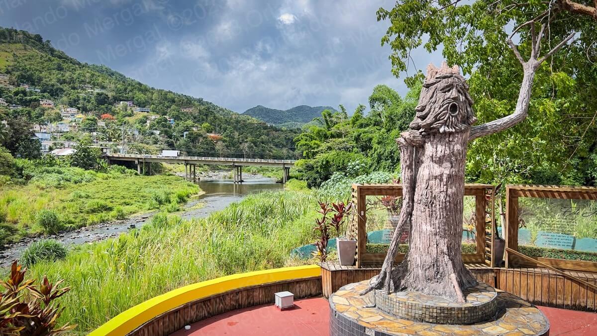
Tree Of Life Viewpoint
(click on image to see it larger)
“The Tree Of Life” is a small park on the North end of town with a unique sculpture sitting in front of the “La Plata” riverbed. La Plata River is Puerto Rico’s longest river and also one of the mightiest. Its width alone will give you an idea of the power of this river.
During hurricane María thousands of “comerieños”, and many others living down river, got to experience that might first hand. But hey, we were there on a beautiful sunny morning and the riverbed only added to the beautiful landscape.
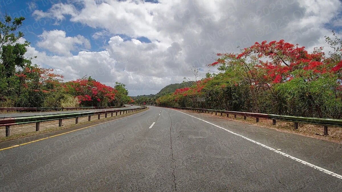
There were “flamboyanes” everywhere
(click on image to see it larger)
Another thing that added to the landscape were the hundreds of “flamboyanes” in bloom. Normally these trees bloom in August, but this year they’re simply out of control. I guess it has to do with climate change.
I talk all about “los flamboyanes”, and how they got to Puerto Rico, in my previous video and post about the town of “Cidra”.
There was one more place on our list. It was a swimming hole, on the West outskirts of town, that I read about somewhere on the Internet. I try to make these posts and videos as varied as possible. After all, not everybody is into old churches and buildings. So I try to include a little bit of everything.
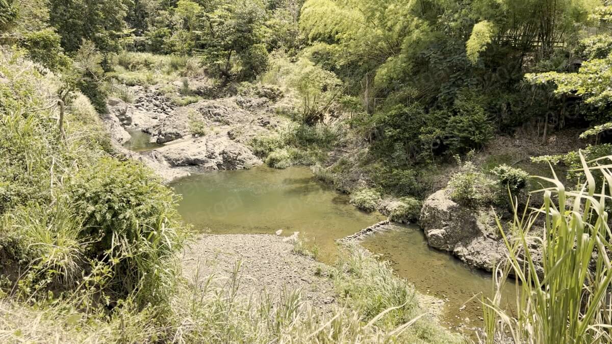
Las Pailas Swimming Hole
(click on image to see it larger)
“Las Pailas” is a natural pond, a few miles west of town, in the “Río Hondo”. In Spanish the words “río hondo” mean “deep river”, so we imagined it more like the “Charco Azul” that we covered in our Cayey video. But it was nothing like that. In fact it was a little underwhelming.
Even so, the winding country road, lined with dozens of “flamboyanes”, made the trip more than pleasurable.
The easiest way to get out of Comerío is the same way you arrived. Just follow State Road 167 until you reach Toll Road 22. Then turn right and follow Toll Road 22 until it merges with State Road 18. Eventually you’ll reach the Minillas Tunnel.
Or better yet, record your hotel coordinates before you leave in the morning and punch them into your GPS in the afternoon to get back to the San Juan Metroplex.
And talking about San Juan, if you’re planning to visit the Old City, save yourself the hassle of traditional city tours. They’re expensive and you’ll be herded along with people that won’t necessarily share your interests.
Instead, order The Old San Juan Walking Tour. It’s packed with useful information about all the main attractions, as well as every GPS coordinate and two hours of exclusive online video. That way you’ll be able to —visit before you visit— and hit the ground running when you arrive in the Old City.
NOTE: Due to the large extension of land covered in this post, you will need to zoom in and out on the map to see every pin. Please pardon the inconvenience.
See you next time!
©2023,Orlando Mergal, MA
____________________
Bilingual Content Creator, Blogger, Podcaster,
Author, Photographer and New Media Expert
Tel. 787–750-0000, Mobile 787–306-1590
![]()
![]()