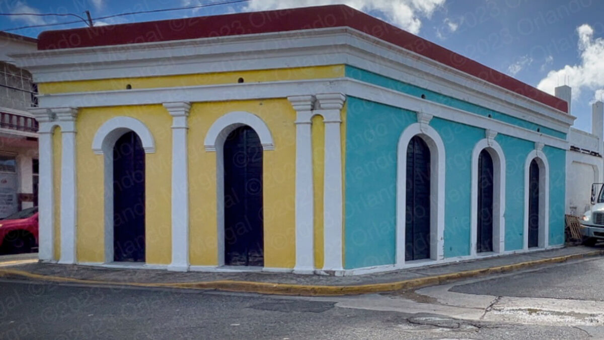
Colonial Architecture in Maunabo
(click on image to see it larger)
Maunabo is one of those tiny towns in Puerto Rico that still has the magic of yesteryear. For many years it was one of the hardest towns to get to because of its geographic location. That certainly put a damper on “progress”, but it also helped save the “magic” of that sleepy Spanish-style town that we all love.
My wife and I visited Maunabo on September 29th, as part of our “5 Must-See Places” series. “5 Must-See Places” at each town that is, not “5 Must-See Places” in Puerto Rico.
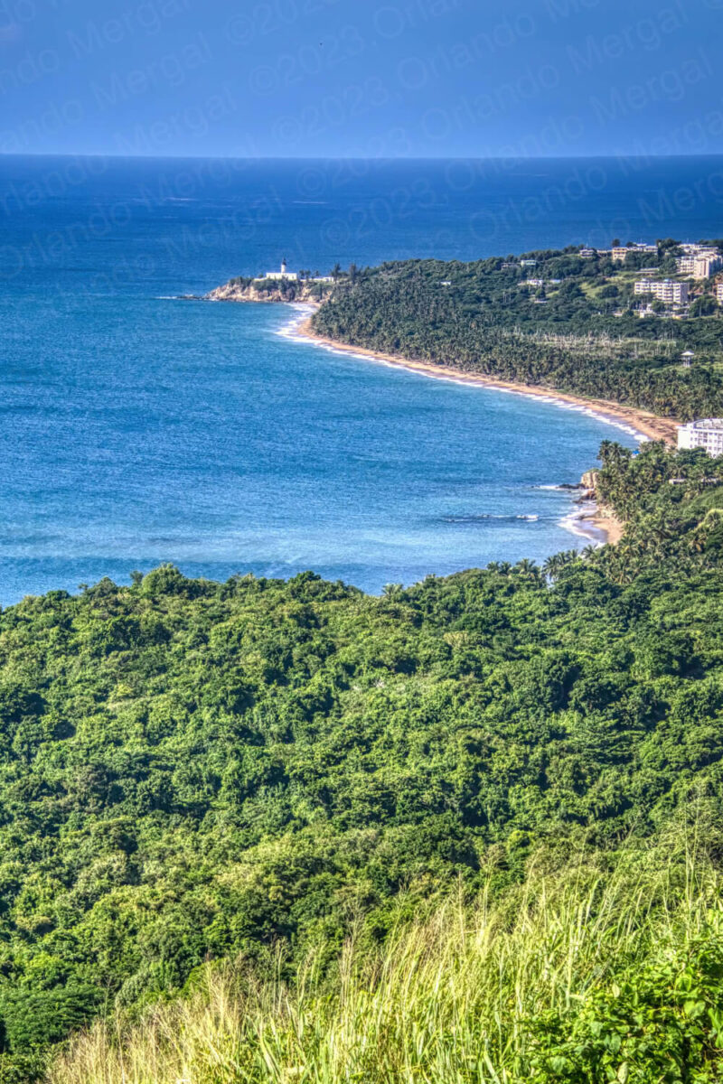
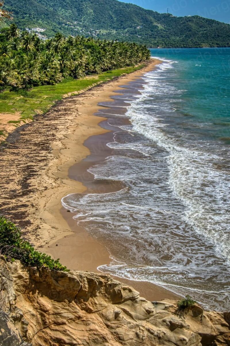
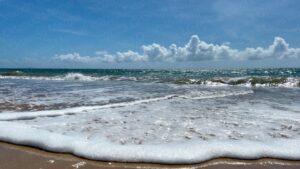
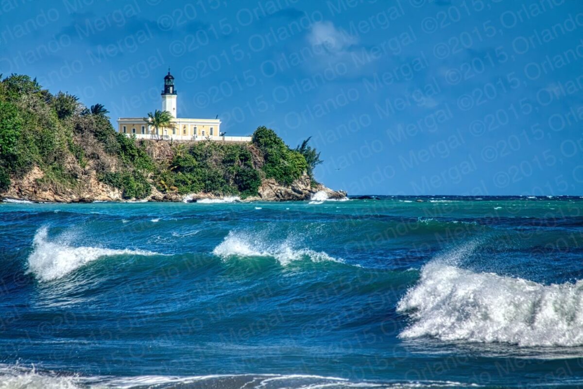
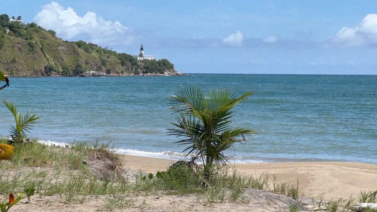
Maunabo shoreline with the Punta Tuna Lighthouse in the distance
(click on image to see it larger)
When we first we entered the jurisdiction of Maunabo it was 8:39am, quite a feat for someone driving from San Juan. We stopped to take in the view from a vantage point way up in the mountains, just after passing the Yabucoa town line. And let me tell you, I’ve been to Italy, Spain and up and down the United States and the Maunabo coastline has nothing to envy. It’s simply breathtaking.
As we reached town it was already 8:38am. The town was just waking up. The main square was deserted, the church was closed and there was just a single person standing in front of City Hall. We walked around the square for a few minutes and decided to head for the Punta Tuna Lighthouse area, cover that from the eastern side, return to town and then cover the western side of Punta Tuna in the afternoon.
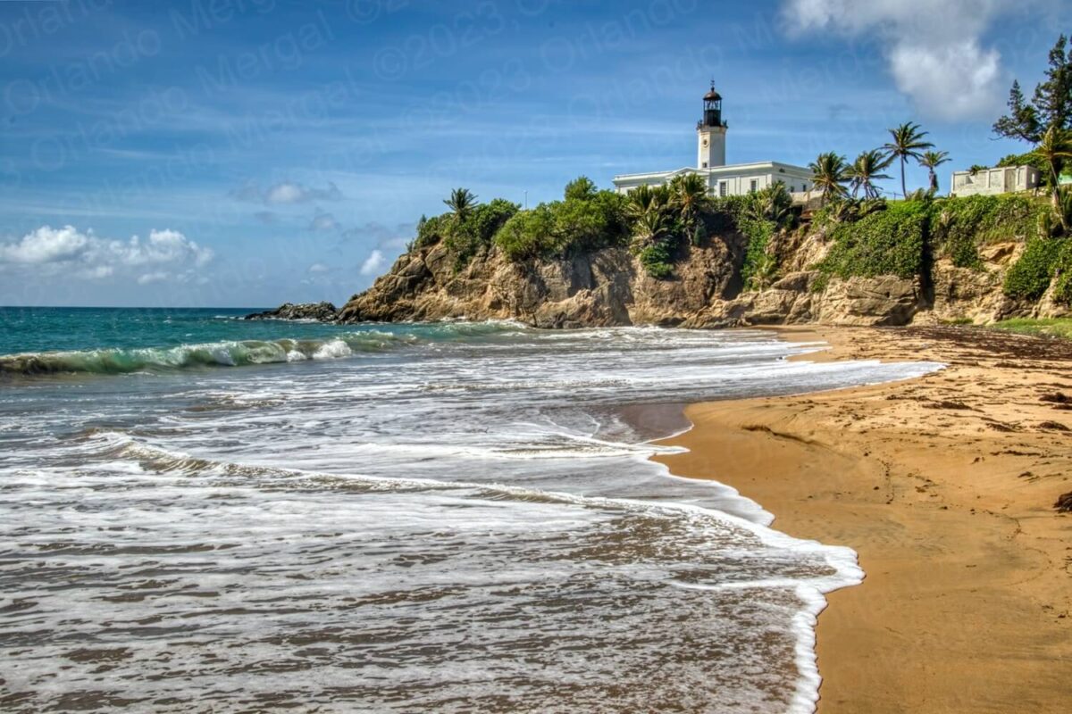
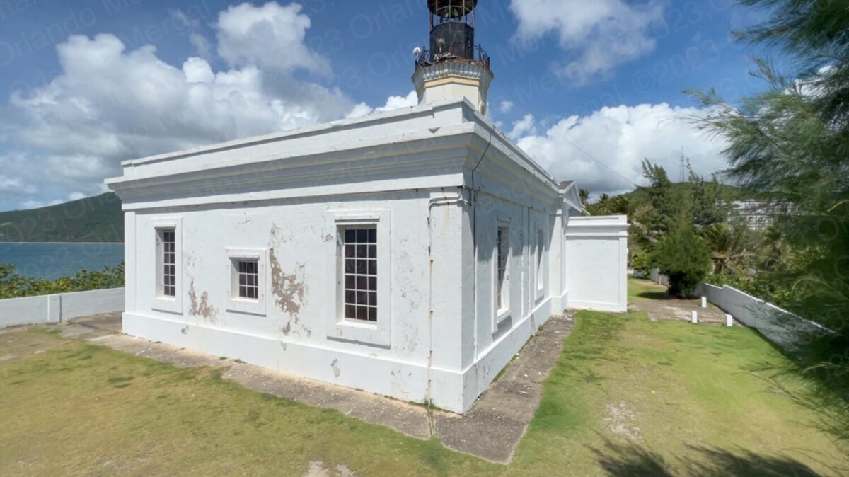
Punta Tuna Lighthouse
(click on image to see it larger)
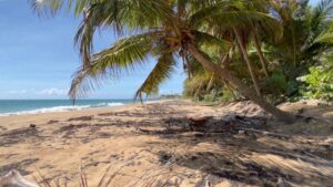
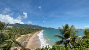
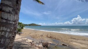
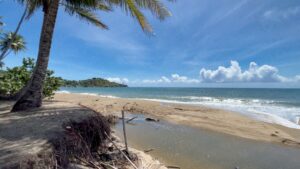
The Punta Tuna Lighthouse is one of those magical places that Puerto Rico isn’t using to its full potential (more on that in a minute). It sits next to another magical place called the Punta Tuna Nature Reserve and a loooooooooong stretch of beach aptly called “Playa Larga”, which in English means “Long Beach”.
Playa Larga is a beautiful part of Puerto Rico’s Caribbean Sea coastline. The sand is golden yellow and the water is a wonderful crystalline turquoise blue. However, I noticed that there wasn’t a single soul throughout the entire stretch. That got me thinking, so I decided to investigate further.
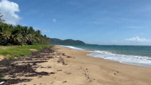
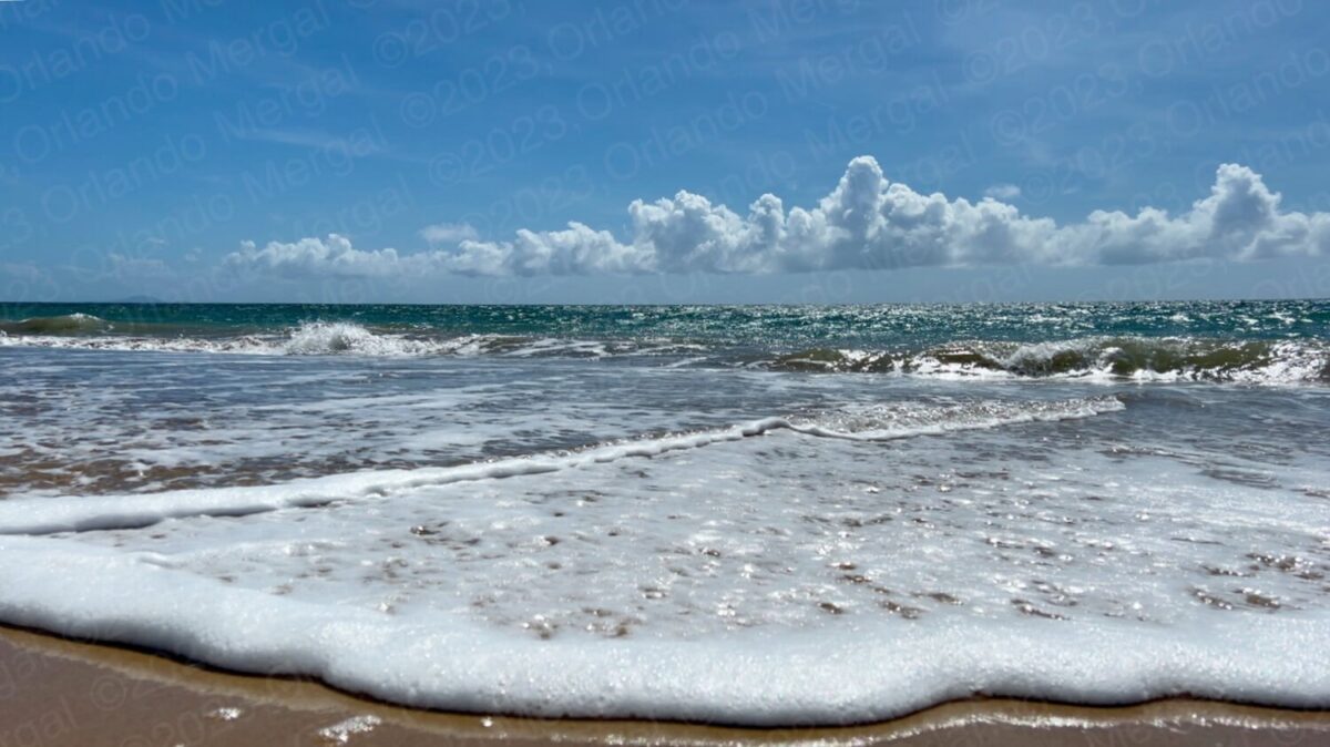
Playa Larga
(click on image to see it larger)
What I discovered is that “Playa Larga” is known for high surf and rip currents. It’s also a protected nesting area for sea turtles. Maybe that’s why there was no one there. The fact of the matter is that the area is simply stunning.
I also noticed two negative aspects for which no one in particular on the Island is to blame. First was the evident effects of erosion caused by rising sea levels. It’s like someone bit a chunk out of the entire coastline. This is caused by the rising temperature levels, that in turn have been melting the polar caps and causing the rise in sea levels.
Add to that the unprecedented amount of sargazo weed that the Island has received this year and it sadly makes for ugly beaches. Not only in Puerto Rico, but throughout the entire Caribbean area and the eastern seaboard of the United States.
All in all “Playa Larga” is still stunning.
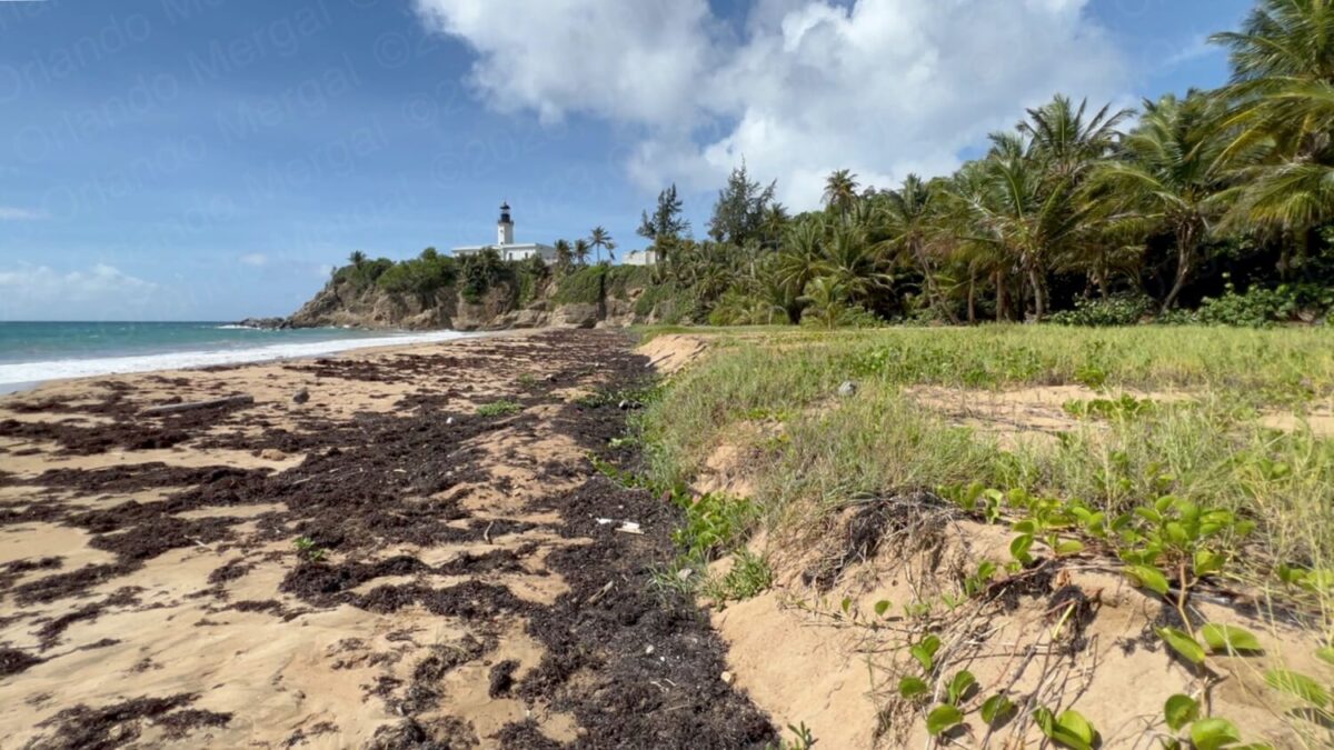
Evident effects of erosion and abundant sargazo weed at Playa Larga
(click on image to see it larger)
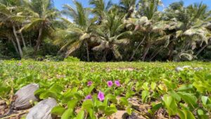
Against my dermatologists recommendations I decided to walk the entire beach, end to end, and came up with some pretty nice images (if I do say so myself). This is one place that is truely “a photographer’s playground”.
It would have been even better to arrive at around 6:30 in the morning, to catch the Caribbean’s golden sun rays hitting the Punta Tuna Lighthouse from the east. But that would have meant leaving home in San Juan at 4:30 in the morning. Another option would have been to stay at a small hotel in the area. But we’re producing this series on our dime and on a shoestring budget, so that was out of the question.
Albeit that it was close to 10:00am, and that the sun was a little bit higher in the sky, I’m sure you’ll agree that this area is pure eye candy for landscape photographers.
-

- Playa Larga | Maunabo, Puerto Rico
(click on image to see it larger)

-
- Playa Larga | Maunabo, Puerto Rico
(click on image to see it larger)

-
- Playa Larga | Maunabo, Puerto Rico
(click on image to see it larger)
-
- Playa Larga | Maunabo, Puerto Rico
(click on image to see it larger)

After putting in my quota of beach pictures for one morning at “Playa Larga” we went up to the Punta Tuna Lighthouse. I had visited the lighthouse for the last time on March 10, 2015. And how do I recall the exact date, you might ask. Because of the time stamp on my digital images for that day. Isn’t technology wonderful?
Most lighthouses, both locally and nationally, have been decommissioned by the U.S. Coastguard and replaced with federal buoys, beacons, and electronic aids (including the commercial version of GPS, which adds additional features).
-
- The lighthose hasn’t been touched at least since 2015
(click on image to see it larger)

-

- The lighthose hasn’t been touched at least since 2015
(click on image to see it larger)
-
- Playa Larga as seen from the lighthouse

Most towns, fortunate enough to have a lighthouse, have converted them into tourist attractions, with museums, playgrounds and even reenactments. I don’t know what it is, but there’s something about lighthouses that attracts tourists.
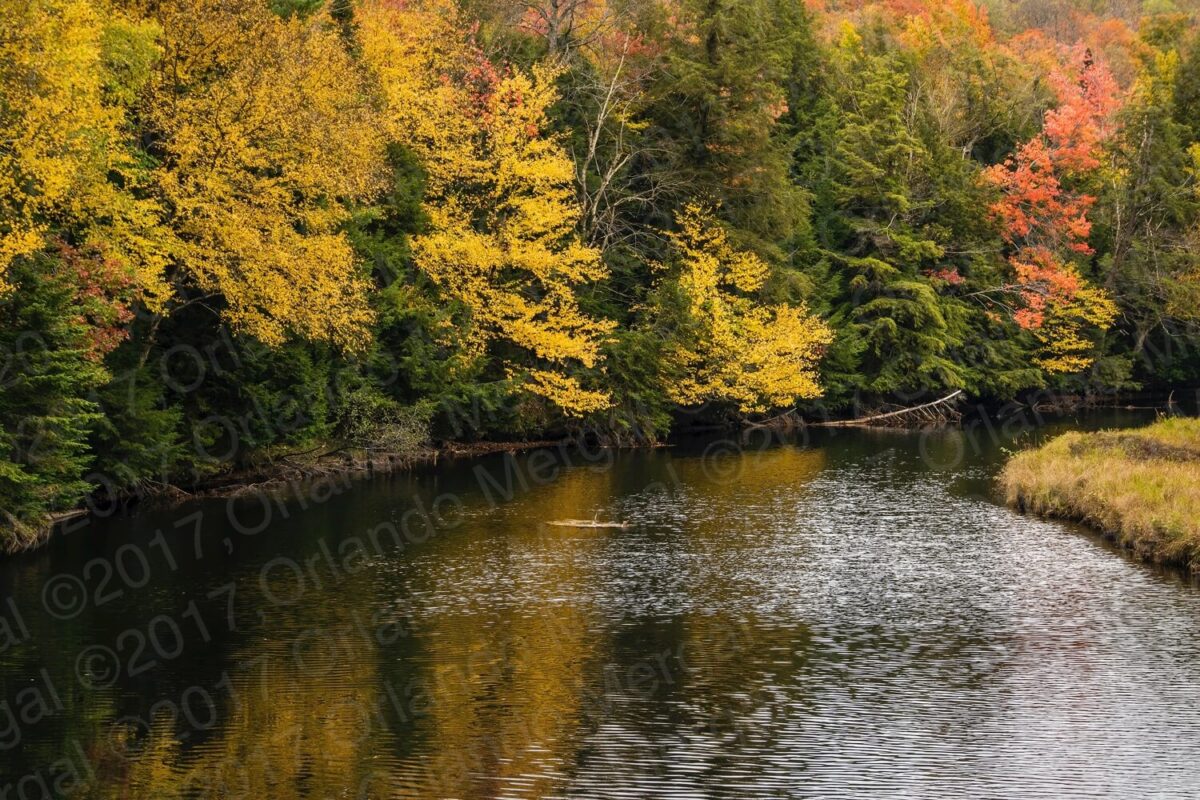
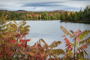
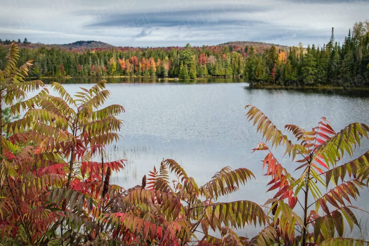
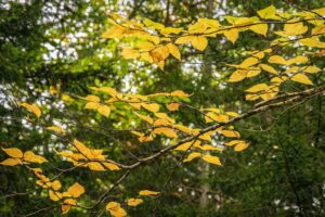
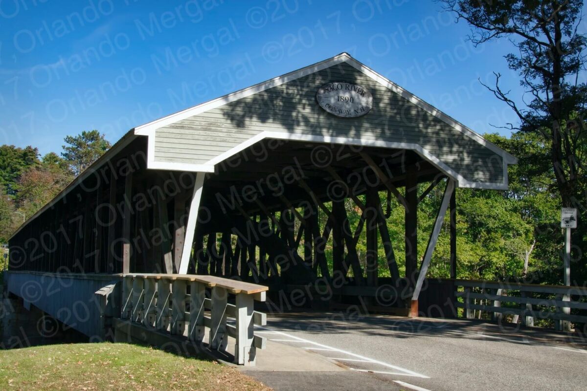
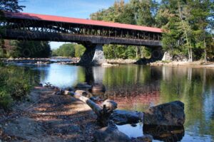
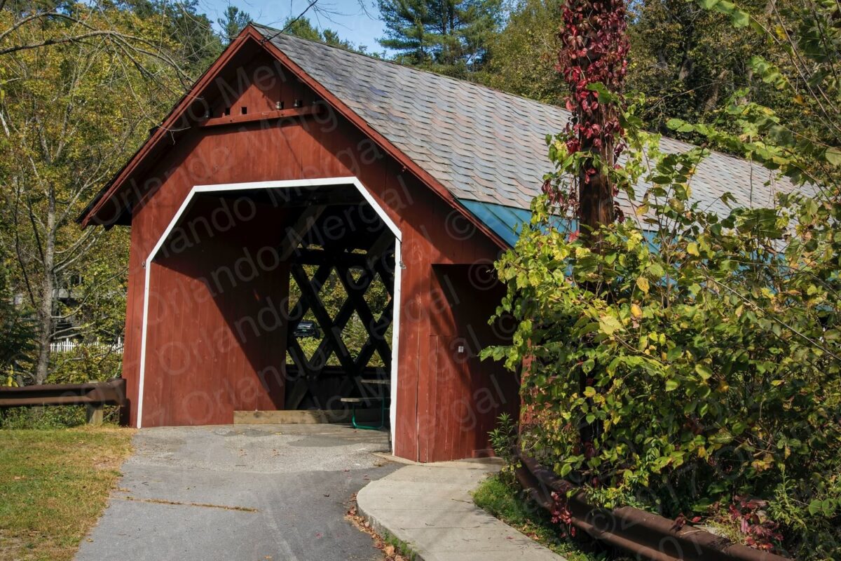
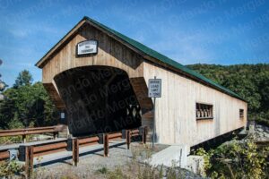
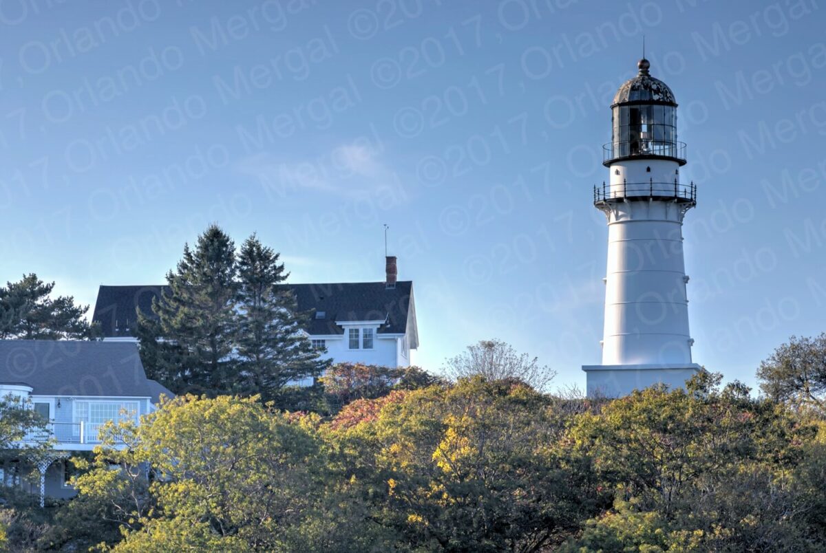
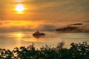
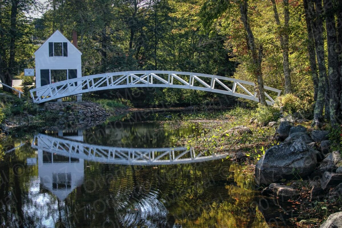
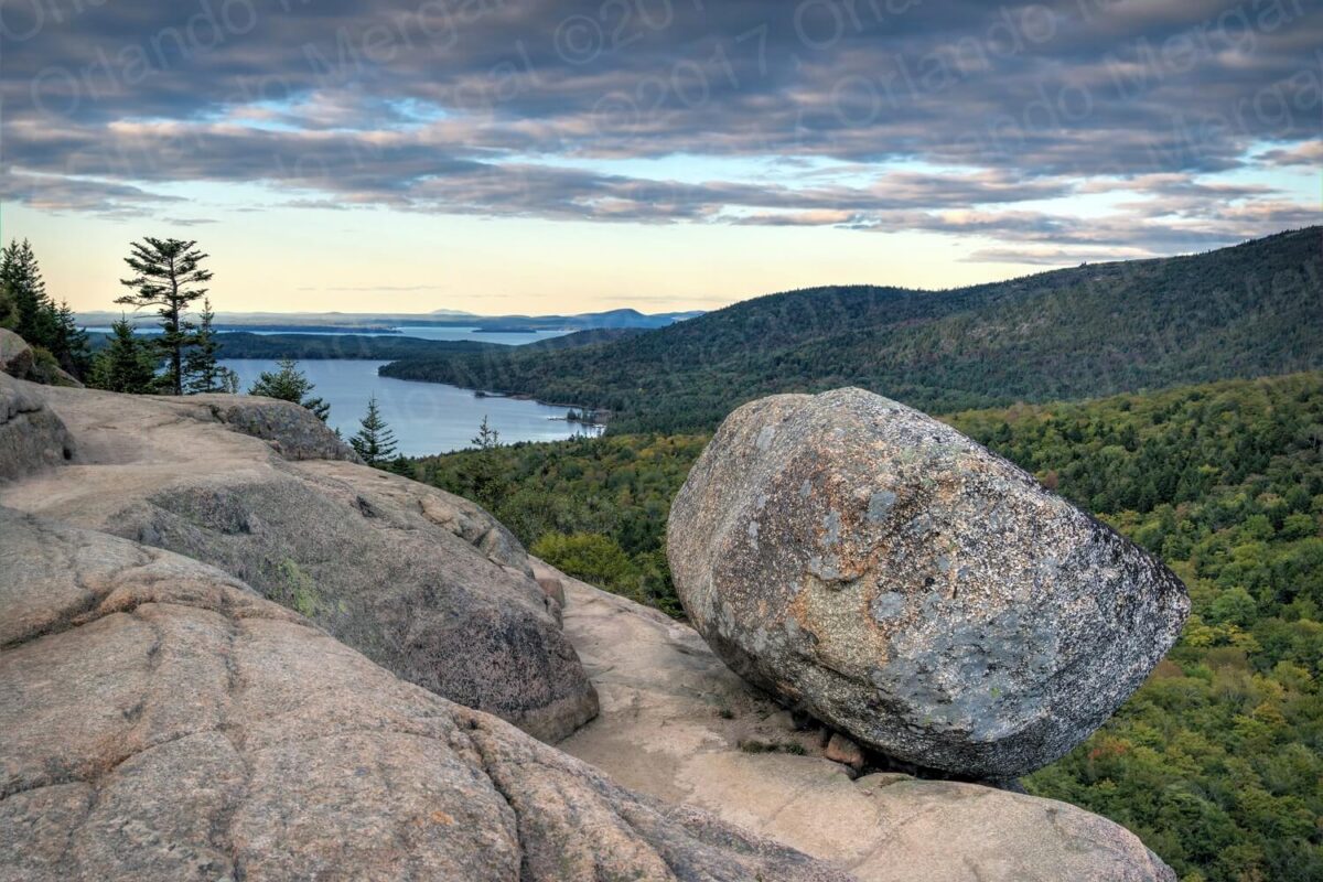
In fact, my wife and I made a trip to New England back in 2017 just to shoot fall color, covered bridges, lighthouses and —of course— visit Acadia National Park.
-
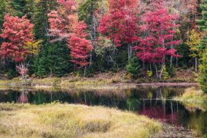

- Fall Color in New England
(click on image to see it larger)

-
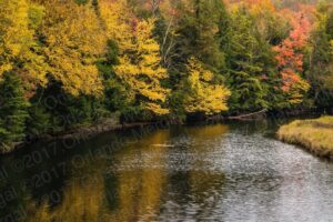
- Fall Color in New England
(click on image to see it larger)
-
- Fall Color in New England
(click on image to see it larger)
-
- Fall color in New England
(click on image to see it larger)

-

- Covered bridge in New England
(click on image to
-
- Covered bridge in New England
(click on image to

-

- Covered bridge in New England
(click on image to
-
- Covered bridge in New England
(click on image to see it larger)

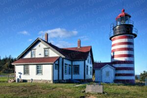
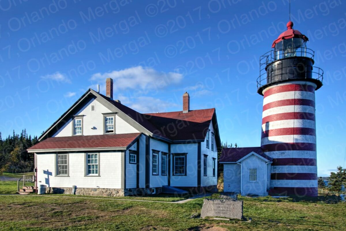
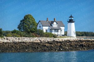
-


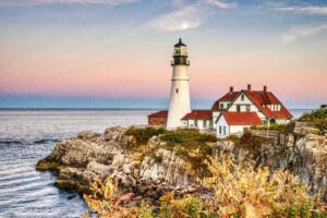
- Lighthouse in New England
(click on image to see it larger)
-
- Lighthouse in New England
(click on image to see it
-
- Lighthouse in New England
(click on image to see it

-
- Lighthouse in New England
(click on image to see it

-
- Acadia National Park
(click on image to see it larger)

-
- Acadia National Park
(click on image to see it larger)
-

- Acadia National Park
(click on image to see it larger)
-

- Acadia National Park
(click on image to see it larger)
Maunabo hasn’t followed the national trend of converting local lighthouses into tourist attractions. Of course, they are fortunate enough to have the lighthouse. But it’s just sitting there.
When we visited, back in 2015, the attendant at the time told us that the city had just been granted the lighthouse and that they were planning to restore it and convert it into a museum. Well, eight years later it hasn’t changed a bit. It’s just sitting there and the present day attendant seems so bored that she hardly moves a muscle when she speaks to you.
We walked around the lighthouse perimeter for a while, but there’s nothing there except for the stunning landscape that surrounds it. You have a beautiful top view of “Playa Larga” to the east and of “Playa Negra” to the west.
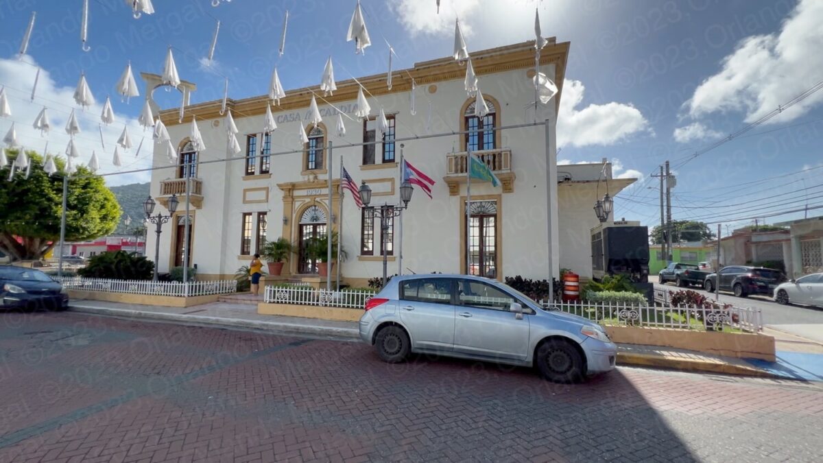
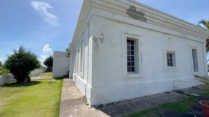
Maunabo City Hall
(click on image to see it larger)
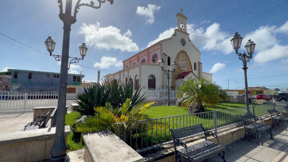
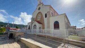
After leaving the Punta Tuna Lighthouse it was almost noon so we decided to give the Catholic Church a second try. As I’ve said in previous posts, there are tourists that go around the world visiting old churches. It’s a form of tourism just like visiting museums, castles or national parks can be. And, since Puerto Rico has a great deal of beautiful old churches, we make it a point to visit them as an essential element of our “5 Must-See Places” series.
And why are they mostly Catholic, you might ask? Well, because Spain is a Catholic country and Puerto Rico belonged to Spain for over 400 years. That means that the oldest churches on the Island are a mostly Catholic.
When we got back to town the church was still closed, so we went to City Hall to ask when we might catch it open.
When I was a child I remember Catholic temples being open all day. But today it’s a different story. Crime and vandalism has forced them to take stricter measures. And, since they don’t have the people, or the budget, to have someone watching the temples all day long, they simply celebrate mass in the morning and close the rest of the day. It’s a sad thing to say, but that’s the world that we live in.
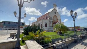
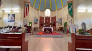
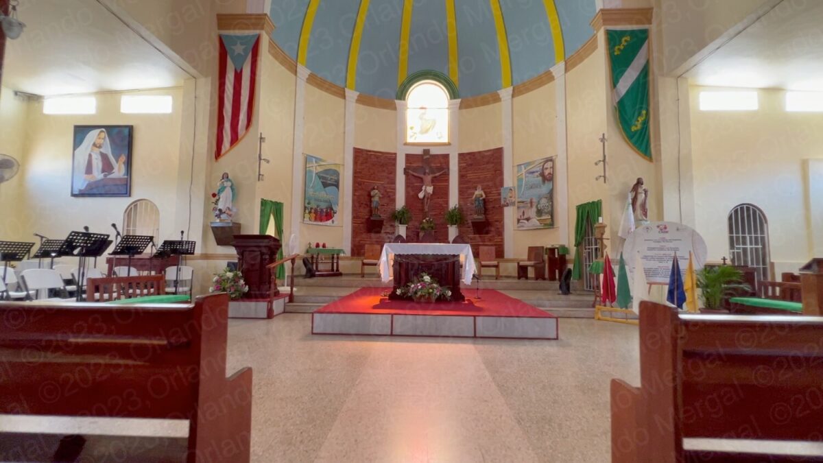
At City Hall they suggested that we walk around the back of the church and ask at the parish office. Fortunately the priest was there and he was nice enough to let us in.
-
- San Isidro Labrador & Santa María de la Cabeza Parish
(click on image to see it larger)
-
- San Isidro Labrador & Santa María de la Cabeza Parish
(click on image to see it larger)

-
- San Isidro Labrador & Santa María de la Cabeza Parish
(click on image to see it larger)
-
- San Isidro Labrador & Santa María de la Cabeza Parish
(click on image to see it larger)

-

- San Isidro Labrador & Santa María de la Cabeza Parish
(click on image to see it larger)
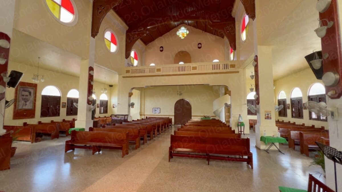
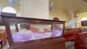
The San Isidro Labrador & Santa María de la Cabeza Parish is a 224-year-old temple that’s as nice on the outside as it is on the inside. It’s not as large as others that we’ve visited, but it’s certainly beautiful.
After leaving the parish we decided to have lunch and go for a drive in the countryside. Shooting the Punta Tuna Lighthouse from both sides poses a geographical and astronomical conundrum. Why? Because it sits on a promontory that points straight south.
That means that you’ll have to be on the east side early in the morning and on the west side late in the afternoon. And if you want to make your images during the blue hour your best bet will be to stay at a local hotel.
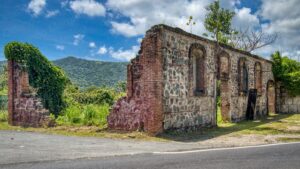
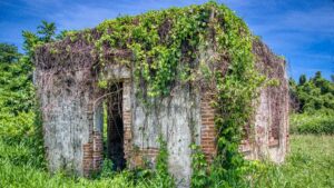
We took State Road #3 going west, as if we were going to the neighboring town of Patillas. It’s a beautiful stretch of road that in many areas borders the Caribbean sea. Another thing we found along State Road #3 were the ruins of the old Columbia Sugar Cane Mill.
The Columbia Sugar Cane Mill was established in 1900 and destroyed by hurricane San Felipe in 1928. According to a neighbor that I spoke with, hurricane Georges destroyed most of what was left in 1998 and hurricane María cleaned out the rest in 2017.
-
- Columbia Sugar Cane Mill
(click on image to see it larger)

-
- Columbia Sugar Cane Mill
(click on image to see it larger)

-

- Columbia Sugar Cane Mill
(click on image to see it larger)
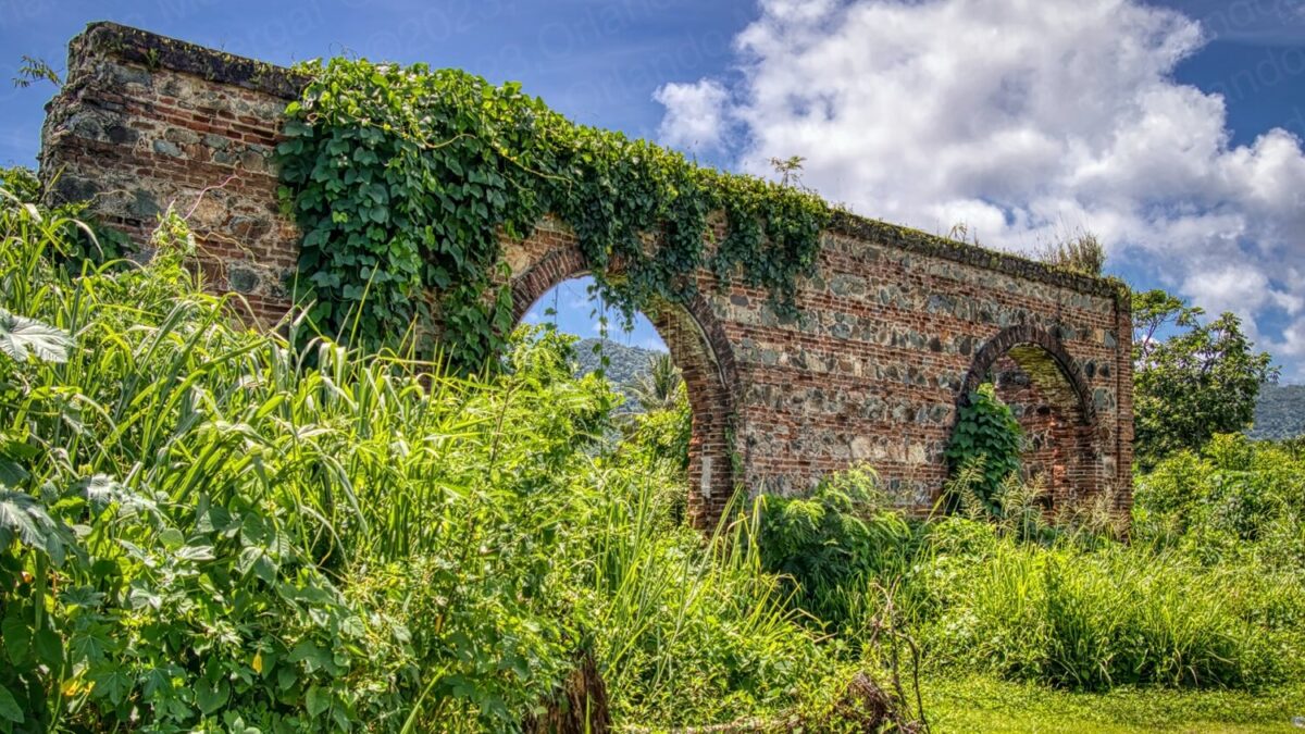
Today only a few walls are left, but with a little creativity and imagination you can make some great images.
It was getting close to 2:00pm and my watch was dragging its hands like Columbia Sugar Mill molases. I had little or nothing left to shoot in Maunabo so we headed for “Playa Negra”, the black sand beach that sits west of the Punta Tuna Lighthouse.
Punta Tuna Lighthouse from Playa Negra 2015
(click on image to see it larger)
This used to be the ideal spot to shoot the lighthouse from its western side. In fact, I made a beautiful image from that very spot back in 2015. But now it’s a different story.
Global warming and the rise in sea levels have taken their toll on Playa Negra. What used to be black sand is more like a hole. The depression from where I parked my car to the water’s edge was between 4 and 5 feet deep. You can see the root system on various palm trees and what you have is tan sand from the sea bottom covering what used to be black sand.
There’s a vacant building behind the beach that looks like it might have been a food stand. Admittedly, someone keeps it clean and mostly free of graffiti. But the fact remains that the area hardly resembles what it was in the past.
As for picture taking, you have the mouth of the Maunabo river right by and there are still a few plants and palm trees that you can use as foreground for an evening shot of the lighthouse.
And believe me, I don’t report any of this with pleasure. But it’s God’s honest truth. And in Puerto Rico By GPS we tell it like it is. That has always been our motto.
-
- This is what Playa Negra looks like today
(click on image to see it larger)

-
- This is what Playa Negra looks like today
(click on image to see it larger)

-

- This is what Playa Negra looks like today
(click on image to see it larger)
As for the government? You could argue that climate change, global warming and rising sea levels are both: not their fault and beyond their control. But other than the same “environmental activist voices”, that are always in the news commenting about these issues, you hardly hear anyone else addressing these problems, especially government figures.
Well, here’s a news flash for them (the government, that is). Most of the tourists that visit Puerto Rico come here for the beaches. Don’t believe me? Ask them!!! And if our beaches “go to hell in a hand basket” so will our tourism sector. So get with the program.
Please give me a second while I get off my soapbox.
Even with the present conditions I was able to pop off a couple of great images from “Playa Negra”. I’ve also included one that I shot back in 2015, with choppy sea conditions, that I especially like.
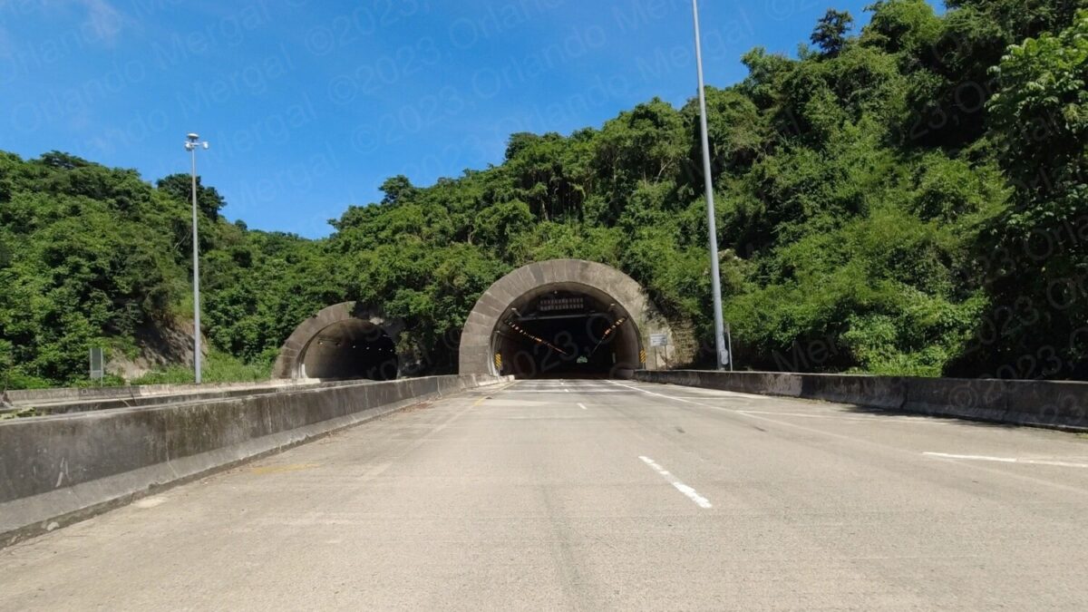
Vicente Morales Tunnels
(click on image to see it larger)
After leaving “Playa Negra” we returned home through the Vicente Morales Tunnels. We didn’t use them during our morning drive because we arrived along the more scenic beachside road.
The Vicente Morales Tunnels are a 1 kilometer-long tunnel system that goes between Maunabo and the neighboring town of Yabucoa. They’re also the longest in Puerto Rico.
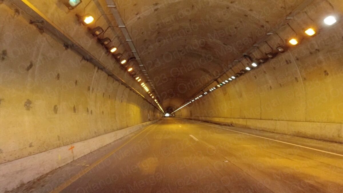
Vicente Morales Tunnel Interior
(click on image to see it larger)
And how can a 1 kilometer tunnel be the longest anywhere, you might ask? Well, that’s because they’re the only real tunnels in Puerto Rico. The other “so called” tunnels are the “Minillas Tunnel” in San Juan, and those aren’t real tunnels to begin with.
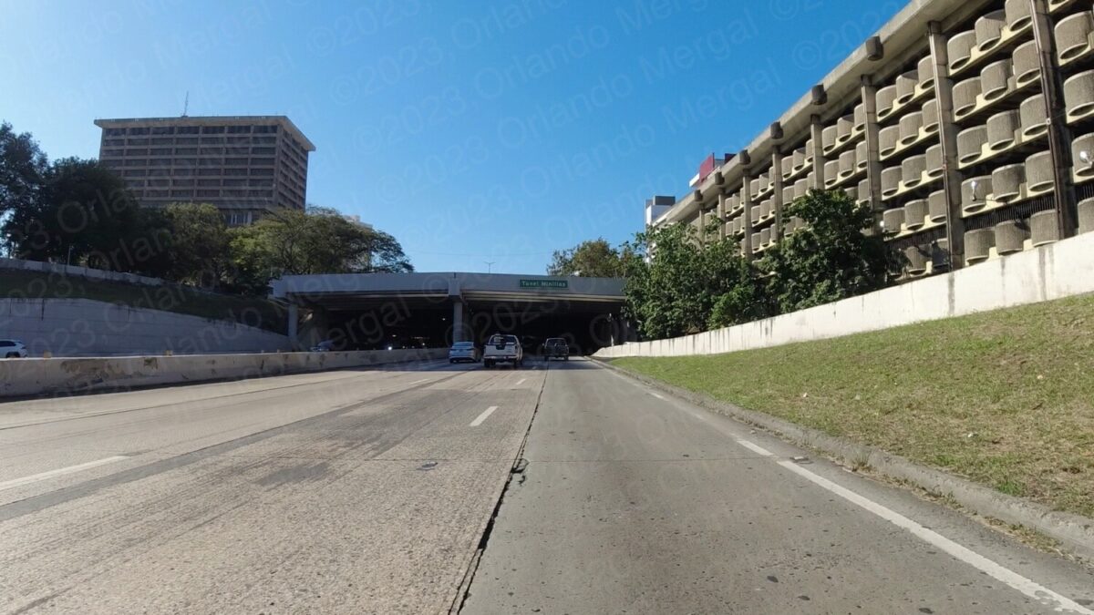
Minillas Tunnel, San Juan
(click on image to see it larger)
The Minillas Tunnel is actually a huge bridge of sorts that holds the Minillas Government Center on top. I saw it being built during the late 70’s and what they did was dig a huge trench, build the road and then build the “ceiling” above. Of course, they ended up with a tunnel of sorts but it wasn’t like they bored a hole through anything.
Besides, the Minillas Tunnel, even if it were a real tunnel, is only 396 meters long.
After exiting the Vicente Morales Tunnels we took a beautiful drive along State Road 53 to Humacao, State Road 30 from Humacao to Caguas and Toll Road 52 back to San Juan.
And talking about San Juan, if you’re planning to visit the Old City, save yourself the hassle of traditional city tours. They’re expensive and you’ll be herded along with people that won’t necessarily share your interests.
Instead, order The Old San Juan Walking Tour. It’s packed with useful information about all the main attractions, as well as every GPS coordinate and two hours of exclusive online video. That way you’ll be able to —visit before you visit— and hit the ground running when you arrive in the Old City.
See you next time.
©2023,Orlando Mergal, MA
____________________
Bilingual Content Creator, Blogger, Podcaster,
Author, Photographer and New Media Expert
Tel. 787–750-0000, Mobile 787–306-1590
![]()
![]()