
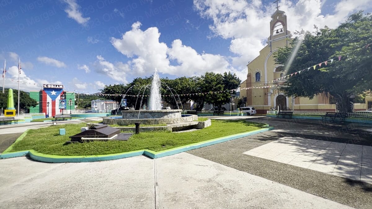
Adelina Cintrón Square, Patillas, PR
(click on image to see it larger)
Last week my wife and I visited the town of Patillas, on the southeastern coast of Puerto Rico. It’s one of those small and sleepy towns that are best visited in combination with adjacent municipalities. However, we did discover some gems that make this town unique and well worth the visit.
I must admit that the words Green, Rocky & Cool don’t generally go together. When a place is rocky it’s generally not cool and it’s definitely not green either. But somehow Patillas manages to pull that all off at the same time.
As always, we left San Juan around six in the morning. Our goal was to catch the Catholic church open, explore that first and then proceed with the rest of the town. Well, this time we hit the jackpot in more ways than one.
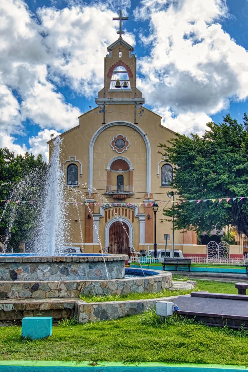
Immaculate Heart Of Mary Parish
(click on image to see it larger)
Not only was the Immaculate Heart Of Mary Parish open, but it was one of the nicest temples that we’ve visited since we started this series back in January, 2023. Of course, most temples are beautiful in the eyes of their parishioners, but we look at them from a “tourist’s” perspective.
Believe it or not, there are tourists that go around the world visiting old churches and Puerto Rico has some of the oldest and nicest in the New World.
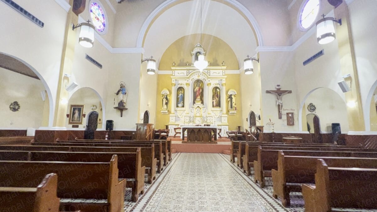
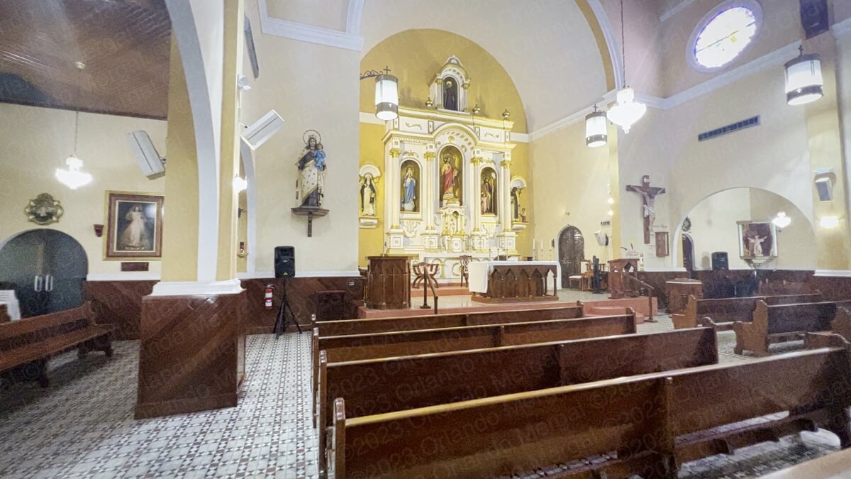
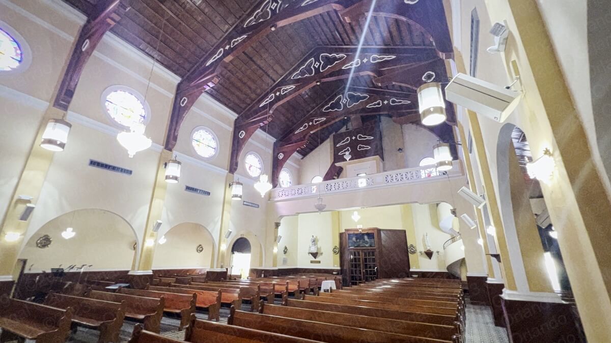
The Immaculate Heart Of Mary Parish was established in 1811 and has undergone several restorations throughout the years. Its elaborate woodwork, vaulted ceilings, stained glass windows and exquisite decorations make it a joy to visit.
When we got there the temple was open but the lights were off. The attendant was kind enough to turn on the lights so we could shoot our video better. You will find that video in the sidebar or under the “Videos” menu.
-


- Immaculate Heart Of Mary Parish
(click on image to see it larger)
-

- Immaculate Heart Of Mary Parish
(click on image to see it larger)

-

- Immaculate Heart Of Mary Parish
(click on image to see it larger)

-

- Immaculate Heart Of Mary Parish
(click on image to see it larger)
-

- Immaculate Heart Of Mary Parish
(click on image to see it larger)
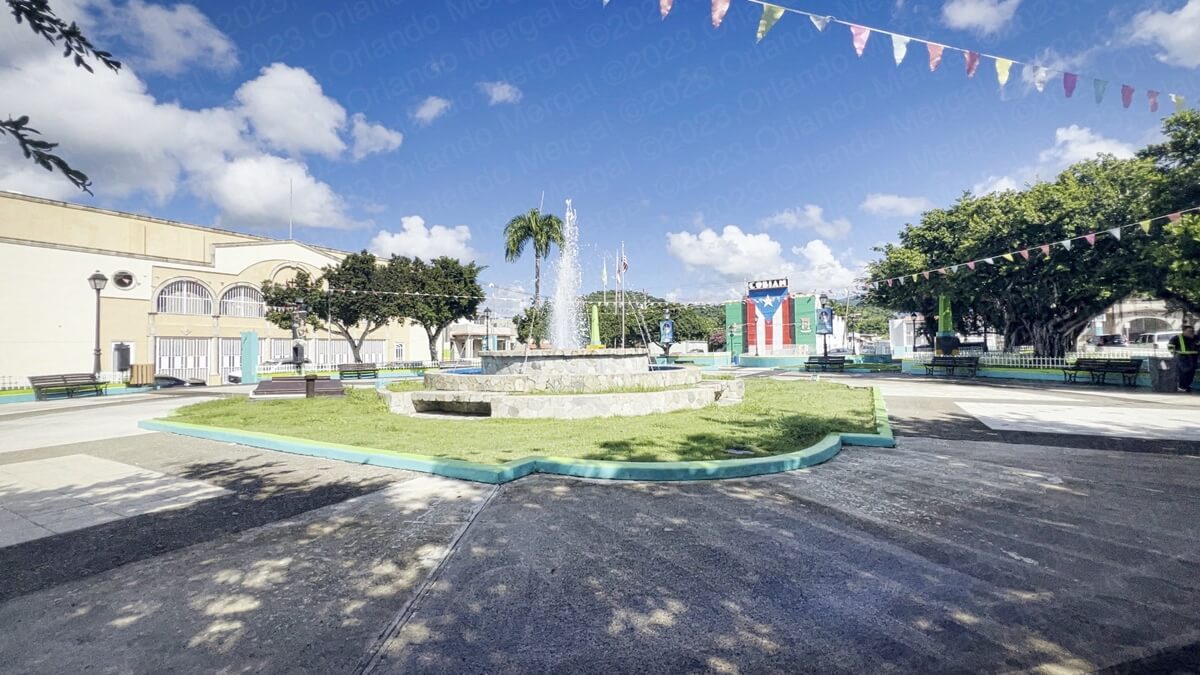
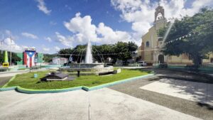
Across the street from the Immaculate Heart Of Mary Parish you’ll find the Adelina Cintrón square, a huge space where “Patillences” congregate. Adelina Cintrón was a local land owner who donated the land for the original town back in 1811.
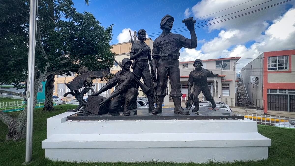
The square has a nice water fountain in the center, that was actually working, as well as monuments for the town’s fallen soldiers and a bandstand for festive and official events.
On the north side of the square there’s a green and white building, with a huge Puerto Rican flag and the word “Cobián” at the top.
Cobián used to be the name of Puerto Rico’s largest movie theater chain during the 1950’s and 60’s.
-

- Adelina Cintrón Square, Patillas, PR
(click on image to see it larger)
-
- Adelina Cintrón Square, Patillas, PR
(click on image to see it larger)

-

- Veteran’s Monument at Adelina Cintrón Square, Patillas, PR | Patillas Puerto Rico
(click on image to see it larger)
By now you will have probably noticed that most of the pictures of churches that appear in our blog have the sun behind the building. That certainly doesn’t make for the most flattering lighting. The problem is that most of those pictures are taken early in the morning. And since Catholic temples always have their altars facing east they always appear with the sun behind them.
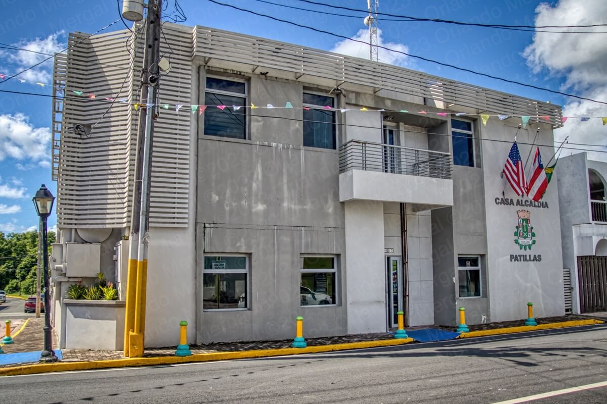
Patillas City Hall
(click on image to see it larger)
After leaving the Adelina Cintrón square we went by City Hall a few blocks south. It’s a nice modern building. Hence, it holds no historic value. So we made our picture and continued on to the town’s beaches.
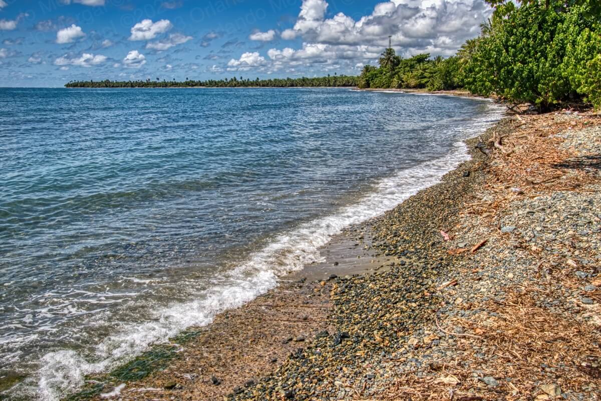
According to my research, Patillas has 6 beaches that people visit the most. Those are: “Los Hoteles”, “Malecón de Patillas”, “Córsica”, “Guardarraya”, “Inches” and “Villa Pesquera”. However, what I soon discovered is that some of them are inaccesible (more on why in a minute) and others are simply the same.
Let’s deal with the similarities first. Most, if not all, beaches in Patillas are “pebble” beaches. That means that if you’re looking for that powdery white sand, that’ll slip through your toes, you’re not going to find it. Instead, you’ll find a rocky terrain, with 1–2 inch pebbles, outside and below the water.
This isn’t unique to Patillas. Many of the beaches in the neighboring town of Arroyo are the same. In fact, many famous beaches around the world are actually “pebble beaches”. So if that’s your cup of tea, then knock yourself out. I personally prefer the powdery stuff.
If you would like to protect your feet from the rocky surface, one way to do it is to bring boat shoes. They’re like underwater sneaker and they don’t slip either.
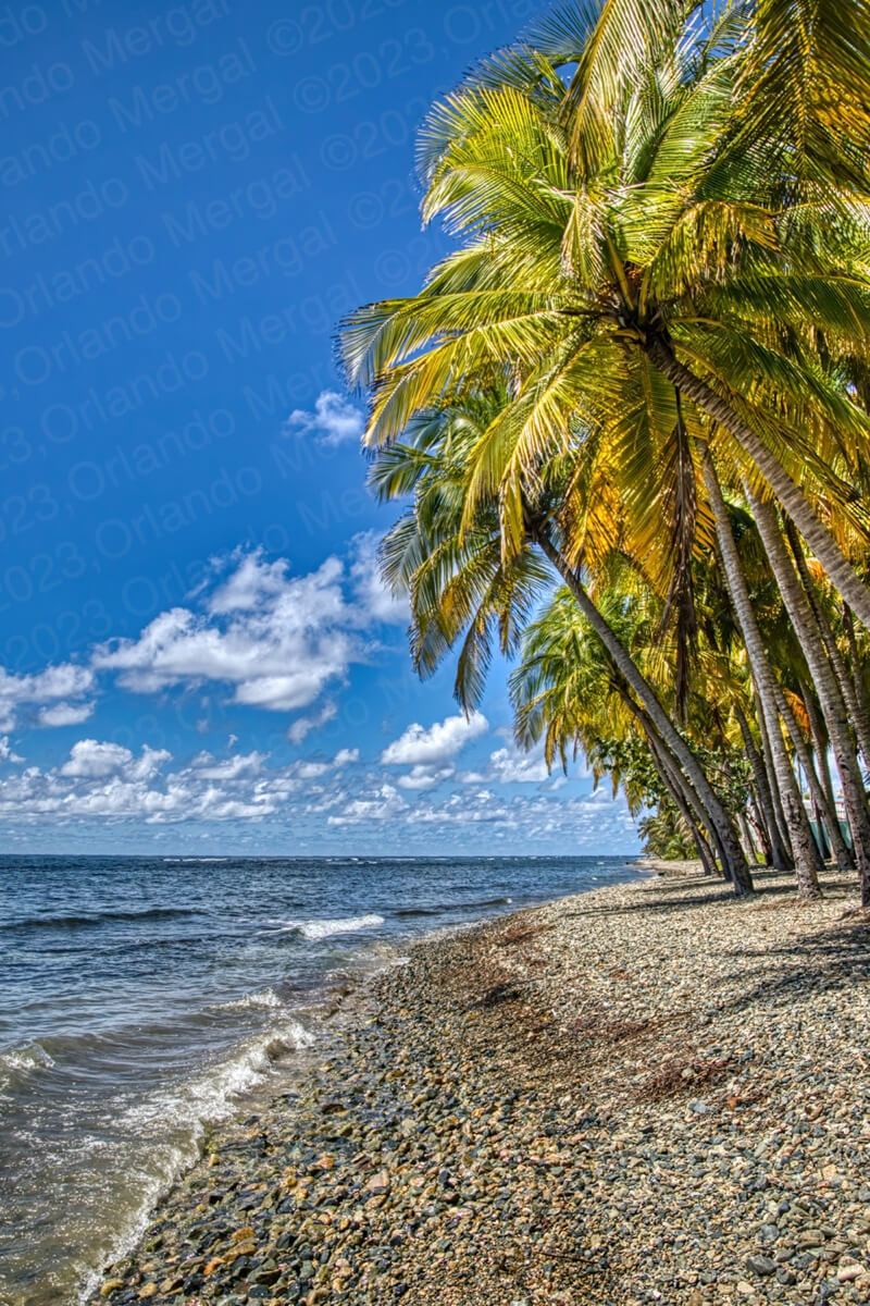
Guardarraya (Las Pocitas) Beach
(click on image to see it larger)
We also met a couple of locals who told us several interesting facts about these beaches. It you look carefully, around 200 feet out, you’ll see the water breaking in a straight line parallel to the shore. That’s because there’s a reef there. There’s also an underwater cave system that runs parallel to the shore.
This makes for abundant rip currents and occasional drownings. I suppose scuba divers must love a place like that but I wouldn’t go anywhere near it. If you do, do it at your own risk.
In the end we visited only two beaches: “La Guardarraya” (which the locals referred to as “Las Tres Pocitas” because there are supposedly three ponds there and “Inches” beach, which is actually very appropriately named because that’s what it has in the way of shore: “inches”.
The fact that most of Patillas’ beaches are basically the same was one of our reasons for visiting only two. The second was because of a sad reality that’s becoming more and more prevalent around the Island. You can see it at “Las Picuas” in Río Grande, at “Piñones” in Loíza, at “Joyuda” in Cabo Rojo and in many more places.
People have simply squatted next to the coast and shut out everybody else. In some cases, like the ones I just mentioned, you can hardly see the water. In Patillas I actually saw a sign that read: “Private Property. Only For Friends And Family”.
Why? Because you say so? How did they obtain that plot? They obviously can’t have a deed because it’s sitting right next to the water!
Inches Beach
(click on image to see it larger)
And the sad part is that the government knows about this situation and simply looks the other way. Simultaneously, visitors observe this mess, go home and tell their friends. And do you think it’ll help tourism? Hell no!!!
So that’s why we visited only two beaches, because after a while we got turned off by the same old same old.
In all fairness, I was told that there are several good seafood restaurants in the area, so if you would like to explore them go for it.
After leaving Inches Beach we drove north to see a 400+ year-old ceiba tree that’s out in the middle of nowhere (don’t worry, the coordinates are below).
Ceiba is a word from the Taíno language that means “boat”. The Taínos used the wood from ceiba trees (which is very hard and has a very high buoyancy factor) to build their dug out canoes.
Ceibas are native to tropical and subtropical areas of the Americas (from Mexico and the Caribbean to Northern Argentina) as well as in tropical West Africa.
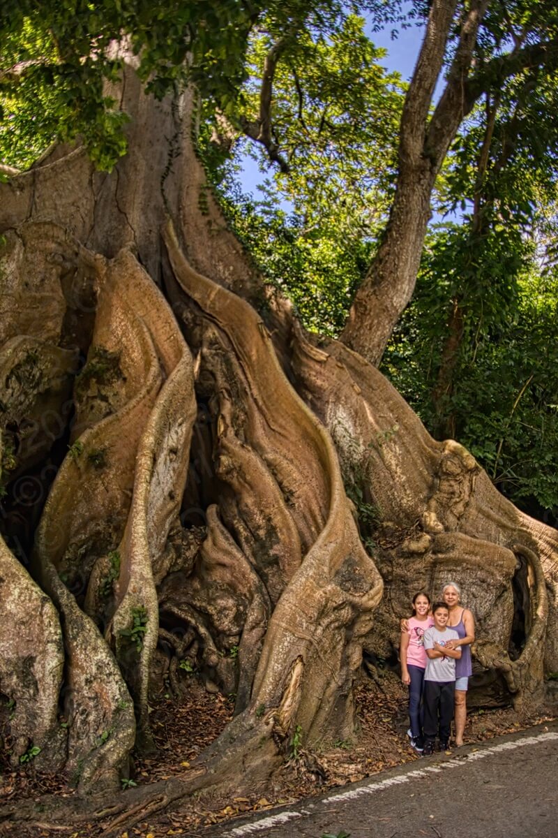
Ceiba Tree (my wife and grandchildren are included as a reference)
(click on image to see it larger)
Ceibas are actually the official tree of Puerto Rico. They are also called silk-cotton tree or kapok tree. Often the tallest tree in the forest, the ceiba attains heights over 150 feet. It has a ridged columnar trunk and a massive umbrella-shaped canopy. Its far-reaching limbs often host aerial plants, such as moss and bromeliads.
At an estimated age of 400+ years the ceiba tree in Patillas is now the oldest known to man. There was an older one, but due to human incompetence it died. It was over 500 years old and it was in the neighboring town of Ponce. So why did it die? Because the river that goes by it was canalized in 1990 and 30 years later the tree “starved to death”. Not enough water, not enough nutrients, no tree.
And the funny thing is that I parked right next to it and stopped a guy that was driving by to ask where the tree was. The guy said: “you’re parked right next to it”. And that’s because the tree is so humongous that I thought I was parked next to several of them.
Well, I was wrong. It was just one huuuuuuuuge tree. To illustrate its sheer size I made a picture with my wife and grandchildren standing next to it. They look like a speck in the picture.
Right next to the ceiba there’s a small bridge that goes over the Marín River. When we crossed there was hardly any water but I can only imagine what this entire area must’ve been like during hurricane María.
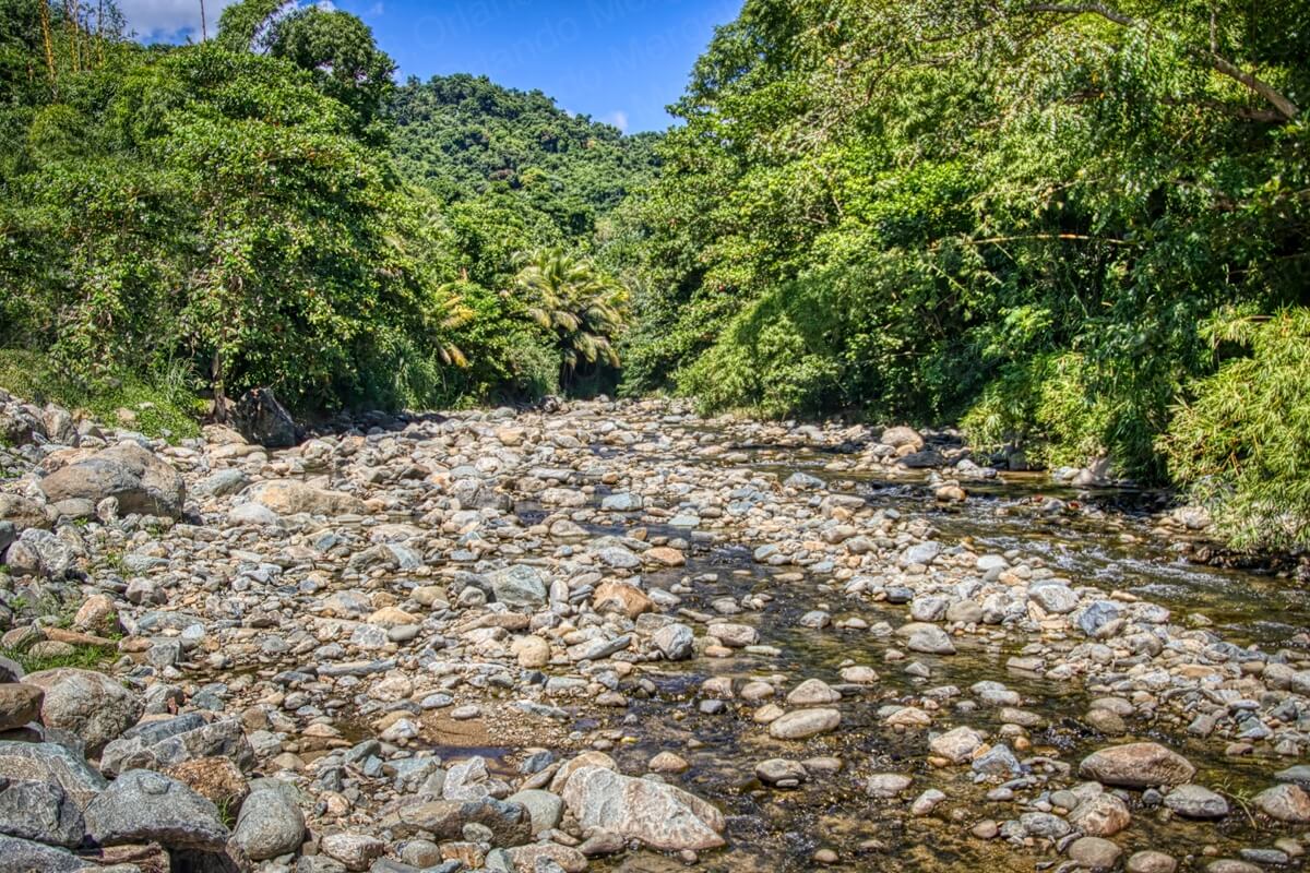
Marín River riverbed
(click on image to see it larger)
Another thing that caught my attention was the rocky river bed. I had never seen so many rocks in one place. Let alone in a river bed. This speaks volumes about the geological nature of Patillas.
We were almost ready to leave, but before we did we decided to go by Patillas Lake. There are no real lakes in Puerto Rico, so Patillas Lake is actually a water reservoir that was created by damming the Patillas River. It provides excellent eye-candy for landscape photographers like me and hopefully like you.
To get to back to San Juan (or anywhere else) your best bet is to retrace the steps that you took in the morning to get to Patillas. Better yet, make sure to copy the GPS coordinates for your hotel before leaving in the morning. That way all you’ll have to do is punch them into your GPS and it will do the rest.
And talking about San Juan, if you’re planning to visit the Old City, save yourself the hassle of traditional city tours. They’re expensive and you’ll be herded along with people that won’t necessarily share your interests.

Instead, order The Old San Juan Walking Tour. It’s packed with useful information about all the main attractions, as well as every GPS coordinate and two hours of exclusive online video.
That way you’ll be able to —visit before you visit— and hit the ground running when you arrive in the Old City.
See you next time!

©2023,Orlando Mergal, MA
____________________
Bilingual Content Creator, Blogger, Podcaster,
Author, Photographer and New Media Expert
Tel. 787–750-0000, Mobile 787–306-1590
![]()
![]()