
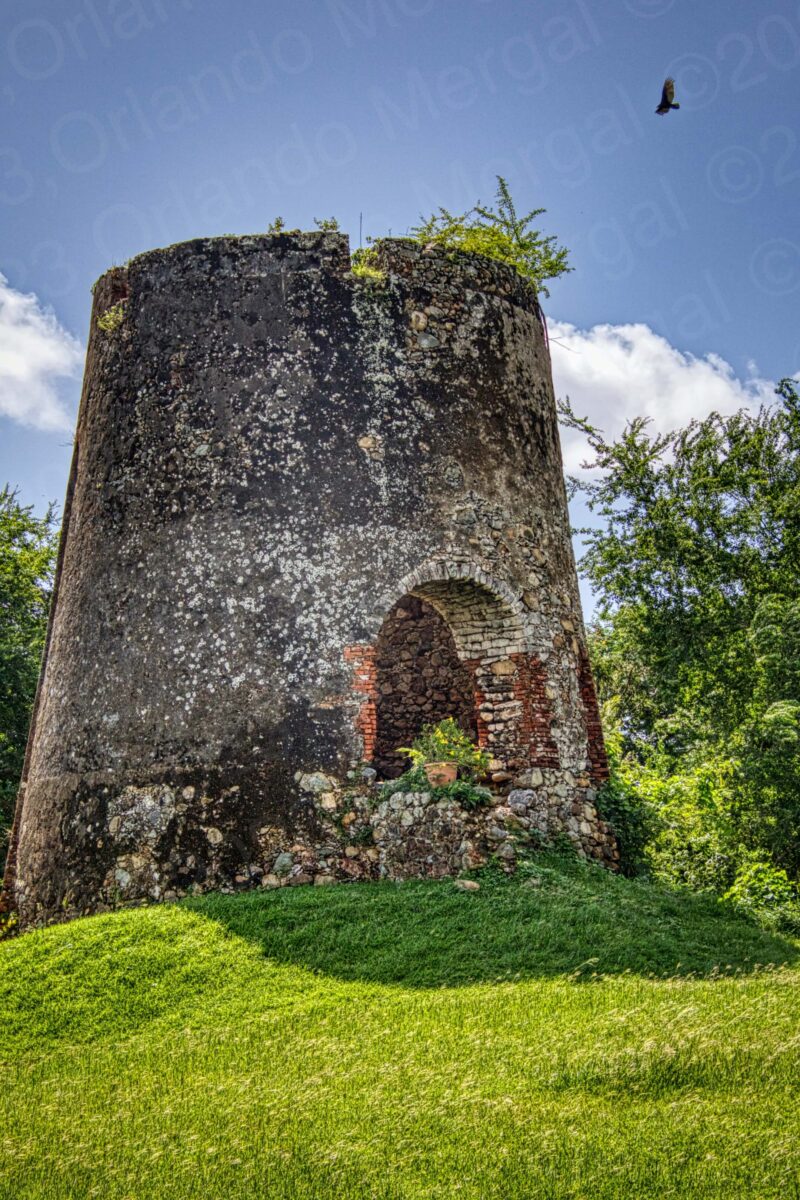
La Berbedera Sugar Cane Mill, Arroyo, Puerto Rico
(click on image to see it larger)
The other day my wife and I visited the town of Arroyo, Puerto Rico. It’s a little town on the southern coast of the Island that was one of those that took the brunt of hurricane María six years ago.
Like many other towns in Puerto Rico the destruction caused by hurricane María is there for all to see. The destroyed buildings still haven’t been repaired, the destroyed waterfront still has no peers and the town itself has an aire of inactivity.
Like always, we left San Juan around 6:30am to get to Arroyo early and catch the church open. When I was a young man Catholic churches used to remain open 24 hours a day, but today it’s a different story. Crime and vandalism have forced them to remain closed when not in use. Hence, many of them celebrate an early mass and then close for most of the day.
A CATHOLIC CHURCH WITH A TWIST
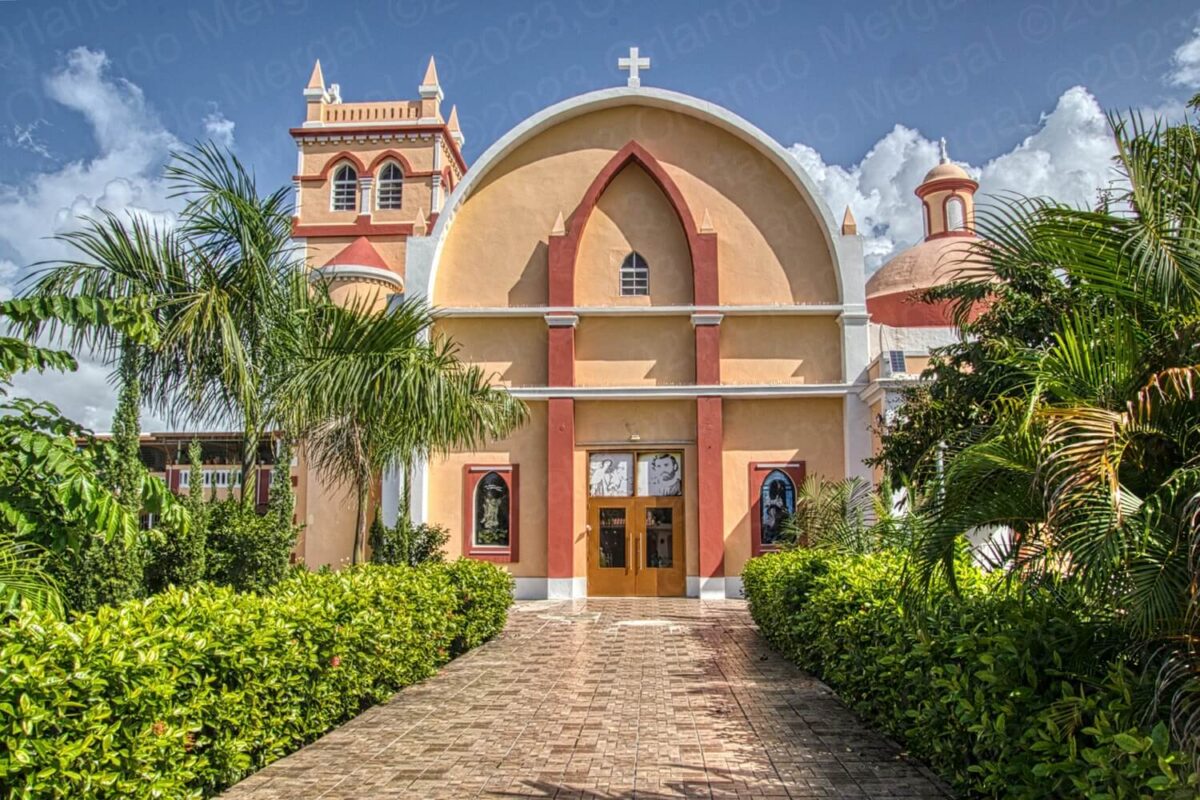
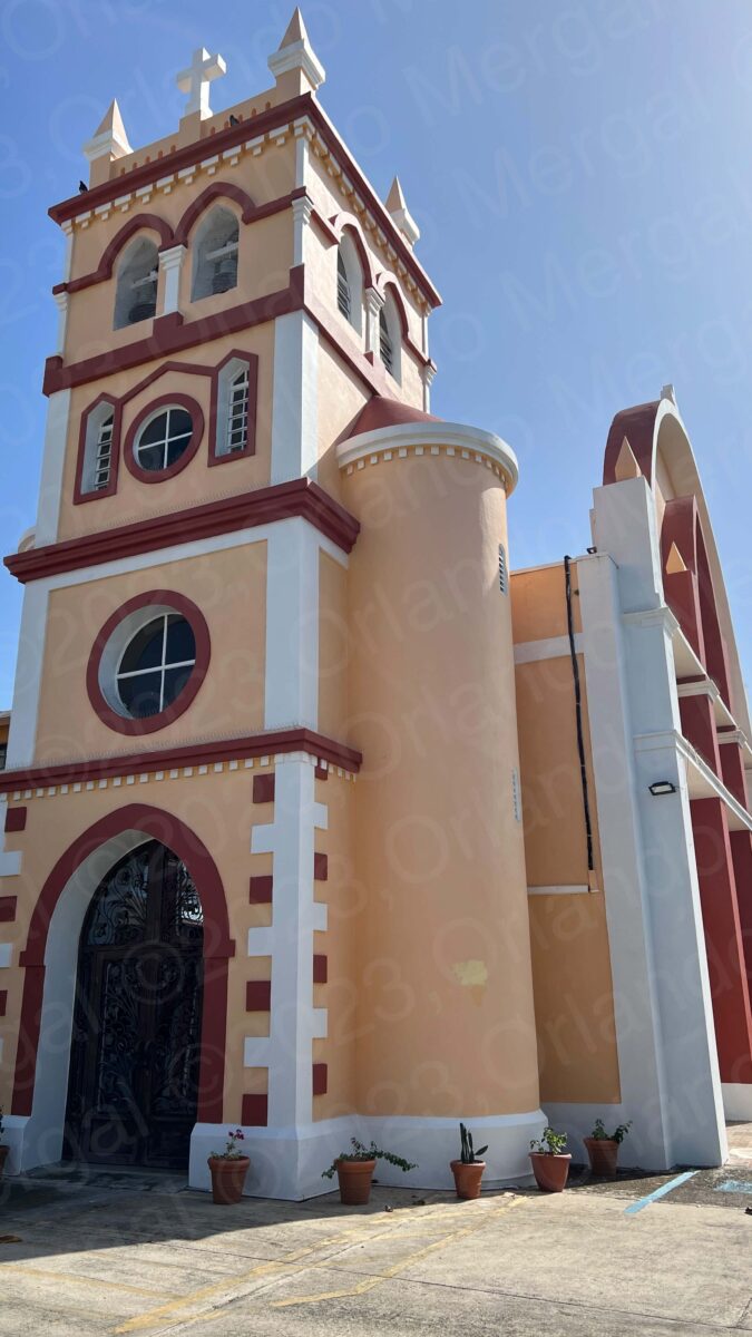
Our Lady Of Carmen Parish, Arroyo, Puerto Rico
(click on image to see it larger)
When we arrived in Arroyo our first stop was at the Our Lady Of Carmen Parish. Construction of this church started back in 1855. The bell tower was added in 1888 and designed by Juan Francisco Bertoli, a nineteenth-century French architect from Bastia, Corsica, and long-time resident of the neighboring town of Ponce.
When we got there the temple was closed, but there was a groundskeeper that quickly approached us and asked if he could help us. I told him who we were, and why we were there, and he led us towards the back of the church were we entered the temple.
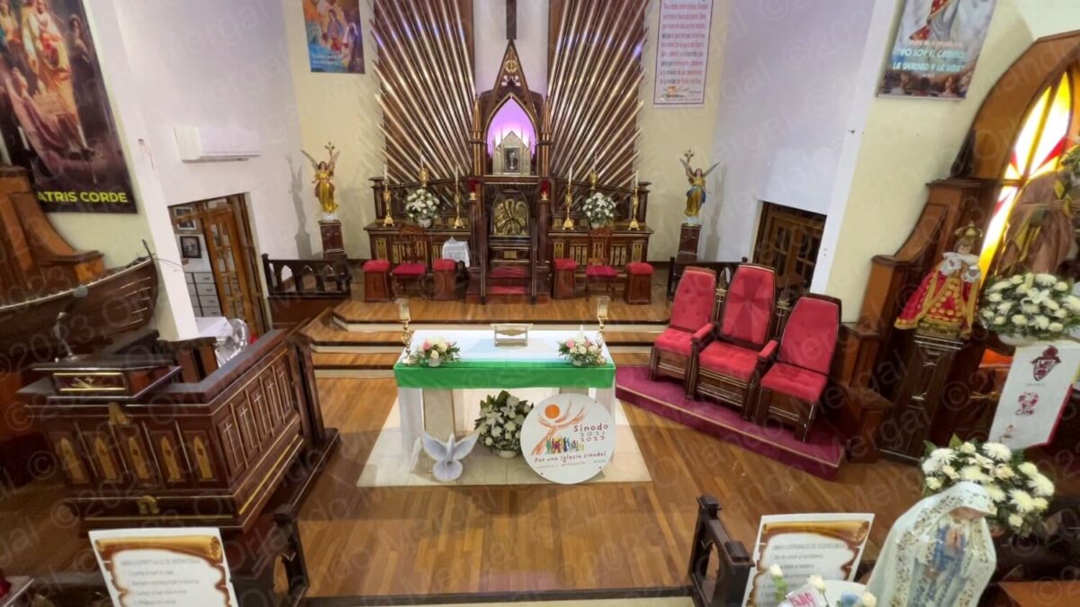
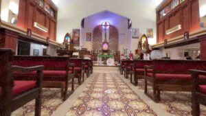
The Our Lady Of Carmen Parish is beautiful on the outside and on the inside. It’s not as large as other temples that we’ve visited in the past but it’s well kept and full of interesting details.
One detail that caught our eye is that the church altar doesn’t point east like in most of the other Catholic churches on the Island. I’ve never understood why they have to point east (not being a catholic myself) but the fact is that they do.
-
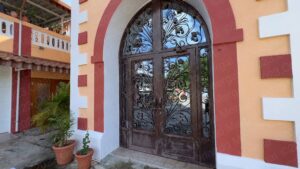

- Original-Door at the Our Lady Of Carmen Parish, Arroyo, Puerto Rico
(click on image to see it larger)

-

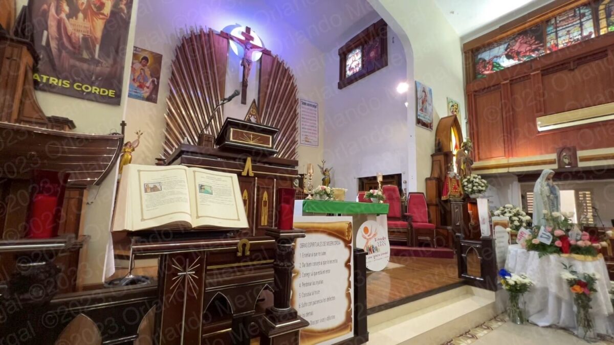
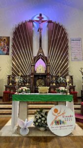
- Our Lady Of Carmen Parish Interior, Arroyo, Puerto Rico
(click on image to see it larger)
-

- Our Lady Of Carmen Parish Interior, Arroyo, Puerto Rico
(click on image to see it larger)
-
- Our Lady Of Carmen Parish Interior, Arroyo, Puerto Ric
(click on image to see it larger)
-
- Our Lady Of Carmen Parish Interior, Arroyo, Puerto Rico
(click on image to see it larger)
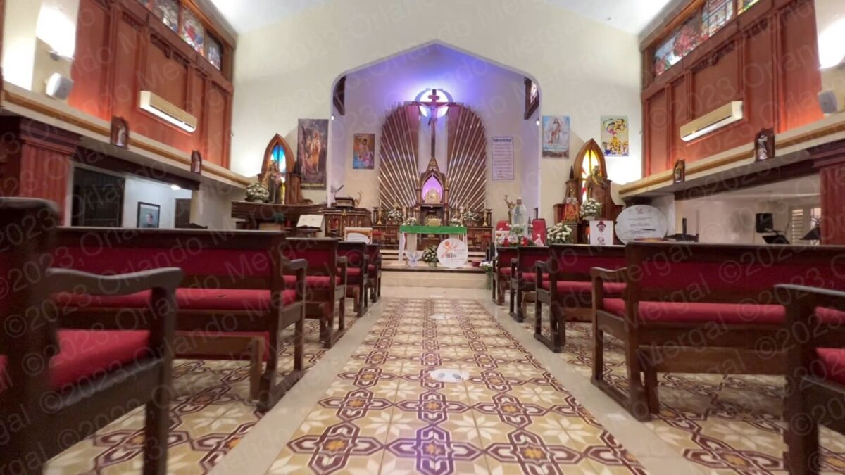
Well, at the Our Lady Of Carmen Parish things are different. And it all has to do with when the church was remodelled. The original temple was a lot smaller. The original altar was underneath the dome pointing east, as expected, and the original door pointed west. After the remodeling the new temple ended up with an altar pointing north and the new door pointing south.
But regardless of the altar, and where it might point, the fact remains that this temple is simply beautiful. You can still see some of the effects of hurricane María but the groundskeeper assured us that they’re being addressed.
-

- Our Lady Of Carmen Parish Interior, Arroyo, Puerto Rico
(click on image to see it larger)

-
- Our Lady Of Carmen Parish Interior, Arroyo, Puerto Rico | Arroyo, Puerto Rico
(click on image to see it larger)

-

- Bell tower by Juan Francisco Bertoli, Arroyo, Puerto Rico
(click on image to see it larger)
-
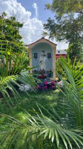
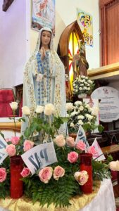
- Garden Niche with Virgin Mary, Arroyo, Puerto Rico
(click on image to see it larger)
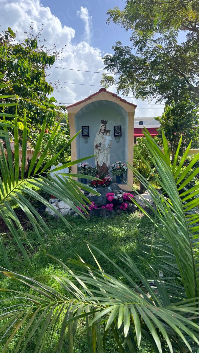
As we left the temple I saw a small niche with the Virgin Mary surrounded by a beautiful garden.
Leaving the church grounds we walked towards Samuel B. Morse square. The square itself isn’t much to write home about, but it does raise additional questions about the town of Arroyo. Most towns in Puerto Rico follow a design inherited from Spain. The church is generally on the east side of the square and City Hall is at the opposite end.
Well, in Arroyo they didn’t follow that design. In fact, the church, the square and City Hall are in a diagonal arrangement (watch our video for details). Now, Arroyo was founded on December 25, 1855. That same year they started building the Our Lady Of Carmen Parish.
I couldn’t find when the square or City Hall were built, but it stands to reason that it must have been around the same time. So the question is: why did they follow that weird diagonal configuration when they must’ve had all the land they needed?
Well, I could find anyone to answer that question. And, as always, all I found on the Internet was fragmented and regurgitated content. It’s amazing how you find page after page with the exact same text in the exact same words. Haven’t these people heard of copyright?
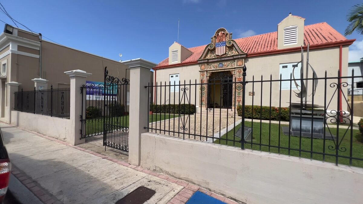
Old Customs House Museum, Arroyo, Puerto Rico
(click on image to see it larger)
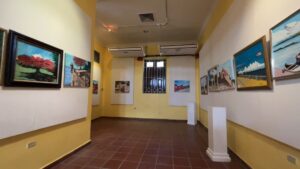
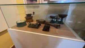
After a brief walk around Samuel B. Morse square we headed south along road 178. A few blocks down we entered the Old Customs House museum on the right hand side. It’s a beautiful colonial building, painted in tan, that holds all sorts of information about Arroyo and its residents.
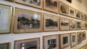
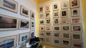
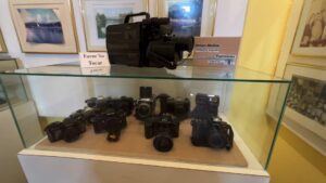
As we entered the museum we saw a series of paintings by local Arroyo artists. There is also memorabilia, photos of life in Arroyo, famous townspeople and a collection of old colonial houses as they used to be before hurricane María. Today many of those houses are just a memory.
As we were about to leave we met a man who was looking after the museum, but admittedly he didn’t know much about it. He did, however, tell us a little bit about the town and the different points of interest. He also added that the regular museum attendant was at a seminar and that she’d be back in the afternoon.
-
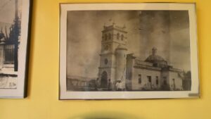
- Original Image of the town church, Old Customs House Museum, Arroyo, Puerto Rico
(click on image to see it larger)
-

- Paintings by local artists, Old Customs House Museum, Arroyo, Puerto Rico
(click on image to see it larger)
-
- Itinerating Art Collections, Old Customs House Museum, Arroyo, Puerto Rico
(click on image to see it larger)
-
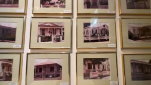
- Photo collections, Old Customs House Museum, Arroyo, Puerto Rico
(click on image to see it larger)
-
- Photo Collections, Old Customs House Museum, Arroyo, Puerto Rico
(click on image to see it larger)
-
- Photo collections, Old Customs House Museum, Arroyo, Puerto Rico
(click on image to see it larger)
-
- Memorabilia, Old Customs House Museum, Arroyo, Puerto Rico
(click on image to see it larger)
-
- Memorabilia, Old Customs House Museum, Arroyo, Puerto Rico
(click on image to see it larger)
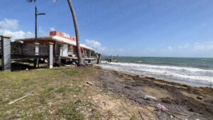
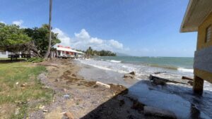
As we left the museum we walked past City Hall on our way to the Samuel B. Morse monument. The Samuel B. Morse monument is an obelisk-shaped marker located at what used to be the Arroyo waterfront. And I say “used to be” because the only thing that remains unharmed is the water. Everything else was messed up by hurricane María.
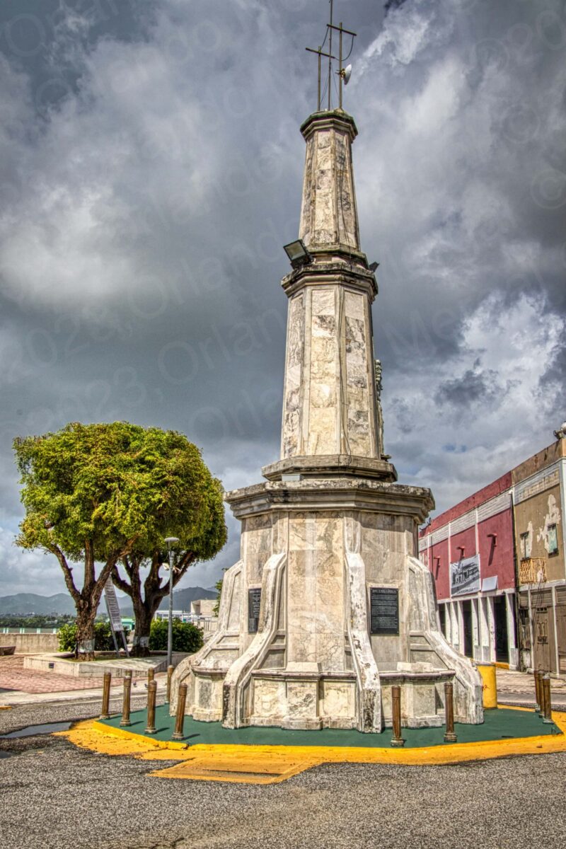
Samuel B. Morse Monument, Arroyo, Puerto Rico
(click on image to see it larger)
The obelisk itself is also in sad shape, with garbage in its water tank and an overall look of abandonment. The surroundings aren’t much better, with destroyed buildings, a port for small boats that is no more and graffiti rearing its ugly head.
One thing I must say is that the place is mostly clean. We hardly saw any garbage on the streets and we did see several garbage cans strategically placed. The one garbage can that was oddly placed was the one in front of the obelisk. I had to work especially hard to keep it out of my video and photographs.
By now you must have noticed that the name Samuel B. Morse keeps popping up as I tell you about the town of Arroyo. He was the guy that invented the telegraph between 1832 and 1835. He also invented Morse code with the aid of his friend Alfred Vail in 1838. But he didn’t invent it in Puerto Rico like some people mistakenly say. Neither was he of Puerto Rican descent.
So why is he such a prominent figure in Arroyo, Puerto Rico? Well, let’s just say that it’s because of a historical accident. A happy one for sure.
You see, Morse had a daughter called Susan Walker Morse who was married to Edward Lind, a Danish merchant that owned the Hacienda Henriqueta in Arroyo.
In 1858 Morse came to Puerto Rico to visit his daughter and grandchildren and fell in love with the Island. He also noticed how long it took to get between the hacienda and his son in law’s office near the peers. So he installed a two-mile long telegraph line between the two locations.
This happy accident made the town of Arroyo the first Latin American city to have a telegraph line.
At this point we had struck a weird balance of interesting places and sheer destruction. The church and museum were great. The square was OK and the waterfront was pitiful. So we thought: “maybe we’d fair better if we hit the beach”. But boy, were we wrong!
We headed for the Punta Figuras Lighthouse, which isn’t exactly the “the beach”, but by nature is next to the water. Like many landscape photographers, I’m a sucker for beautiful lighthouses. My wife and I have shot dozens of them in the United States alone. Even one in Oklahoma, which isn’t a coastal state (figura that one out).
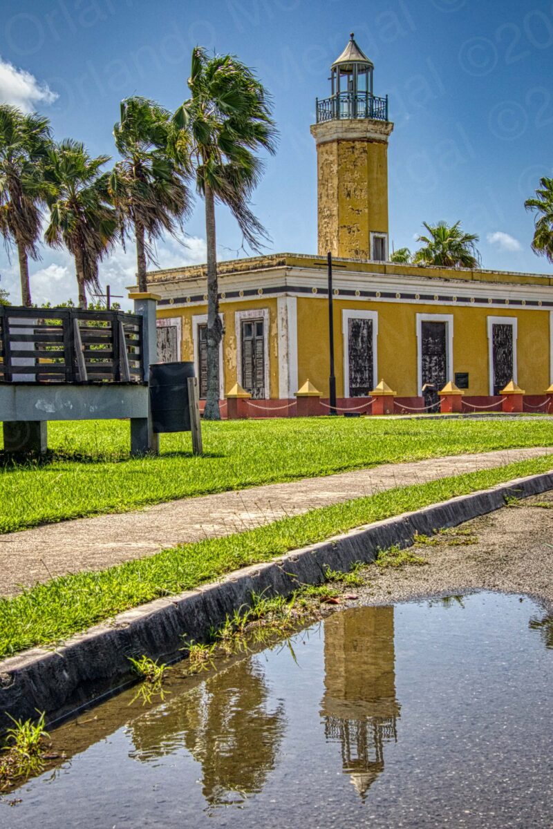
Punta Figuras Lighthouse, Arroyo, Puerto Rico
(click on image to see it larger)
The Punta Figuras Lighthouse is a beautiful structure that was first lit by the Spanish government back in 1893. However, it was decommissioned by the U.S. government in 1938. After that it was used as a lookout point during World War II and abandoned by the U.S. Army in 1963. In 1969 the lens and lantern were destroyed and in 2017 Hurricane María damaged it even more.
Today the lighthouse is closed, boarded up and ridden with graffiti. Now, here’s my question: if the lighthouse is such a mess, why does the government list it as a tourist attraction?
Puerto Rico is blessed with a collection of close to a dozen lighthouses around the Island. Some of them are OK and others are a mess. Now, here’s an idea. How much would it cost to restore them all and offer a “lighthouse tour of Puerto Rico” as a tourist package?
It could be combined with visits to the neighboring towns, restaurants, beaches and other attractions. It’s not too hard boys. All it takes is a little imagination.

Portland Head Light, Maine, USA
(click on image to see it larger)
And how do I know that this could work? Because I went up the entire New England seaboard doing just that: visiting lighthouses and covered bridges. In today’s world there’s a tourist for anything you can imagine.
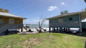
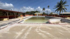
Right next to the lighthouse there’s another eyesore that’s weirdly listed among Arroyo’s tourist attractions. It’s the “Punta Guilarte Beach and Vacation Center”. This used to be a beautiful area with a very nice beach, but rising sea levels and hurricane María turned it into a mess.
The reason: stubbornness and stupidity. They built it too close to the water.
This causes several problems. First it obscures the view for people not staying at the complex. Second, it closes off access to the beach, which is supposed to be illegal because beaches in Puerto Rico are in the public domain. And third, it assures the eventual destruction of the buildings as rising sea levels corrode the foundations.
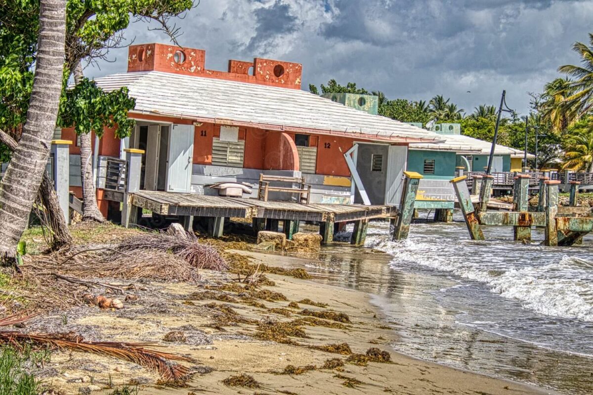
Punta Guilarte Beach and Vacation Center, Arroyo, Puerto Rico
(click on image to see it larger)
Today what you have is a closed complex with a bunch of buildings falling into the sea. Ironically, the main entrance road is still open, ridden with potholes, uncontrolled vegetation and a closed gate at the end of a very long drive.
Now, here are a couple of questions. Why not close the entrance road where it meets with State Road 3? Why not save people the hassle of driving down a destroyed road just to end up at a closed gate? Better yet, why not stop promoting the “Punta Guilarte Beach and Vacation Center” as a tourist attraction when it’s actually closed?
My wife and I walked around the place, took some pictures and returned to our car. During the brief time that we were there two cars approached the facilities asking questions.
WHY HARP ON ARROYO?
By now you must be wondering: “why would someone drive all the way across Puerto Rico just to show the negative aspects of a place”? Well, that has never been our intention in the first place. But, as I always say, at Puerto Rico By GPS “we tell it like it is”.
I would love to sing the praises for every place that we visit. But if it’s no good, then that’s what I have to say. Take a look at the following images of Punta Guilarte Beach and Vacation center and you’ll see what I mean.
-
- Punta Guilarte Beach and Vacation Center, Arroyo, Puerto Rico
(click on image to see it larger)

-
- Punta Guilarte Beach and Vacation Center, Arroyo, Puerto Rico
(click on image to see it larger)
-
- Punta Guilarte Beach and Vacation Center, Arroyo, Puerto Rico
(click on image to see it larger)

-
- Punta Guilarte Beach and Vacation Center, Arroyo, Puerto Rico
(click on image to see it larger)

-
- Punta Guilarte Beach and Vacation Center, Arroyo, Puerto Rico
(click on image to see it larger)

-
- Punta Guilarte Beach and Vacation Center, Arroyo, Puerto Rico
(click on image to see it larger)

And I’m sure that our readers and viewers appreciate us. After all, wouldn’t it be worse if they hopped on a plane, drove all the way here and wasted their hard-earned greenbacks? What do you think they’d write on social media?
And the sad part is that many of the towns that we’ve been hard on could actually become travel gold mines with a little work and a little imagination. What they can’t do is to keep sitting on their hands waiting for the central or federal government, to solve their problems.
In the case of Arroyo the people are nice… very nice. The groundskeeper at the Our Lady Of Carmen Parish answered all of our questions and showed us every corner of the temple. At the Old Customs House museum it was the same thing. Even though the attendant didn’t work at the museum, he did his best to answer our questions.
As for the town itself, I detected inactivity. We were there on a Wednesday and the place was deserted. You could hardly see people on the streets. Come to think of it, I hardly saw any stores either.
Like many other small towns on the Island, Arroyo feels like it’s on its way to becoming a ghost town. And I say this with great sadness because I truly believe that this town has a lot of things going for it.
And here’s one last thing. And this applies to various smaller municipalities throughout the Island. They’ve been hung out to dry by the central government. Maybe it’s time for them to join forces and start doing their own thing.
I mean… it should be obvious by now that whoever sits in the governor’s seat —regardless of political persuasion— is only going to look out for Number One.

To get to back to San Juan your best bet is to retrace the steps that you took in the morning to get to Arroyo. Better yet, make sure to copy the GPS coordinates for your hotel before leaving in the morning. That way all you’ll have to do is punch them into your GPS and it’ll do the rest.
And talking about San Juan, if you’re planning to visit the Old City, save yourself the hassle of traditional city tours. They’re expensive and you’ll be herded along with people that won’t necessarily share your interests.
Instead, order The Old San Juan Walking Tour. It’s packed with useful information about all the main attractions, as well as every GPS coordinate and two hours of exclusive online video. That way you’ll be able to —visit before you visit— and hit the ground running when you arrive in the Old City.
See you next time!

©2023,Orlando Mergal, MA
____________________
Bilingual Content Creator, Blogger, Podcaster,
Author, Photographer and New Media Expert
Tel. 787–750-0000, Mobile 787–306-1590
![]()
![]()