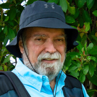
Last Monday, February 12, my wife Zory and I visited the town of Salinas, on the southern coast of Puerto Rico to produce this post and a 13 minute video. It was pouring cats and dogs when we left our home in San Juan. But by the time we got to Salinas we had a clear blue sky and and plenty of sunshine.
Salinas owes its name to the salt flats that once covered some of its coastal territory. However, to quote a local resident; “the only place where there’s salt these days is at the supermarket”.
The drive to Salinas takes a little over an hour, mostly along PR-52. As always, we left around 7:00am and were there at a little over 8:30. So why the difference in time? Because it was Monday and traffic was murder on the San Juan portion of the trip.
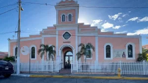
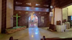
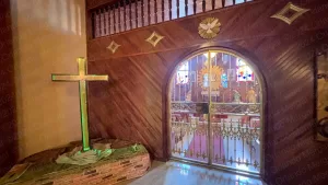
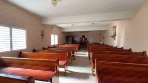
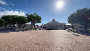
Our first stop was at the “Nuestra Señora de la Monserrate” Parish. I guess that would be “Our Lady of Monserrate Parish” in the King’s English. And let me tell you, the experience was totally different than at the previous town of Guayama.
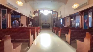
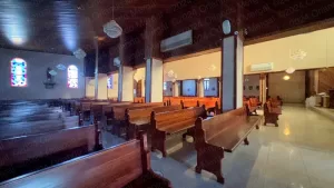
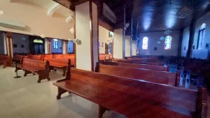
The door was open and we walked right in. It’s a beautiful temple, built in 1854, that has undergone several restorations and enlargements throughout the years. Today it can comfortably accommodate up to 600 patrons, although there’s a sign at the door that says that admission is limited to 300, due to Covid restrictions. Masks are also a must to enter the temple.
When we entered the temple the lights were out, but we walked to the Parish office and they kindly turned them on so that we could shoot our video.
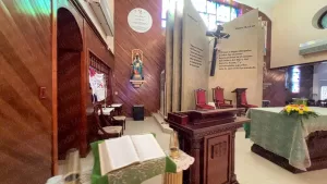
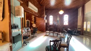
The “Nuestra Señora de la Monserrate” Parish is 169 years old. But it doesn’t show because it’s exquisitely maintained. The interior is simply beautiful. It has one large seating area and two smaller chapels.
- Nuestra Señora de la Monserrate Parish
(click on image to see it larger)
- Nuestra Señora de la Monserrate Parish
(click on image to see it larger)
- Nuestra Señora de la Monserrate Parish
(click on image to see it larger)
- Nuestra Señora de la Monserrate Parish
(click on image to see it larger)
- Nuestra Señora de la Monserrate Parish
(click on image to see it larger)
- Nuestra Señora de la Monserrate Parish
(click on image to see it larger)
- Nuestra Señora de la Monserrate Parish
(click on image to see it larger)
- Nuestra Señora de la Monserrate Parish
(click on image to see it larger)
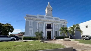
As we left the “Nuestra Señora de la Monserrate” Chapel we walked south to the City Hall building. It’s a beautiful neoclassical structure built in 1920 and painted in gray and white.
This is the second year that my wife and I have been exploring Puerto Rico town by town. And one of the things that I’ve discovered is how little information you find sometimes and how scattered it is. For example, the only information I found on the Internet about the Salinas City Hall building was on a couple of websites from Oklahoma and Washington DC. Here in Puerto Rico all I found were pretty pictures.
Our reason for visiting City Hall was to ask about points of interest in Salinas. Instead, we were directed to the Tourism office on the south end of the municipality. Actually, I had met the person in charge of tourism for Salinas the year before at a convention in San Juan. But I called him twice prior to our visit and he never returned my calls. Later I would learn that the guy was on vacation. I guess no one answers when he’s not around.
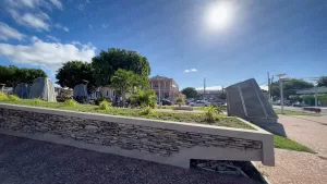
In any case, before heading for the tourism office, we decided to go for a stroll at “Plaza Las Delicias”, the beautiful square in the center of town. The first thing that caught our attention were the cone shapes sculptures on the south side of the square. They’re actually salt shakers evoking the town’s “salty” past.
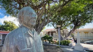
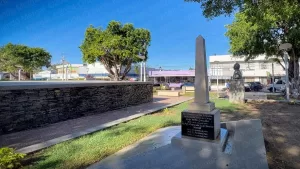
On the north side there’s a bandstand with a bust of Don Chepo Caraballo on the western end. Chepo Caraballo was a union leader from the town’s sugar cane era. On the northeastern corner there’s an obelisk honoring the town’s fallen heroes from the Korea and Vietnam wars.
- Salt Shaker Sculptures
(click on image to see it larger)
- Las Delicias Square
(click on image to see it larger)
- Don Chepo Caraballo bust
(click on image to see it larger)
- Obelisk to the town heroes
(click on image to see it larger)
The drive to the Tourism office took about 10 minutes. Initially we stopped at the old office, but that one was destroyed by Hurricane Fiona a couple of years ago. The new one is about a half a mile up the road where an old elementary school used to be. In any case, our visit to the Tourism Office was more about where “not to go”.
You see, Salinas is a foodie town. It’s also a swimmer’s town, although it’s not a beach town (more on that in a minute). It also has a race track (for drag racing, that is) and the famous (or infamous, depending on who you ask) Central Aguirre Historic District.
In any case, most of the action takes place during the evenings and weekends, not on Monday mornings. So we left the tourism office and headed for the “La Playa” sector. Don’t take me wrong, I guess you can find great seafood restaurants all over Salinas. But the really great ones are within a two-mile stretch of road at “Barrio La Playa”.
In English “barrio” means “ward” and “la playa” means “the beach”. So I guess it could be called “the beach ward”. But no one does. So just stick to “Barrio La Playa”.

People come from all corners of Puerto Rico to enjoy seafood in Salinas
(click on image to see it larger)
This time we didn’t visit any of the restaurants. After all, it was 9:30. But we’ve been to several of them in the past and they’re just great. There’s all sorts of seafood and the lobsters are so fresh that the practically crawl off your plate.
One thing you’ll notice in Salinas is that there are boats everywhere. The town has a large and active fishing community so fresh fish is everywhere.
Those boats also serve a second purpose: recreation. Remember a while ago when I said that Salinas is a swimmer’s town, but not a beach town? Well, that’s because Salinas is a coastal town that doesn’t have any beaches. So where do people swim? At the keys!!!
The keys south of Salinas are simply “heavenly”. But you’ll need a boat to get there. Literally. There used to be a water taxi that you could take, but it has been “in repair” for a while and the only option at the moment is to charter a local boat owner. You’ll have to arrange for the person to take you there, leave you and pick you up at a prearranged time. Of course, many tourists aren’t that trusting, so the crowd at the keys is mostly locals with their private boats.
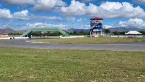
Leaving “Barrio La Playa” our next stop was at the Puerto Rico International Speedway, better known among the locals as “La Pista de Salinas”. I used to race there during the 70’s and it has come a loooooooong way. Gone are the days of a haphazard strip with bleachers in the sun. Today’s speedway seats 18,000 people undercover and has both drag racing and circuit.
Sadly, all we could do was look through the fence.
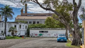
This is the closest thing that you’ll see of what once was Central Aguirre
(click on image to see it larger)
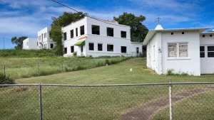
Our next stop was at “Central Aguirre”. Aguirre was a 2,000+ acre sugar plantation and mill that operated in Salinas between the 19th and late 20th centuries. In 1898 the operation was purchased by Ford and Company and converted into a company town.
In case you didn’t know, company towns were the closest thing to slavery, except that they were legal. Why? Because the workers in a company town had no way of escaping their reality.
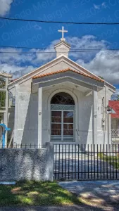
From the outside, life in a company town could seem great. You had housing, shopping facilities, churches, entertainment, parks, post office, telegraph and even a hotel; all inside a community that was separate from the regular town of Salinas, or whichever other town might have been the case. That’s right, because company towns sprouted like mushrooms after the United States took over Puerto Rico.
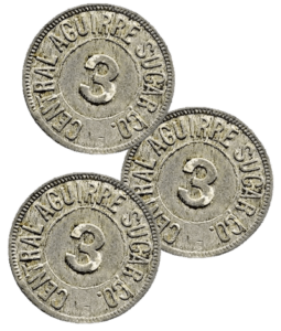
But not everything was peaches and cream. Workers at company towns were paid with vouchers or coin instead of cold hard cash. Those vouchers or coins were only redeemable at stores inside the company town. Hence, the workers had no option but to buy everything at company stores, regardless of the price, variety and quality.
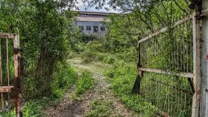
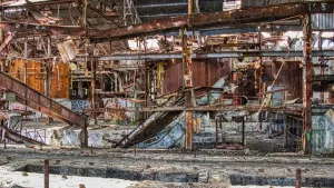
- This looks like a gate from a horror movie
(click on image to see it larger)
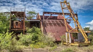
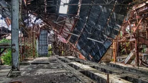
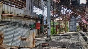
- Mother nature is reclaiming what used to be Central Aguirre
(click on image to see it larger)
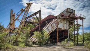
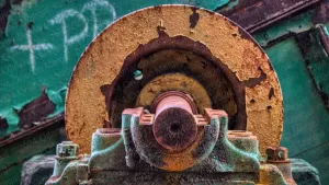
- Rust is eating away at the old structures.
(click on image to see it larger)
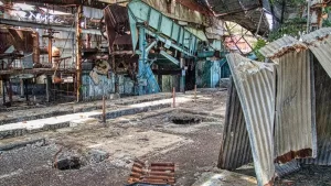
- The holes in the floor are close to 10 feet deep.
(click on image to see it larger)
- Time seems to be at a standstill at Central Aguirre.
(click on image to see it larger)
- If you feel like the roof is about to cave in, it’s because it is.
(click on image to see it larger)
- There are sharp edges everywhere.
(click on image to see it larger)
- The machinery has moved in decades.
(click on image to see it larger)
There were also separate coins for milk, meat, merchandize, etc. Hence, you might have coins for meat in your pocket and not be able to buy milk for your kids. It was basically a scheme for “paying without paying”. In the end company owners would take home all the money and pay workers with scraps.
By the same token (pardon the pun), the town didn’t benefit either from any kind of multiplier effect.
In the end, the workers were left with a substandard quality of life and no money to show for their hard work. This sparked the creation of labor unions which led to legislation, improved working conditions and the eventual demise of sugar cane farming on the Island.
Just so you know, walking inside the Aguirre production area is VERY DANGEROUS. Especially if you have little children in your party. There are sharp rusty edges everywhere and those holes in the floor are over 10 feet deep. There’s scrap metal hanging everywhere and the next piece to fall could be seconds away. Be alert!
Of course, this whole chapter in Puerto Rico’s history didn’t happen as neatly or as succinctly as I’ve just told you. It was messy, people got hurt and many lived in misery for close to 100 years.
Even so, good or bad, sugar cane farming was a chapter in Puerto Rico’s history and it isn’t being shown anywhere on the island, except maybe for the notable exception of Hacienda La Esperanza in Manatí. We covered Hacienda La Esperanza in a prior post several years ago and we will certainly return when we visit the town of Manatí in the future.
However, from what I remember from that visit, the folks at Hacienda La Esperanza show you more of a “sanitized” version of what life was really like at a sugar cane plantation. The truth is that these places had miserable working conditions. It was backbreaking labor under the blistering Puerto Rican sun.
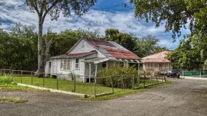
There are dozens of old sugar cane haciendas peppered all over Puerto Rico. Some are down to the mere foundations, but others are in better shape. It sounds to me like the perfect reenactment opportunity. Of course, such an effort would come with an admittance fee. But it would certainly be an interesting attraction.
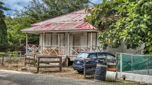
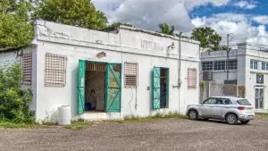
- Some places are just abandoned.
(click on image to see it larger)
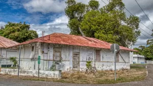
- Some are falling apart.
(click on image to see it larger)
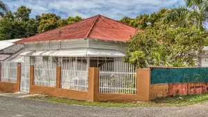
- Others have been sold.
(click on image to see it larger)
- Some are condemned
(click on image to see it larger)
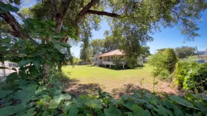
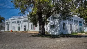
- Some had a little more land.
(click on image to see it larger)
- This used to be the telegraph office.
(click on image to see it larger)
- This used to be a warehouse.
(click on image to see it larger)
- This used to be the town store.
(click on image to see it larger)
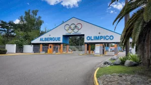
After leaving “Central Aguirre” we headed for “El Albergue Olímpico”, the training facilities where Puerto Rico’s elite athletes prepare for international events. There’s a museum there where you can learn about the Island’s illustrious and hard earned participation in world games. Sadly, it was closed and and it won’t reopen until February 27th.
Here again we see poor website maintenance rear its ugly head. What’s worse, in most cases you find nothing at all when looking for certain tourists attractions. And when you do it’s often outdated. Why did we have to drive all the way there to learn that the museum was closed? Isn’t that what websites are for?
From “El Albergue Olímpico” gate we turned around and headed for two additional places in Salinas. Except that most people don’t even realize that they’re in Salinas. They think they’re in Cayey!
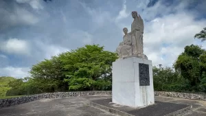
Monument to the Puerto Rican Peasant (Monumento al Jíbaro Puertorriqueño)
(click on image to see it larger)
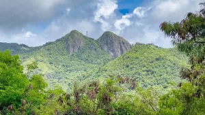
Of course, I’m talking about the “Monumento Al Jíbaro Puertorriqueño” (Monument to the Puerto Rican Peasant) and las Piedras del Collado, better known as “Las Tetas de Cayey”, a couple of mountains with a very peculiar shape. You pass them both on your right hand side on your way to Salinas.
The “Monumento Al Jíbaro Puertorriqueño” is a statue sculpted by Tomás Batista, a Puerto Rican sculptor who has created some of Puerto Rico’s most notable monuments. It was unveiled in 1976 by the government of Puerto Rico to honor the Island’s peasant workers.
There used to be a parking lot next to the statue where you could park your car, stretch your legs and walk up to the statue. Today the parking is no more and there’s a fence around the statue.
The grass is high and the place simply seems abandoned. Of course, Puerto Ricans have made a hole on the north side of the fence and you can walk up to the statue. But the whole thing is dangerous, especially if yo have children in your party. I mean, just imagine. You have to park on the shoulder of a busy expressway for starters.
I guess “El Monumento Al Jíbaro Puertorriqueño” has faired about as well as the Island’s actual peasants.
On the north end of the fence, just about where the hole is, there’s an excellent view of “Las Tetas de Cayey” (believe me, no one calls them “Las Piedras del Collado”). So why are they called “Las Tetas de Cayey”? For the same reason that the Grand Tetons, in the great state of Wyoming, are called that way. Don’t know why that is either? Google it!
“Las Tetas de Cayey” are a protected area that stand at 2,759 feet above sea level in the Cayey Mountain Range. I’ve read that there are people that conduct rappelling at “Las Tetas de Cayey”. But don’t quote me on that one, because at 225 pounds and 69 years of age, I’d never try something like that.
By the way, your best bet for visiting “El Monumento Al Jíbaro Puertorriqueño” and “Las Tetas de Cayey” is on your way to Salinas and not on your way back. To visit on your way back you’ll have to drive several miles past the statue just to make a u‑turn. I only showed them last because I had all the imagery from our previous visit to the town of Cayey in June of 2023.
If you leave the “El Monumento Al Jíbaro Puertorriqueño” and intend to go towards San Juan, you’ll have to drive all the way to the next toll plaza to turn back. From there follow PR-52 for around 45 minutes ‘till you reach PR-18. Follow PR-18 ‘till the end and you’ll reach the Minillas Tunnel.
And talking about San Juan, if you’re planning to visit the Old City, save yourself the hassle of traditional city tours. They’re expensive and you’ll be herded along with people that won’t necessarily share your interests.
Instead, order The Old San Juan Walking Tour. It’s packed with useful information about all the main attractions, as well as every GPS coordinate and two hours of exclusive online video. That way you’ll be able to —visit before you visit— and hit the ground running when you arrive in the Old City.
See you next time!
©2024,Orlando Mergal, MA
____________________
Bilingual Content Creator, Blogger, Podcaster,
Author, Photographer and New Media Expert
Tel. 787–750-0000, Mobile 787–306-1590
