Orlando Mergal
(click on image to see it larger)
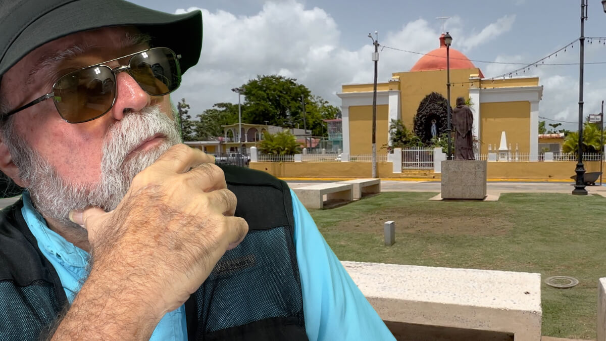
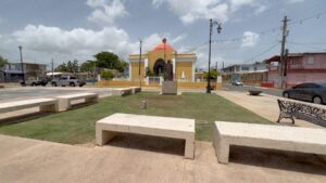
It was 11:00am on the morning of July 20, 2023. My wife Zory and I were standing in the middle of Virgilio Dávila Square in the little town of Toa Baja, Puerto Rico. There was something off about the place and at first I couldn’t put my finger on it. Then it hit me! Everything was reversed. The church was on the wrong side. Even worse, it was backwards. Were we in another dimension?
I’ve lived in Puerto Rico for over 60 years. Most towns in Puerto Rico follow the model inherited from the Spaniards. They in turn inherited it from the Constantine Roman Empire. The Catholic church is on the east side of the main square with the altar facing east. That means that the front door of the church faces the square. City Hall is generally at the opposite end of the square.
Well, in Toa Baja everything is crossed. City Hall is on the east side of the square. The Catholic church is on the west end. To make things even worse the church is facing away from the square. What kind of a screwup happened there?
Well, it wasn’t a screwup. It actually had to do with a river, like everything else in Toa Baja.
The morning we visited Toa Baja we actually arrived from Toa Alta. There too the town is all about the river. So much so that they both have the name of the river included in the name of their town. That name is “toa”.

“Toa” was the name that the original settlers of the Island gave the modern day “La Plata” river. Those settlers were the Taínos, which according to some historians were exterminated during the first 50 years of the Spanish conquest. Others argue that the Taíno gene pool is actually alive and well in a large segment of the Puerto Rican population living in the Island’s western mountains.
In any case, both Toa Alta and Toa Baja owe their very existence to the “Toa” river. In fact, in their heyday both towns were agricultural powerhouses thanks to the river.
Sadly, today most of that fertile land is uncultivated and covered in brush. Toa Alta has some lands dedicated to cow farming and horses. But Toa Baja’s fertile expanses are mostly empty. In fact, many of the best lands have been taken over by squatters and underdeveloped.
But I digress. Back to our story.
When we arrived in Toa Baja we found a small town that was clean, well kept and mostly empty. After all, it was around 11:00am so we expected a little hustle and bustle.
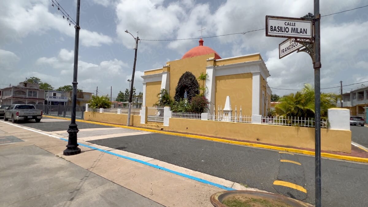
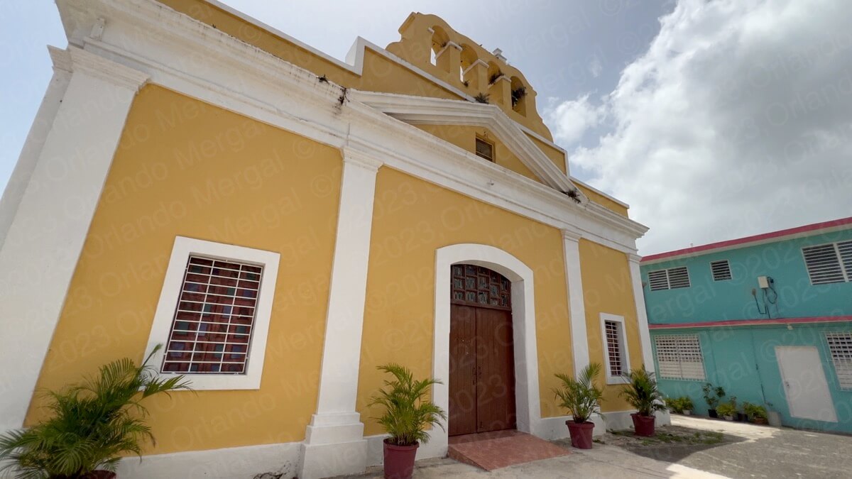
San Pedro Apóstol Parish
(click on image to see it larger)
Like always, our first stop was at the “San Pedro Apóstol Parish”, built in 1747. It was closed. Experience has taught us that most Catholic churches open early in the morning, celebrate mass and then close for the day.
This wasn’t always this way. When I was a child in the 60’s I recall that most churches never closed. You could walk right in, say your prayers and then go about your day. But not anymore. Today churches are subject to robbery and vandalism. On the other hand, most of them don’t have the manpower or the budget to have someone watching all day. So the easiest thing to do is close.
This makes it harder to catch them open because each temple does things differently.
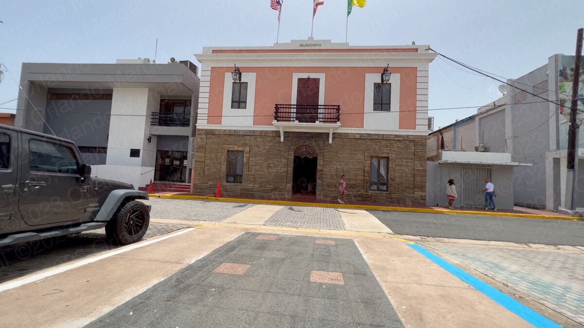
Toa Baja City Hall
(click on image to see it larger)
After finding the parish closed we walked across the square to City Hall. I remember telling my wife: “there’s something weird about this town”. “It’s like everything’s reversed”.
When we got to City Hall, which was on the eastern side of the square, we were told that the church was only celebrating mass on Saturdays and Sundays because the priest was off on a trip to South America. We were there on a Thursday, so that supposed a second trip just to see the church interior.
I had read that the “San Pedro Apóstol Parish” is one of the oldest in Puerto Rico. It’s also one of the nicest and among the best preserved. So a second trip was more than warranted.
But why was it backwards? Did someone screw up? Well, the answer has to do with the river.
Back in the 1840’s the town suffered severe flooding. Back then town’s were constructed close to the rivers because it provided easy access to water and transportation. But that same proximity made the towns subject to flooding.
Well, the townspeople of Toa Baja had had enough. Every time it rained profusely the entire “toa valley” was covered in water. And so were their homes. So they decided to move the town east, away from the river.
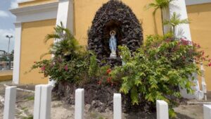
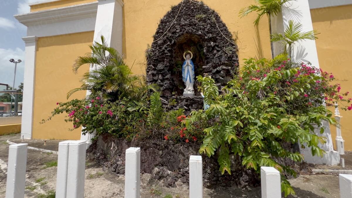
Moving the church was out the question. After all it was one of Puerto Rico’s oldest and the cost would have been prohibitive. So they decided to build a little stone feature with a virgin, on the church’s east side, to make it less obvious that it was looking away from the new square. However, it’s the first thing that catches your eye.
Some people don’t know why, but they just feel that something’s off.
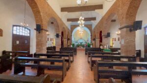
But let me tell you, the “San Pedro Apóstol Parish” was well worth the trouble of making a second trip. It’s simply beautiful. So we returned the following Sunday morning just to see the interior. When we got there the church was still closed and the town was silent.
I guess when you live in the city you get used to the fast-paced breakneck style of living. But not in little Toa Baja. Over there life happens slowly.
My wife and I drove around town for a while while we waited for the church to open. While we did we ran into a gentleman who told us about the “riser”. Later in the day the were going to celebrate the 100th birthday of one of the town patrons.
Does that happen in the city? Hell no! But in a small town like Toa Baja it’s important!
We returned to the church and it was still closed. Shortly after a lady arrived and inquired why we were there. I told here about my blog and YouTube channel and she agreed to let us in a few minutes before mass so we could film the interior.
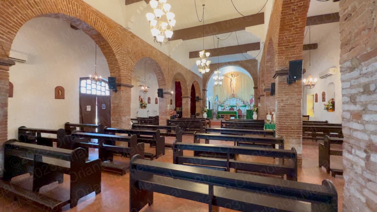
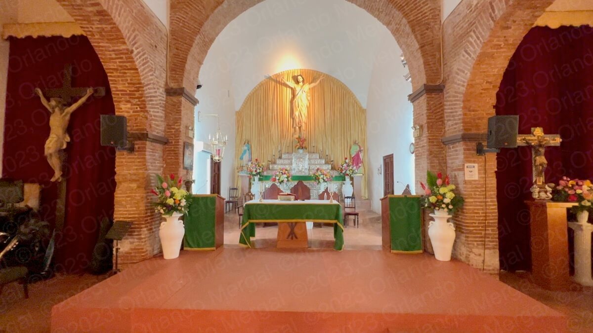
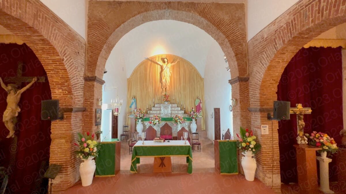
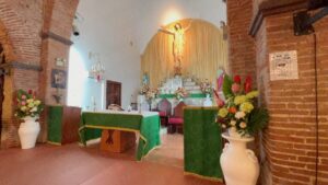
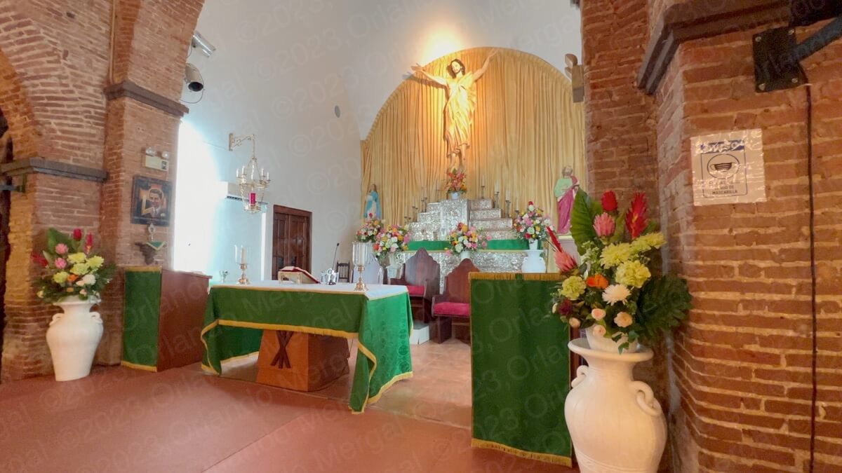
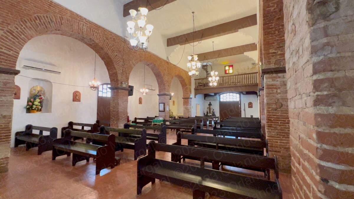
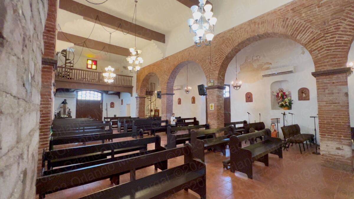
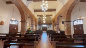
The church is amazing. The interior is in its original brick with arches and hardwood beams. The look is austere but elegant. It has that old world charm that you no longer see in modern churches.
-


- (click on image to see it larger)
-
- (click on image to see it larger)
-
- (click on image to see it larger)

-

- (click on image to see it larger)
-

- (click on image to see it larger)
-

- (click on image to see it larger)
-
- (click on image to see it larger)
-
- (click on image to see it larger)

-

- (click on image to see it larger)
-
- (click on image to see it larger)
-
- (click on image to see it larger)

-
- (click on image to see it larger)
There’s nothing luxurious about this temple and yet it has a charm all its own.
And then there’s the altar, which is carved in baroque silver and has been part of the temple from the very day it opened to the public.
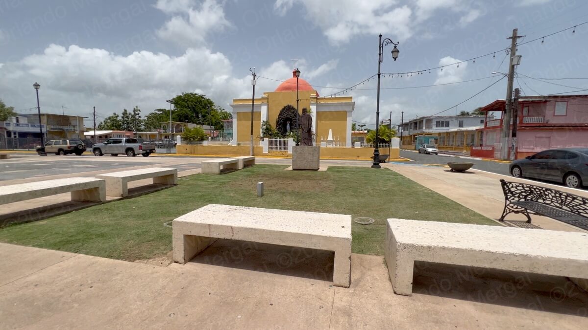
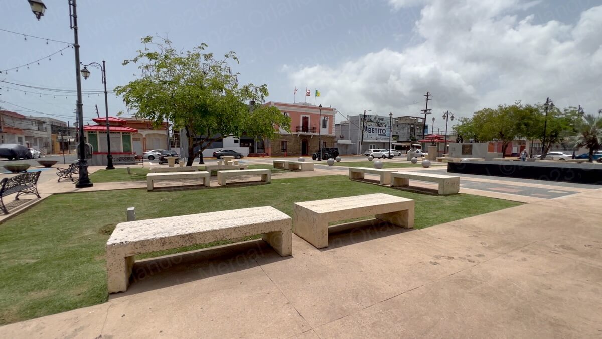
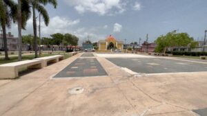
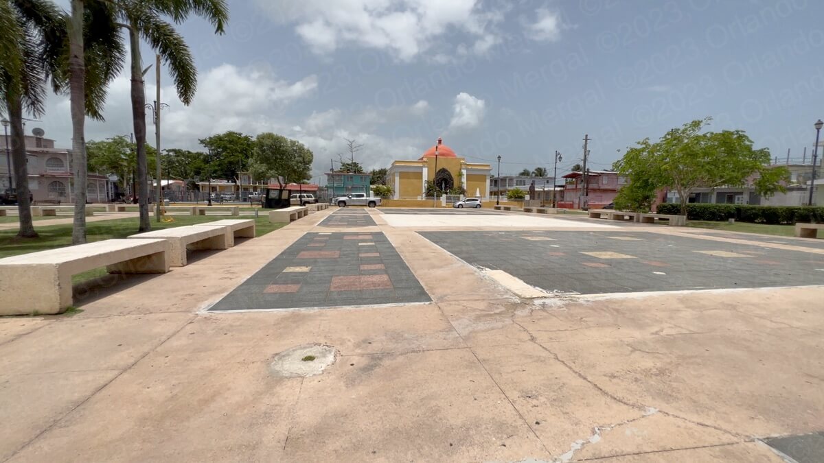
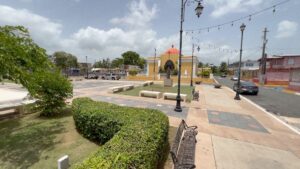
So what about the rest of town? Well, across from the church you have the Virgilio Dávila Square. Virgilio Dávila was a poet, educator, politician and businessman born in Toa Baja during the mid 19th century.
-
- (click on image to see it larger)
-

- (click on image to see it larger)
-
- (click on image to see it larger)
-
- (click on image to see it larger)

It’s a huge square, with ample sitting space, clean, well kept and with hardly enough trees. It’s also devoid of a center piece of some sort. Maybe a water fountain would do the trick.
On the east side of the square you have City Hall. To the naked eye the building seems old. Albeit, I didn’t research it or ask. What I can tell you is that the people are nice and eager to help.
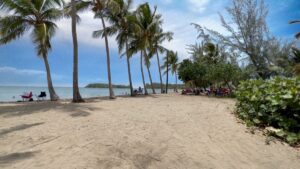
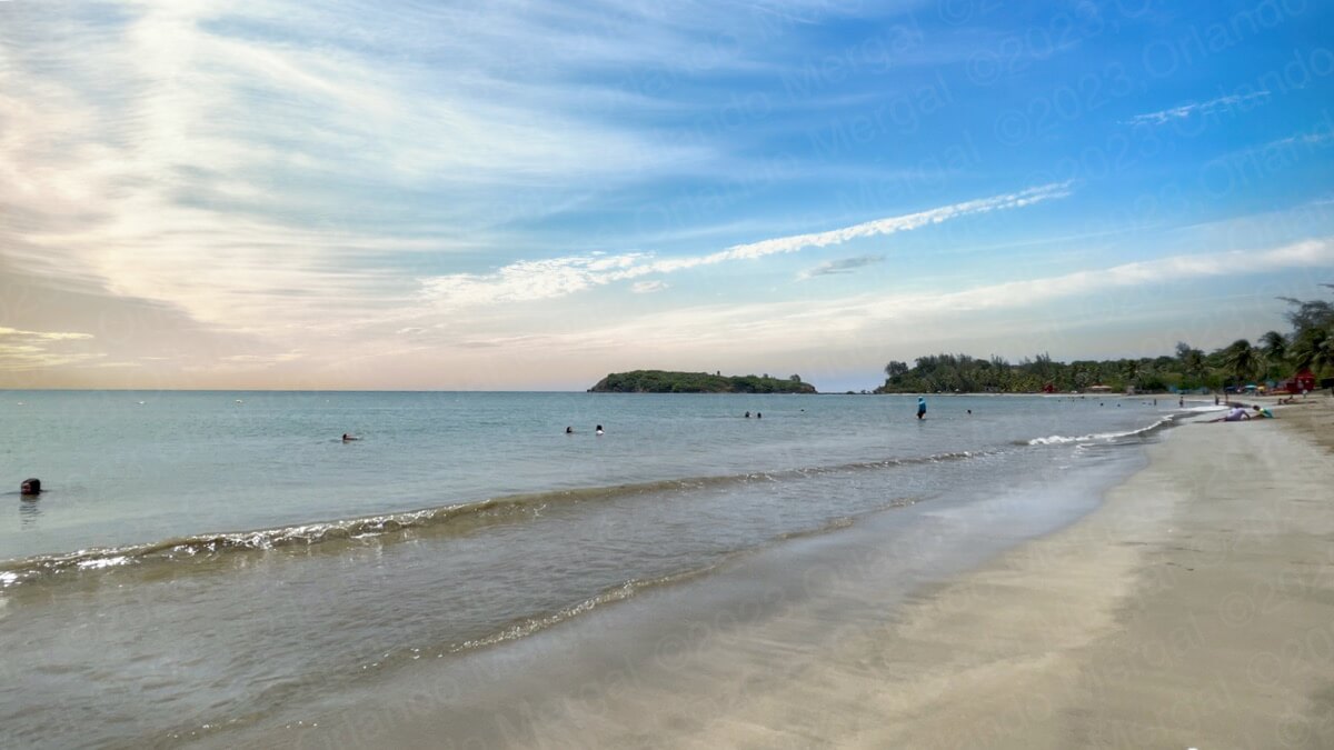
Leaving Toa Baja you have two options. You can take Road 165 south and connect with toll road 22 to return to San Juan or you can take road 165 north and border the seashore going towards “Balneario Punta Salinas”. In our case we did the later.
The road along the seashore going towards “Balneario Punta Salinas” is amazing. Some people actually park along this road and bathe there. But I wouldn’t recommend it for a couple of reasons. First, this area is not a beach. Yes it has water, but it “open water”. That means that it gets real deep real fast! It’s also subject to high surf, rip currents and other perils.
Second, the area can be solitary. And given Puerto Rico’s high crime rate it isn’t the best place to be all by yourself.
But hey, it makes for excellent eye candy.
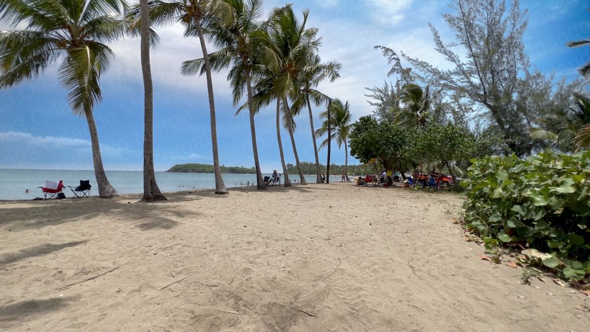
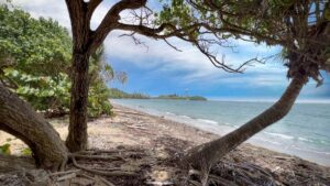
A few miles down the road you find the entrance to “Balneario Punta Salinas” on your left-hand side. “Balneario Punta Salinas” used to be a Blue Flag Beach. What does that mean? In short it means that it was among the best in the world. For more information about the Blue Flag Program check out our video. Of course, this certification is given out yearly and things change. So what was true then doesn’t necessarily hold true today.
-
- (click on image to see it larger)
-

- (click on image to see it larger)
-
- (click on image to see it larger)
-
- (click on image to see it larger)

And that’s the case with “Punta Salinas”. Hurricane María was hard on all Puerto Rican beaches, but Punta Salinas was hit particularly hard. So authorities are working hard to bring it back to its former glory.
In any case “Punta Salinas” is nice. Just check out the recent footage in this article.
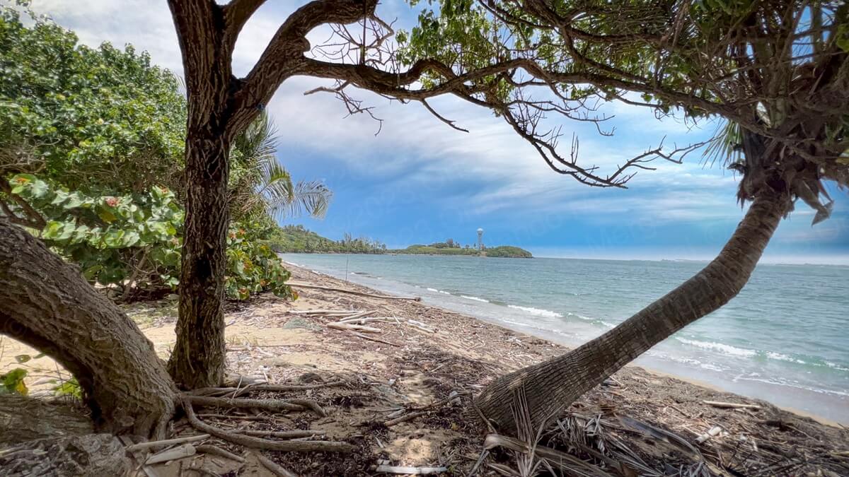
So what are “balnearios” anyway? In Spanish a “balneario” is a government run public beach. Now, technically all beaches in Puerto Rico are public, at least according to the law. But “balnearios” are the best of the bunch because they usually come with showers, gazebos, food concession stands, lifeguards, security buoys, thousands of palm trees to keep the sun at bay and ample parking.
And guess what, they’re practically free. Your only expense will be a small parking fee.
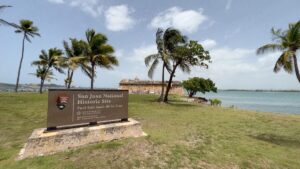
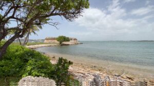
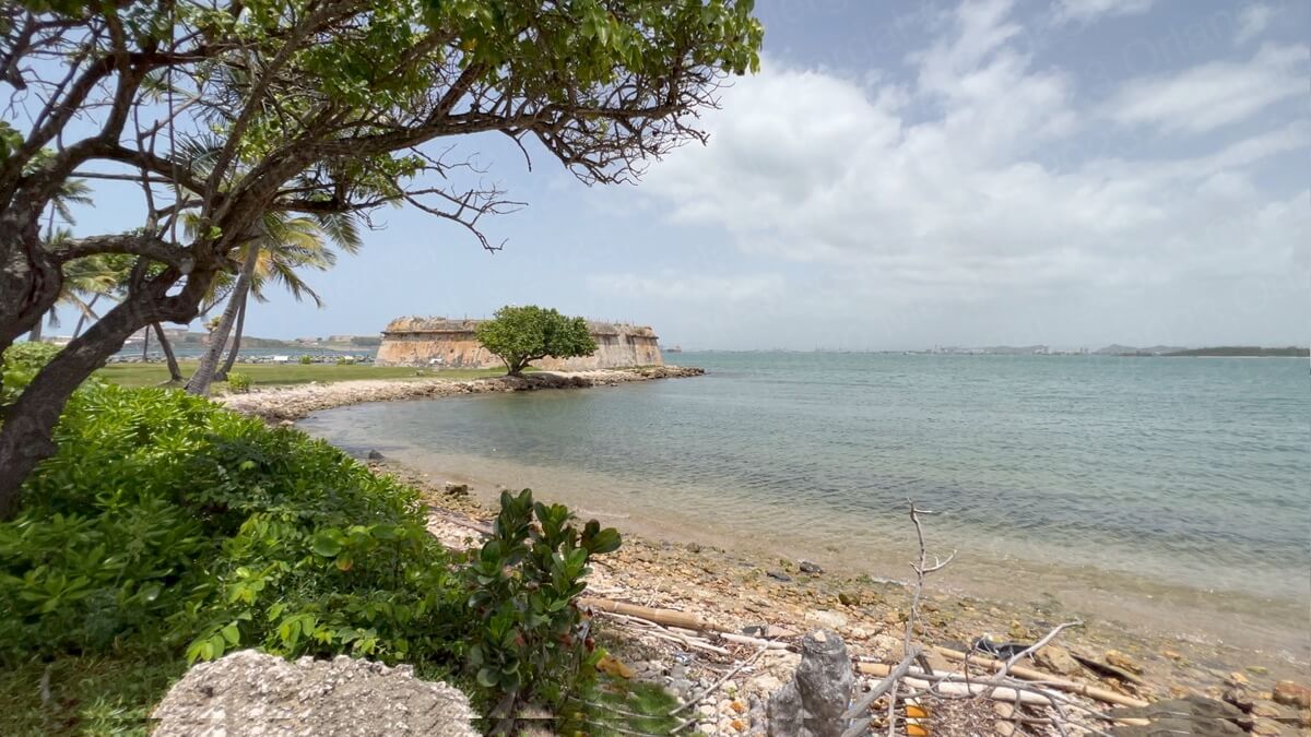
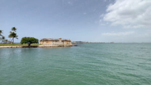
As you leave Punta Salinas turn left on road 165 and follow the GPS coordinates on the map below to “Isla de Cabras”. The name “Isla de Cabras” means “goat Island” in the King’s English. But I wasn’t able to uncover any information that there were ever any goats there.
In fact, calling it an Island is a stretch. Albeit, it’s surrounded by water. It’s actually an islet. But you couldn’t tell just by going there. It looks more like a strip of land that extends into the ocean. This is because of a man made strip that connects the original islet to firm land.
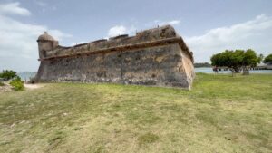
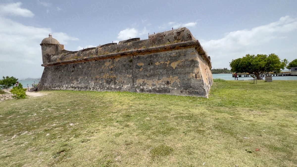
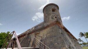
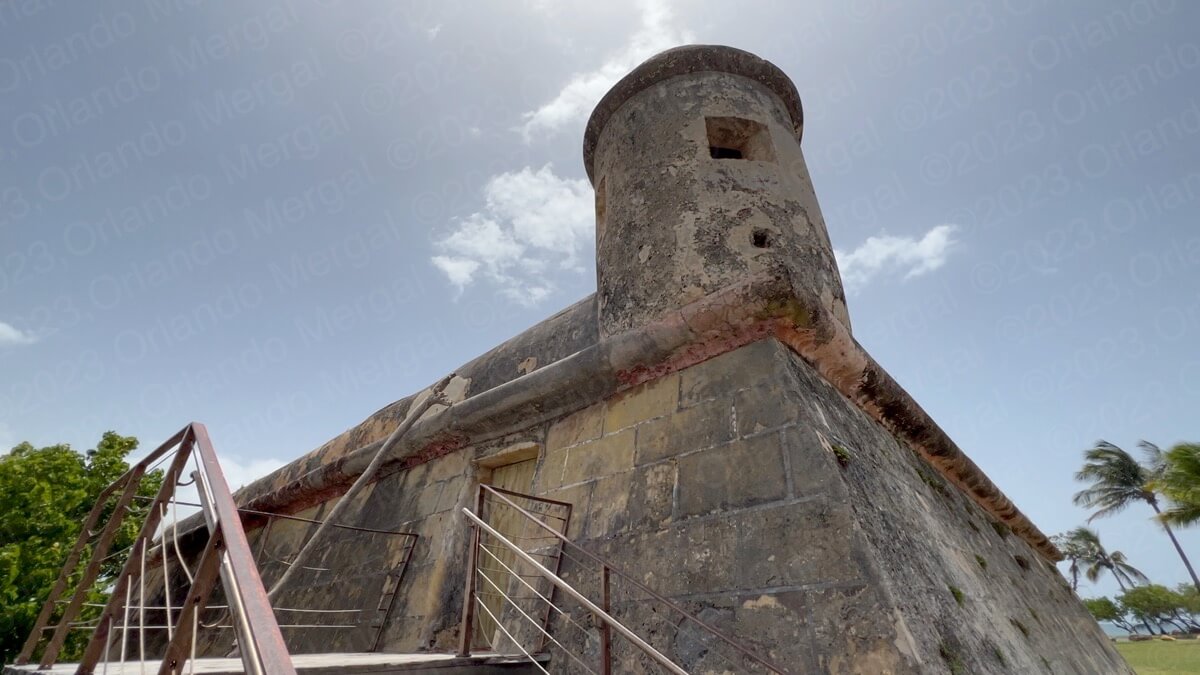
When you approach “Isla de Cabras” the first thing you’re going to see is Fort San Juan De La Cruz, better known along the locals as “el cañuelo”. If you’re a mainlander you’re going to have trouble pronouncing that name so just hit on the little player to learn exactly how it should sound. el-cañuelo
-
- Fort San Juan de la Cruz
(click on image to see it larger)

-
- Fort San Juan de la Cruz
(click on image to see it larger)
-
- Fort San Juan de la Cruz
(click on image to see it larger)
-
- Fort San Juan de la Cruz
(click on image to see it larger)
-
- Fort San Juan de la Cruz
(click on image to see it larger)
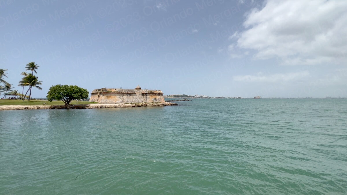
Fort San Juan De La Cruz was part of the defense system used by the Spaniards to protect the entrance to San Juan Bay. It also protected the entrance to the Bayamón river on its west side.
Ships attempting to enter San Juan Bay would be caught in a crossfire between Fort San Felipe del Morro and Fort San Juan de la Cruz. Add this to the fact that the entrance to San Juan Bay is quite narrow, and that there are reefs on the west side, and it made for a very effective defense.
Sadly, many years ago Fort San Juan de la Cruz fell into disrepair and the government decided to fill it with sand to avoid vandalism. That’s why you can only see the outside.
You should also know that, in its original state, the fort was surrounded by water. This made it even harder to breach.
The United States Park Service is in charge of this fort but they haven’t made any announcements about bringing it back to its original glory. On the other hand, they have done an excellent job on the Old San Juan side. So I guess it all has to do with how much interest the municipality of Toa Baja shows for the fort and how much they insist on bringing it back to life.
Immediately after you pass Fort San Juan de la Cruz you enter a recently inaugurated recreational park that offers: swimming areas, showers, restrooms, private security, kayaking, green areas for events, recreational fishing, diving areas, snorkelling, a playground for kids, a boat ramp, gazebos, an activity room and even food and snack concessions.
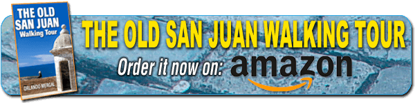
Leper Asylum Ruins
(click on image to see it larger)
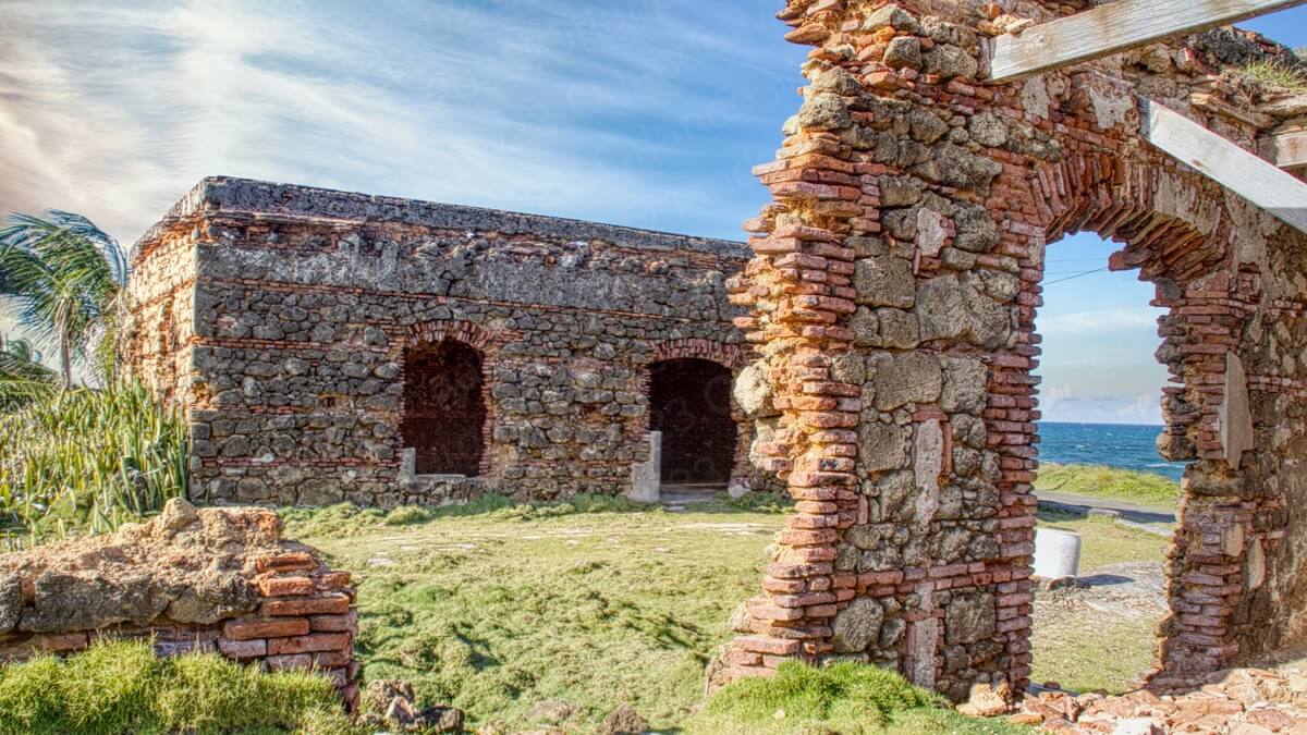
Finally, towards the northern shore of the islet, you’ll find the ruins of the old Leper Asylum. There isn’t much left of the original facilities, but let me let you in on a little secret. This is actually the best place to observe “la marea de los muertos” (or tide of the dead) every month of November.
Tide Of The Dead
(click on image to see it larger)
The image you see below was actually shot on November 2nd, which is the actual day of the dead. The current was so strong that the waves crashed tens of feet into the air.
Like the little town of Cataño, which we covered in a previous post and video, Toa Baja has lots of possibilities. Just to give an example, the little town of “Palo Seco”, that you passed through on your way to Isla de Cabras, used to be a thriving restaurant area. Today it’s a ghost town.
You can argue that Puerto Rico has gone through rough times during the last decade. Hurricanes, earthquakes, shifts in our economic structures and even bankruptcy have left our country in shambles. But lots of it has been self inflicted, due to corruption and poor decisions.
But hey, Puerto Rico receives billions of dollars in Federal funds and I just don’t see them reflected on the Island’s reality. It’s like they go into a black hole. I also don’t hear any new ideas. It seems like we do like Einstein used to say: “we keep doing the same things and expect different results”. That’s lunacy!!!
I know this doesn’t seem to fit with the rest of this post, but it angers me when I see places bursting with potential converted into “sleepy little towns”. Puerto Rico could be a tourism mecca if we only put our minds to it. It could truly live up to its name of “rich port”!!!
But what do I know? I can only say like the Spanish poet León Felipe”:
“Yo no sé muchas cosas, es verdad.
Digo tan sólo lo que he visto.
Y he visto:
que la cuna del hombre la mecen con cuentos,
que los gritos de angustia del hombre los ahogan con cuentos,
que el llanto del hombre lo taponan con cuentos,
que los huesos del hombre los entierran con cuentos,
y que el miedo del hombre…
ha inventado todos los cuentos.
Yo no sé muchas cosas, es verdad,
pero me han dormido con todos los cuentos…
y sé todos los cuentos”.
And, in the rare case that you might not understand, here’s the English translation:
I don’t know many things, it’s true.
I only say what I’ve seen.
And I’ve seen:
that the cradle of man is rocked with stories,
that man’s anguish is drowned with stories,
that man’s cries are covered with stories,
that man’s bones are buried with stories,
and that man’s fear…
has given way to all the stories.
I don’t know many things, it’s true,
but I have been laid to sleep with all the stories…
and I know all the stories.
Let’s forget the stories and build a new reality.
Puerto Rico can be truly great,
NOTE: Due to the large extension of land covered in this post, you will need to zoom in and out on the map to see every pin. Please pardon the inconvenience.
See you next time:
©2023,Orlando Mergal, MA
____________________
Bilingual Content Creator, Blogger, Podcaster,
Author, Photographer and New Media Expert
Tel. 787–750-0000, Mobile 787–306-1590
![]()
![]()